The Metro Blue Line is a 12-mile (19.3 km) light rail line in Hennepin County, Minnesota, that is part of the Metro network. It travels from downtown Minneapolis to Minneapolis–Saint Paul International Airport and the southern suburb of Bloomington. Formerly the Hiawatha Line prior to May 2013, the line was originally named after the Milwaukee Road's Hiawatha passenger train and Hiawatha Avenue, reusing infrastructure from the former and running parallel to the latter for a portion of the route. The line opened June 26, 2004, and was the first light rail service in Minnesota. An extension, Bottineau LRT, is planned to open in 2028.

Saint Paul Union Depot is a historic railroad station and intermodal transit hub in the Lowertown neighborhood of Saint Paul, Minnesota. It serves light rail, intercity rail, intercity bus, and local bus services.

Government Plaza station is a Metro light rail station on the Blue Line and Green Line in Minneapolis, Minnesota. The station is located on 5th Street South, between 3rd and 4th Avenues South in downtown Minneapolis. This station opened on June 26, 2004, with initial light rail service in the Twin Cities.
Franklin Avenue station is a light rail station on the Blue Line in Minneapolis, Minnesota.
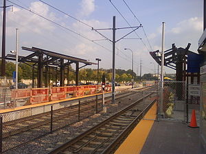
Lake Street/Midtown station, also referred locally as either the Lake Street station or Midtown station, is a Blue Line light rail stop in Minneapolis, Minnesota, United States. The station is located on a bridge over East Lake Street adjacent to Highway 55.
38th Street station is a light rail station on the Blue Line in Minneapolis, Minnesota.
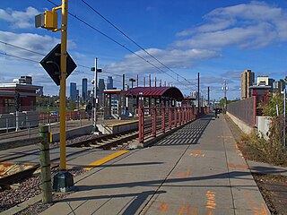
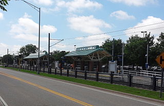
46th Street station is a light rail station on the Metro Blue Line in Minneapolis, Minnesota. This station is located on the northwest corner of the intersection of 46th Street and Minnesota State Highway 55, in the Ericsson neighborhood. This is a side-platform station. Service began at this station when the Blue Line opened on June 26, 2004.
VA Medical Center station is a light rail station on the Blue Line on Fort Snelling in the Twin Cities region of Minnesota.

Lake Street is a major east-west thoroughfare between 29th and 31st streets in Minneapolis, Minnesota United States. From its western most end at the city's limits, Lake Street reaches the Chain of Lakes, passing over a small channel linking Bde Maka Ska and Lake of the Isles, and at its eastern most end it reaches the Mississippi River. In May 2020, the Lake Street corridor suffered extensive damage during local unrest following the murder of George Floyd. In August of the same year, city officials designated East Lake Street as one of seven cultural districts to promote racial equity, preserve cultural identity, and promote economic growth.

Hiawatha is a neighborhood within the larger Longfellow community in Minneapolis. It is bordered by Howe to the north, the Mississippi River to the east, Minnehaha Park and Minnehaha neighborhood to the south, and Ericsson and Standish to the west. The Hiawatha neighborhood is bordered by 40th Street to the north, the Mississippi River to the east, 54th Street East to the south, and Hiawatha Avenue to the west.

Longfellow is a defined community in Minneapolis, Minnesota which includes five smaller neighborhoods inside of it: Seward, Cooper, Hiawatha, Howe and Longfellow. The community is a mix of agri-industrial properties along the old Northern Pacific Railway, expansive parkland surrounding the famous Minnehaha Falls, and smaller residential areas.

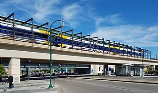
Target Field station is a multimodal commuter train and light rail station in Minneapolis, Minnesota. Located in the North Loop area of Downtown Minneapolis, the station is named for Target Field, the Minnesota Twins baseball stadium. METRO Blue Line light rail service started on November 14, 2009; Northstar Line commuter rail service started November 16, 2009; METRO Green Line light rail service started on June 14, 2014.
In addition to the proposed transit projects in the Twin Cities region, there have been some transit corridors that are no longer proposed.

The Minneapolis Great Northern Depot, also known as Great Northern Station, was a passenger railroad station which served Minneapolis, Minnesota, USA. It was built in 1913 and demolished in 1978. It was located on Hennepin Avenue next to the Hennepin Avenue Bridge and across the street from the main Minneapolis Post Office.
Minnehaha is a neighborhood in the Nokomis community in Minneapolis, Minnesota. Its boundaries are Minnehaha Parkway to the north, Hiawatha Avenue to the east, 54th Street to the south, and 34th Avenue to the west. It shares a neighborhood organization with the Keewaydin, Morris Park, and Wenonah neighborhoods, which are collectively referred to as Nokomis East and served by the Nokomis East Neighborhood Association (NENA).

Nokomis East is a group of neighborhoods in the southeastern corner of Minneapolis, Minnesota, United States. It consists of four neighborhoods: Keewaydin, Minnehaha, Morris Park and Wenonah. Nokomis East contains two schools, the Nokomis Community Library, and a post office. On its western edge is Lake Nokomis, for which it is named. Two regional parks, and three neighborhood parks, provide recreation and educational programming for all age groups. Seven churches serve residents of various denominations. Nokomis East is served by the Nokomis East Neighborhood Association (NENA). The main transportation corridors are the neighborhood boundaries: Cedar Avenue, 34th and 28th Avenues, 50th and 54th Streets, Hwy 55, and Crosstown highway 62.
The Canadian Pacific Kansas City's Merriam Park Subdivision or Merriam Park Sub, also known as the Short Line, is a railway line in Saint Paul, Minnesota. It is run by the Soo Line Railroad, a U.S. in-name-only division of CPKC. It runs from the Saint Paul Yard, also known as the Pigs Eye Yard, westward to the Short Line Bridge over the Mississippi River, where rails continue as part of the Minnesota Commercial Railway. It was named for John L. Merriam, a Minnesota banker and politician. Completed by the Chicago, Milwaukee and St. Paul Railroad in 1880, it shortened the route Milwaukee Road trains took between downtown Saint Paul and downtown Minneapolis. Previous trains would exit Saint Paul and follow the Mississippi River southwest until crossing at Fort Snelling, where they would follow the path of today's Hiawatha Avenue and the Metro Blue Line toward the Milwaukee Road Depot. Originally built as an interurban route, it was eventually converted for heavy rail traffic because the Twin City Rapid Transit streetcar system had taken over the local transit market.

Metro is a transit network in Minnesota serving the cities of Minneapolis and Saint Paul. It also provides service to some suburban areas. As of 2022, the system consists of two light rail lines and five bus rapid transit (BRT) lines all of which are operated by the local public transit company: Metro Transit. The five lines connect Downtown Minneapolis and St Paul with the Bloomington, Minneapolis-St Paul International Airport, Roseville, Richfield, Burnsville and Brooklyn Center.

Hiawatha LRT Trail is a 4.7-mile (7.6 km), multi-use path adjacent to a light-rail transit line in Minneapolis, Minnesota, United States, that is popular with bicycle commuters. Users travel along the Metro Blue Line and Hiawatha Avenue transit corridor, reaching downtown Minneapolis near an indoor sports stadium at the trail’s northern end, and reaching a bridge above Minnehaha Creek at the trail’s southern end. Hiawatha LRT Trail provides a vital link between several Minneapolis neighborhoods and the city’s downtown area.

Min Hi Line is a proposed linear park and shared-use path that would eventually re-purpose an active rail and agri-industrial corridor in the Longfellow community of Minneapolis, Minnesota, United States. Modeled after successful projects like the Atlanta Beltline and New York High Line, it would feature an approximately 3-mile (4.8 km), shared-use pathway that traverses housing, retail, commercial buildings, gardens, playgrounds, and public art installments. Two pilot projects completed in 2018 and 2019 connect the Min Hi Line corridor to trail systems at its northern and southern ends.