The Borough of Newcastle-under-Lyme is a local government district with borough status in Staffordshire, England.

The Moseley Railway Trust is a major British collection of industrial narrow gauge locomotives and other equipment. It originally had its base in south Manchester, but has relocated to the Apedale Community Country Park near Newcastle-under-Lyme, Staffordshire, where the Apedale Valley Light Railway and an important museum are being established next to the Apedale Heritage Centre.
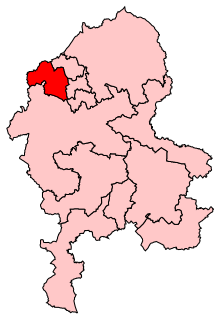
Newcastle-under-Lyme is a constituency in north Staffordshire created in 1354 and represented in the House of Commons of the UK Parliament since 2001 by Paul Farrelly of the Labour Party. It was the last to be co-represented by a member of the Conservative Party when it was dual-member, before the 1885 general election which followed the Redistribution of Seats Act 1885 coupled with the Reform Act 1884. In 1919 the local MP, industrialist and major local employer Josiah Wedgwood shifted his allegiance from the Liberal Party — the Lloyd George Coalition Liberals allying with the Conservatives — to the Labour Party and the seat has elected the Labour candidate who has stood since that date, a total of 29 elections in succession. Labour came close to losing the seat in 1969, 1986, 2015 and 2017.

Chesterton is a small, former mining village in Staffordshire, England. It is situated in the town of Newcastle-under-Lyme.
Halmer End is a small village in the Borough of Newcastle-under-Lyme in Staffordshire, neighbouring the small hamlet of Alsagers Bank and the larger village of Audley.
Holditch ward is a ward in the Borough of Newcastle-under-Lyme. It covers the suburbs of Broad Meadow, and Beasley. The population of the ward at the 2011 census was 4,694.
Sir Nigel Gresley's Canal was a 3-mile (4.8 km) private canal between Apedale and Newcastle-under-Lyme both in Staffordshire, England.

Apedale Hall was a manor house near Newcastle-under-Lyme in Staffordshire, it was rebuilt in 1826 by the Heathcote family in the Elizabethan style by British Industrialist Richard Edensor Heathcote,, but was demolished in 1934, due to subsidence from the coal mines underneath.

Sir Nigel Gresley, 6th Baronet was an English land-owner, mine-owner and the builder of Sir Nigel Gresley's Canal.
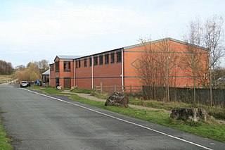
The Apedale Heritage Centre was created at the site of Staffordshire's Apedale Mine and is run by volunteers. It is located just outside the village of Chesterton near Newcastle-under-Lyme in the Apedale Community Country Park.
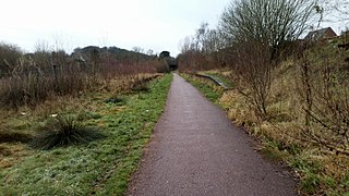
The Stoke to Market Drayton Line was a railway line that ran through Staffordshire and Shropshire that was built by the North Staffordshire Railway. The closure of the station in Newcastle-under-Lyme made the town the largest borough in the United Kingdom not to have a railway station.
Silverdale railway station was a railway station that served the village of Silverdale, Staffordshire, England. It was opened by the North Staffordshire Railway in 1863 and closed to passengers in 1964.
The Holditch Colliery disaster was a coal mining accident on 2 July 1937, in Chesterton, Staffordshire, England, in which 30 men died and eight were injured. It was caused due to a fire and subsequent explosions, and was exacerbated by a decision from management to risk the lives of mine workers to try to save the coal seam.
Trent Vale is a village located on the western outskirts of Stoke-on-Trent in England. It is bordered on the south by Hanford, and both villages are separated by the A500. To the west is Clayton, whilst the north is Newcastle-under-Lyme. The south east is Oakhill, while Penkhull is to the north east of the village. The appropriate ward on Stoke-on-Trent MBC is called 'Springfields and Trent Vale'. The population of this ward at the 2011 census was 6,816.
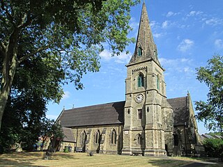
Newcastle-under-Lyme is a town and an unparished area in the district of Newcastle-under-Lyme, Staffordshire, England. It contains 71 buildings that are recorded in the National Heritage List for England. Of these, four are listed at Grade II*, the middle of the three grades, and the others are at Grade II, the lowest grade. The list covers the town of Newcastle-under-Lyme, including suburbs such as Bradwell, Clayton, Porthill, and Wolstanton, and nearby villages including Apedale and Chesterton. Most of the listed buildings are houses and cottages, farmhouses and farm buildings, shops, and offices. The other listed buildings include churches and chapels, memorials in churchyards, the remains of a castle, public houses, a guildhall, a market cross, a former blast furnace, the base of a mine chimney, a former military barracks converted into workshops, items in a cemetery, a school, a milepost, and a statue of Queen Victoria.