Canals, or navigations, are human-made channels, or artificial waterways, for water conveyance, or to service water transport vehicles.
Lombardy is one of the twenty administrative regions of Italy, in the northwest of the country, with an area of 23,844 square kilometres (9,206 sq mi). About 10 million people, forming one-sixth of Italy's population, live in Lombardy and about a fifth of Italy's GDP is produced in the region, making it the most populous and richest region in the country and one of the richest regions in Europe. Milan, Lombardy's capital, is the second-largest city and the largest metropolitan area in Italy.
Somma Lombardo is a town in the province of Varese, Lombardy, Italy. It received the honorary title of city with a presidential decree on June 16, 1959.
Construction began in 1877, but Villoresi himself died two years later. The works were completed in 1890 by a consortium.
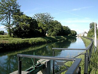
Irrigation was the canal's main reason for being but the addition of locks enabled cargoes of sand to be carried along it.
Irrigation is the application of controlled amounts of water to plants at needed intervals. Irrigation helps to grow agricultural crops, maintain landscapes, and revegetate disturbed soils in dry areas and during periods of less than average rainfall. Irrigation also has other uses in crop production, including frost protection, suppressing weed growth in grain fields and preventing soil consolidation. In contrast, agriculture that relies only on direct rainfall is referred to as rain-fed or dry land farming.
Further reading
Del Felice, Lorenzo; Roberta Valtorta (1997). Canali e Opere nell'Est Ticino-Villoresi (in Italian). Guerini e Associati. ISBN88-7802-829-0.
The International Standard Book Number (ISBN) is a numeric commercial book identifier which is intended to be unique. Publishers purchase ISBNs from an affiliate of the International ISBN Agency.
A geographic coordinate system is a coordinate system that enables every location on Earth to be specified by a set of numbers, letters or symbols. The coordinates are often chosen such that one of the numbers represents a vertical position and two or three of the numbers represent a horizontal position; alternatively, a geographic position may be expressed in a combined three-dimensional Cartesian vector. A common choice of coordinates is latitude, longitude and elevation. To specify a location on a plane requires a map projection.
This Lombardy location article is a stub. You can help Wikipedia by expanding it.
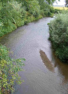
The river Ticino is the most important perennial left-bank tributary of the Po. It has given its name to the Swiss canton through which its upper portion flows.
Campione d'Italia is a comune of the Province of Como in the Lombardy region of Italy and an exclave surrounded by the Swiss canton of Ticino. At its closest, the exclave is less than one kilometre (0.6 mi) from the rest of Italy, but the intervening mountainous terrain requires a journey by road of over 14 km (9 mi) to reach the nearest Italian town, Lanzo d'Intelvi, and over 28 km (17 mi) to reach the city of Como.
Chignecto Bay is an inlet of the Bay of Fundy located between the Canadian provinces of New Brunswick and Nova Scotia and separated from the waters of the Northumberland Strait by the Isthmus of Chignecto. It is a unit within the greater Gulf of Maine Watershed. Chignecto Bay forms the northeastern part of the Bay of Fundy which splits at Cape Chignecto and is delineated on the New Brunswick side by Martin Head. Chignecto bay was also the site of an unsuccessful railway and canal project of the 1880s and 1890s that would have intersected the landmass, thereby providing a transit passage between New England and Prince Edward Island. After several investigations into the feasibility of a new canal project, including most importantly by the Chignecto Canal Commission, the proposed Chignecto Canal was deemed commercially and economically unjustifiable and the project was abandoned. Some of the physical remnants of the 1880s project still continue to dot the landscape of Chignecto Bay today.
Vizzola Ticino is a village and comune of the province of Varese in Lombardy, Italy. It is on the banks of the Ticino River, immediately to the west of Strada Provinciale 52 on the western perimeter of Malpensa Airport.
The Province of Milan was a province in the Lombardy region, Italy. Its capital was the city of Milan. The provincial territory was highly urbanized, resulting in the third highest population density among the Italian provinces with more than 2,000 inhabitants/km2, just behind the provinces of Naples and the bordering Monza e Brianza, created in 2004 splitting the north-eastern part from the province of Milan itself. On January 1, 2015 it was replaced by the Metropolitan City of Milan.
The Naviglio della Martesana is a canal in the Lombardy region, Northern Italy. Running from the Adda river, in the vicinity of Trezzo sull'Adda, to Milan, it was also known as Naviglio Piccolo. It is part of the system of navigli of the Milan area.
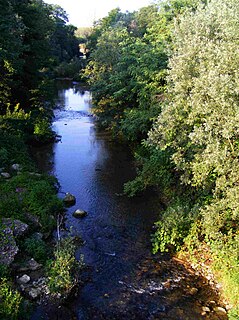
The Naviglio Grande is a canal in Lombardy, northern Italy, connecting the Ticino river near Tornavento to the Porta Ticinese dock, also known as the Darsena, in Milan. It drops 34 m over 49.9 km. It varies in width from 22 m to 50 m from Tornavento to Abbiategrasso, dropping to 15 m between there and Milan. Initially carries 63 m³ per second, 116 outlets take water to irrigate 500 square kilometres leaving the canal 12 m wide and carrying 12 m³ per second as it enters the dock.
Nerviano is a comune (municipality) in the northwestern part of the Metropolitan City of Milan in the Italian region Lombardy, located about 15 kilometres (9 mi) northwest of downtown Milan. Its territory is crossed by the Olona river and by the Villoresi Canal.
Mogno is a village in Vallemaggia District in the canton of Ticino, Switzerland. Mogno is situated near the top of Val Lavizzara, a valley through which the upper Maggia river flows. Formerly part of the municipality of Fusio, which merged with adjoining municipalities in 2004 to form the new municipality of Lavizzara.
The Naviglio Pavese is one of the canals making up the Navigli system in Lombardy, Italy. Once navigable, it is 33 km long and connected the city of Milan to Pavia, and through a flight of six locks to the River Ticino.
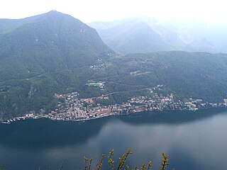
The river Tresa leaves Lake Lugano at a point between Lavena Ponte Tresa in Italy and Ponte Tresa in Switzerland and flows into Lake Maggiore near Luino, a few hundred metres after joining the Margorabbia. At the outflow from Lake Lugano the river is crossed by a bridge which unites the Swiss and Italian parts of Ponte Tresa; a customs post divides them.
The Mara is an 8-kilometre (5 mi) Italian stream of Insubria, which runs through the Italian Province of Como and the Swiss Canton Ticino. It rises on the slopes of Monte Sighignola and enters Lake Lugano at Maroggia.
Sornico is a village and former municipality in the district of Vallemaggia in the canton of Ticino, Switzerland.
The Cervo is a 65-kilometre (40 mi) torrent in the Piedmont region of north-west Italy. It is the principal tributary of the river Sesia, which itself is a significant tributary of the Po.
The Battle of Tornavento was a battle fought in Italy on June 22, 1636 during the Thirty Years' War.
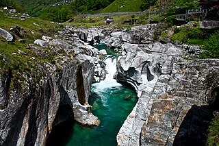
The Verzasca is a Swiss 30-kilometre (19 mi) long mountain river originating at Pizzo Barone and flowing into Lake Maggiore. It is known for its clear turquoise water and vibrant colored rocks, as well as its treacherous currents. The Verzasca Dam is a few kilometers upriver from this lake.
Villoresi is a surname. Notable people with the surname include:
The Marchiazza is a 34 km long stream of Piedmont, in north-western Italy. It is a left side tributary of the Cervo which flows through the provinces of Biella and Vercelli.
The Rovasenda is a 38 km long stream of Piedmont, in north-western Italy. It's a left side tributary of the Cervo which flows through the provinces of Biella and Vercelli.
This page is based on this Wikipedia article Text is available under the CC BY-SA 4.0 license; additional terms may apply. Images, videos and audio are available under their respective licenses.