
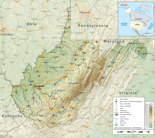
Chestnut Ridge is the westernmost ridge of the Allegheny Mountains in Pennsylvania, United States. It is located primarily within the Laurel Highlands region of southwestern Pennsylvania, extending into northern West Virginia.
Chestnut Ridge is the westernmost ridge of the Allegheny Mountains in Pennsylvania, United States. It is located primarily within the Laurel Highlands region of southwestern Pennsylvania, extending into northern West Virginia.
Chestnut Ridge rises in southern Indiana County and continues to the south-southwest for approximately 75 miles. The ridge crosses Westmoreland County and Fayette County into West Virginia then gradually disappears into a series of hills and finally ends roughly 5 miles (8.0 km) southeast of Morgantown, West Virginia.
The ridge passes near the cities of: Blairsville, Derry, Latrobe, Mt. Pleasant, Connellsville, and Uniontown in Pennsylvania; and Morgantown in West Virginia.
The Chestnut Ridge people take their name from this region.

Garrett County is the westernmost county of the U.S. state of Maryland. As of the 2020 census, the population was 28,806, making it the third-least populous county in Maryland. Its county seat is Oakland. The county was named for John Work Garrett (1820–1884), president of the Baltimore and Ohio Railroad. Created from Allegany County, Maryland in 1872, it was the last Maryland county to be formed.
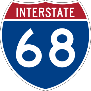
Interstate 68 (I-68) is a 112.9-mile (181.7 km) Interstate Highway in the US states of West Virginia and Maryland, connecting I-79 in Morgantown, West Virginia, east to I-70 in Hancock, Maryland. I-68 is also Corridor E of the Appalachian Development Highway System. From 1965 until the freeway's construction was completed in 1991, it was designated as U.S. Route 48 (US 48). In Maryland, the highway is known as the National Freeway, an homage to the historic National Road, which I-68 parallels between Keysers Ridge and Hancock. The freeway mainly spans rural areas and crosses numerous mountain ridges along its route. A road cut at Sideling Hill exposed geological features of the mountain and has become a tourist attraction.
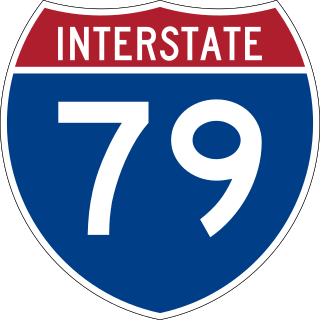
Interstate 79 (I-79) is an Interstate Highway in the Eastern United States, designated from I-77 in Charleston, West Virginia, north to Pennsylvania Route 5 (PA 5) and PA 290 in Erie, Pennsylvania. It is a primary thoroughfare through western Pennsylvania and West Virginia and makes up part of an important corridor to Buffalo, New York, and the Canadian border. Major metropolitan areas connected by I-79 include Charleston and Morgantown in West Virginia and Greater Pittsburgh and Erie in Pennsylvania.

Monongalia County, known locally as Mon County, is located in the U.S. state of West Virginia. As of the 2020 census, the population was 105,822, making it West Virginia's third-most populous county. Its county seat is at Morgantown. The county was founded in 1776. Monongalia County is included in the Morgantown, WV Metropolitan Statistical Area, and is the largest county in North-Central West Virginia. It is part of the Pittsburgh media market.

Upper Frankford Township is a township in Cumberland County, Pennsylvania, United States. The population was 2,005 at the 2010 census.
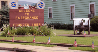
Fairchance is a borough in Fayette County, Pennsylvania, United States. The population was 1,889 at the 2020 census, a decline from the figure of 1,975 tabulated in 2010. It is served by the Albert Gallatin Area School District.

Georges Township is a township in Fayette County, Pennsylvania, United States. The population was 6,341 at the 2020 census, a decline from the figure of 6,612 tabulated in 2010. It is served by the Albert Gallatin Area School District.
North Union Township is a township in Fayette County, Pennsylvania, United States. The population was 11,826 at the 2020 census, a decline from the figure of 12,728 tabulated in 2010. The Laurel Highlands School District serves the township.
South Union Township is a township in Fayette County, Pennsylvania, United States. The population was 10,895 at the 2020 census, an increase over the figure of 10,681 tabulated in 2010.
Springhill Township is a township in Fayette County, Pennsylvania, United States. The population was 2,723 at the 2020 census. The Albert Gallatin Area School District serves the region.

Uniontown is the largest city in and county seat of Fayette County, Pennsylvania, United States, 46 miles (74 km) southeast of Pittsburgh. The population was 9,984 at the 2020 census. It is part of the Pittsburgh metropolitan area.
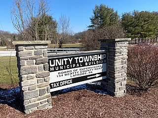
Unity Township is a township in Westmoreland County, Pennsylvania, United States. The population was 21,724 at the 2020 census, a decline of approximately 4% compared to the 2010 census.

The Laurel Highlands is a region in southwestern Pennsylvania made up of Fayette County, Somerset County, and Westmoreland County. It has a population of about 600,000 people.
The Potomac Highlands of West Virginia centers on five West Virginian counties in the upper Potomac River watershed in the western portion of the state's Eastern Panhandle, bordering Maryland and Virginia. Because of geographical proximity, similar topography and landscapes, and shared culture and history, the Potomac Highlands region also includes Pocahontas, Randolph, and Tucker counties, even though they are in the Monongahela River or New River watersheds and not that of the Potomac River.
The Environment of West Virginia encompasses terrain and ecosystems ranging from plateaus to mountains. Most of West Virginia lies within the Appalachian mixed mesophytic forests ecoregion, while the higher elevations along the eastern border and in the panhandle lie within the Appalachian-Blue Ridge forests.
Geographic regions of the Commonwealth of Pennsylvania.
Chestnut Ridge may refer to:
Acme is an unincorporated community in Donegal, Mount Pleasant and Bullskin townships in Pennsylvania, United States. The Acme ZIP code of 15610 extends well beyond the more densely populated part of the area, into rural parts of Donegal Township in Westmoreland County and Bullskin Township in Fayette County.

Laurel Hill, also known as Laurel Ridge or Laurel Mountain, is a 70-mile-long (110 km) mountain that is located in Pennsylvania's Allegheny Mountains. This ridge is flanked by Negro Mountain to its east and Chestnut Ridge to its west. The mountain is home to six state parks: Laurel Ridge State Park, Laurel Mountain State Park, Linn Run State Park, Kooser State Park, Laurel Hill State Park, and Ohiopyle State Park. The 70-mile-long (110 km) Laurel Highlands Hiking Trail runs the length of the ridge.