Glienicke/Nordbahn

Last updated
Glienicke/Nordbahn
Rathaus Glienicke.JPG
Town Hall
Wappen Glienicke-Nordbahn.png
Location of Glienicke/Nordbahn within Oberhavel district
Glienicke-Nordbahn in OHV.png
Germany adm location map.svg
Red pog.svg
Glienicke/Nordbahn
Brandenburg location map.svg
Red pog.svg
Glienicke/Nordbahn
Coordinates: 52°38′N13°20′E / 52.633°N 13.333°E / 52.633; 13.333
Country Germany
State Brandenburg
District Oberhavel
Government
   Mayor (201725) Dr. Hans G. Oberlack [1]
Area
  Total4.60 km2 (1.78 sq mi)
Elevation
47 m (154 ft)
Population
 (2022-12-31) [2]
  Total12,366
  Density2,700/km2 (7,000/sq mi)
Time zone UTC+01:00 (CET)
  Summer (DST) UTC+02:00 (CEST)
Postal codes
16548
Dialling codes 033056
Vehicle registration OHV
Website www.glienicke.eu

Glienicke/Nordbahn is a municipality in the Oberhavel district, in Brandenburg, Germany. It is located right north of Berlin.

Contents

Situation

Glienicke/Nordbahn is located on the northern outskirts of Berlin. The addition "Nordbahn" (Northern Railway) is based on the proximity to the 19th century-built railway line Berlin-Stralsund, the Prussian Northern Railway. The town is bordered to the south and west by the district Reinickendorf of Berlin (localities Frohnau, Hermsdorf (Berlin) and Lübars) and Schönfließ, Mühlenbecker Land. Between 1961 and 1990 was situated at the eastern border of the Berlin Wall. The village is a typical Angerdorf (meadow) of the Mark Brandenburg. The highest point of the village is the "Langeberg" with 55 m.ü.NN.

From Glienicke there are 16 kilometres (10 miles) to Oranienburg, 40 km (25 mi) to Potsdam, 290 km (180 mi) to Stralsund near the Baltic See, 290 km (180 mi) to Hamburg and 140 km (90 mi) to Cottbus.

History

Demography

After (East) Berlin, Glienicke/Nordbahn is the most densely populated municipality of any type in what was formerly East Germany, ahead of third-place Eichwalde (both are classified as rural municipalities, or Gemeinden ), and well ahead of larger municipalities with city ("Stadt") status, such as Leipzig, Halle, and Dresden.

Glienicke/Nordbahn: Population development
within the current boundaries [3]
YearPop.±% p.a.
1875 201    
1890 251+1.49%
1910 912+6.66%
1925 1,823+4.73%
1933 3,713+9.30%
1939 5,187+5.73%
1946 5,232+0.12%
1950 5,392+0.76%
1964 4,997−0.54%
1971 4,930−0.19%
1981 4,774−0.32%
1985 4,768−0.03%
1989 4,483−1.53%
1990 4,407−1.70%
1991 4,370−0.84%
YearPop.±% p.a.
1992 4,327−0.98%
1993 4,365+0.88%
1994 4,515+3.44%
1995 4,641+2.79%
1996 4,965+6.98%
1997 5,338+7.51%
1998 5,943+11.33%
1999 6,947+16.89%
2000 7,709+10.97%
2001 8,324+7.98%
2002 8,714+4.69%
2003 8,929+2.47%
2004 9,140+2.36%
2005 9,597+5.00%
2006 9,879+2.94%
YearPop.±% p.a.
2007 10,270+3.96%
2008 10,461+1.86%
2009 10,774+2.99%
2010 11,005+2.14%
2011 11,085+0.73%
2012 11,357+2.45%
2013 11,667+2.73%
2014 11,942+2.36%
2015 12,155+1.78%
2016 12,159+0.03%
2017 12,227+0.56%
2018 12,218−0.07%
2019 12,358+1.15%
2020 12,430+0.58%

Pictures

Politics

The Council consists of 22 members.

(Election: May 26, 2019) [5]

Mayors

Personalities

Gustav Bauer 1920 Bundesarchiv Bild 183-J0113-0500-001, Gustav Bauer.jpg
Gustav Bauer 1920

Freemen

Related Research Articles

Oberhavel is a Kreis (district) in the northern part of Brandenburg, Germany. Its neighbouring districts are : Mecklenburgische Seenplatte (district) in Mecklenburg-Western Pomerania, the districts of Uckermark and Barnim, the Bundesland of Berlin, and the districts of Havelland and Ostprignitz-Ruppin.

Uckermark is a Kreis (district) in the northeastern part of Brandenburg, Germany. Neighbouring districts are Barnim and Oberhavel, the districts Mecklenburgische Seenplatte and Vorpommern-Greifswald in Mecklenburg-Vorpommern, and to the east Poland. It is one of the largest districts of Germany areawise. The district is named after the historical region of Uckermark.

<span class="mw-page-title-main">Bernau bei Berlin</span> Town in Brandenburg, Germany

Bernau bei Berlin is a town in the Barnim district in Brandenburg in eastern Germany, located about 10 km (6.2 mi) northeast of Berlin.

<span class="mw-page-title-main">Hennigsdorf</span> Town in Brandenburg, Germany

Hennigsdorf is a town in the district of Oberhavel, in Brandenburg, in eastern Germany. It is situated north-west of Berlin, just across the city border, which is formed mainly by the Havel river.

<span class="mw-page-title-main">Hermsdorf (Berlin)</span> Quarter of Berlin in Germany

Hermsdorf is a district (Ortsteil) of Berlin located in the borough (Bezirk) of Reinickendorf.

<span class="mw-page-title-main">Blankenfelde-Mahlow</span> Municipality in Brandenburg, Germany

Blankenfelde-Mahlow is a municipality in the Teltow-Fläming district of Brandenburg, Germany. It is situated approximately 3 kilometres south of Berlin.

<span class="mw-page-title-main">Hohen Neuendorf</span> Town in Brandenburg, Germany

Hohen Neuendorf is a town in the Oberhavel district, in Brandenburg, Germany. It is located north west of Berlin.

<span class="mw-page-title-main">Velten</span> Town in Brandenburg, Germany

Velten is a town in the Oberhavel district of Brandenburg, Germany. It is situated 10 km southwest of Oranienburg, and 24 km northwest of Berlin.

<span class="mw-page-title-main">Stahnsdorf</span> Municipality in Brandenburg, Germany

Stahnsdorf is a municipality in the Potsdam-Mittelmark district, in Brandenburg, Germany.

<span class="mw-page-title-main">Ahrensfelde</span> Municipality in Brandenburg, Germany

Ahrensfelde is a municipality in the district of Barnim, in Brandenburg, Germany. It is situated on the Barnim Plateau at the city limits of Berlin, about 13 km (8.1 mi) northeast of the city centre. The municipal area comprises the villages of Ahrensfelde, Blumberg, Eiche, Lindenberg, and Mehrow.

<span class="mw-page-title-main">Kremmen</span> Town in Brandenburg, Germany

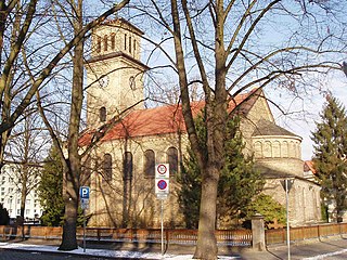
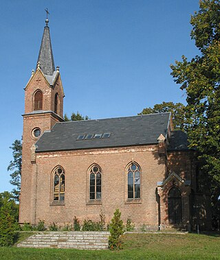
Kremmen is a town in the district of Oberhavel, in Brandenburg, Germany. It is located 15 km west of Oranienburg and 38 km northwest of Berlin. It is known mostly for its castle Ziethen. The local church contains an organ built in 1817 by Tobias Thurley.

<span class="mw-page-title-main">Liebenwalde</span> Town in Brandenburg, Germany

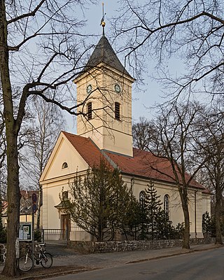
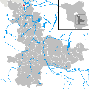
Liebenwalde is a town in the Oberhavel district, in Brandenburg, in north-eastern Germany. It is situated 16 km (10 mi) northeast of Oranienburg, and 39 km (24 mi) north of Berlin (centre).

<span class="mw-page-title-main">Eichwalde</span> Municipality in Brandenburg, Germany

Eichwalde is a municipality of the Dahme-Spreewald district in Brandenburg, Germany, situated at the southeastern Berlin city limits. With 2.8 km² it is the smallest Brandenburg municipality by area, while its population density is the second highest.

<span class="mw-page-title-main">Leegebruch</span> Municipality in Brandenburg, Germany

Leegebruch is a municipality in the Oberhavel district, in Brandenburg, Germany.

<span class="mw-page-title-main">Löwenberger Land</span> Municipality in Brandenburg, Germany

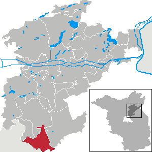
Löwenberger Land is a municipality in the Oberhavel district, in the German state of Brandenburg, about 50 km north of Berlin.

<span class="mw-page-title-main">Mühlenbecker Land</span> Municipality in Brandenburg, Germany

Mühlenbecker Land is a municipality in the Oberhavel district, in Brandenburg, Germany.

<span class="mw-page-title-main">Oberkrämer</span> Municipality in Brandenburg, Germany

Oberkrämer is a municipality in the Oberhavel district, in Brandenburg, Germany. An experimental farm of wind turbines existed between 1941 and 1945 on the 50 m high Matthias mountain in the area.

<span class="mw-page-title-main">Heiligengrabe</span> Municipality in Brandenburg, Germany

Heiligengrabe is a municipality in the Ostprignitz-Ruppin district, in Brandenburg, Germany.

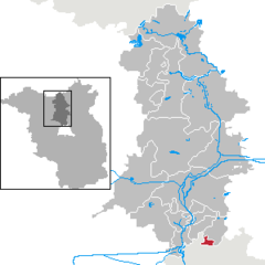
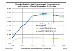
Glienicke may refer to the following places in Germany:

<span class="mw-page-title-main">Lübars</span> Quarter of Berlin in Germany

Lübars is a German locality (Ortsteil) within the borough (Bezirk) of Reinickendorf, Berlin.

References

  1. Landkreis Oberhavel Wahl der Bürgermeisterin / des Bürgermeisters Archived 2021-07-09 at the Wayback Machine , accessed 2 July 2021.
  2. "Bevölkerungsentwicklung und Bevölkerungsstandim Land Brandenburg Dezember 2022" (PDF). Amt für Statistik Berlin-Brandenburg (in German). June 2023.
  3. Detailed data sources are to be found in the Wikimedia Commons.Population Projection Brandenburg at Wikimedia Commons Archived 2014-09-24 at the Wayback Machine
  4. "Gebäude | Evangelische Kirchengemeinde". Archived from the original on 2013-02-18. Retrieved 2010-10-07.
  5. "Ergebnis der Kommunalwahl am 26. Mai 2019". Archived from the original on 2019-10-18. Retrieved 2017-07-22.
  6. http://www.glienicke.eu/presse/oga/archiv/2011/januar/29_01_02.html%5B%5D
  7. http://www.glienicke.eu/presse/maz/archiv/2011/januar/29_01_02.html%5B%5D
  8. "Ehrenbürger Erich Schwabe gestorben". 9 October 2015.