
Beddington is a suburban settlement in the London Borough of Sutton on the boundary with the London Borough of Croydon. Beddington is formed from a village of the same name which until early the 20th century still included land which became termed entirely as Wallington. The latter was in the 13th century shown on local maps as Hakebrug, and named after a bridge on the River Wandle. The locality has a landscaped wooded park at Beddington Park – also known as Carew Manor; and a nature reserve and sewage treatment works in the centre and to the north of its area respectively. The population of Beddington according to the 2011 census is 21,044.

Hambleden is a small village and civil parish within Wycombe district in the south of Buckinghamshire, England. It is about 4 miles (6.4 km) west of Marlow, and about 3 miles (4.8 km) north east of Henley-on-Thames in Oxfordshire.

Calbourne is a village in the civil parish of Calbourne, Newtown and Porchfield, on the Isle of Wight, England. It is located 5 miles (8 km) from Newport in the west of the island.
Cogges is an area beside the River Windrush in Witney, Oxfordshire, 0.5 miles (800 m) east of the town centre. It had been a separate village and until 1932 it was a separate civil parish.

Colbury is a small village in the New Forest National Park, in Hampshire, England. The village lies along Deerleap Lane, near the modern village of Ashurst.

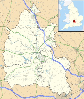
West Peckham is a village in the borough of Tonbridge and Malling in Kent, England. The River Bourne flows through the extreme west of the parish, and formerly powered a paper mill and corn mill. The Wateringbury Stream rises in the parish. Oxon Hoath is the former manor house of West Peckham.

Bickton is a hamlet in the New Forest District of Hampshire, England. It is within the civil parish of Fordingbridge and is situated by the River Avon.

Trevalga is a coastal civil parish and hamlet in north Cornwall, England, United Kingdom. The parish is bounded on the north by the Celtic Sea, on the southeast by Forrabury and Minster parish and on the west by Tintagel parish.

Littleworth is a small village and civil parish off the A420, almost 2 miles (3 km) northeast of Faringdon. It was part of Berkshire until the 1974 boundary changes transferred it to Oxfordshire. The parish includes the hamlets of Thrupp and Wadley. The 2011 Census recorded the parish's population as 239.

Cēre Manor is a manor house in Cēres Parish in Kandava Municipality in the historical region of Courland, in western Latvia.

Kameņeca Manor is a manor house in Jaunaglonā, Aglona Parish, Aglona Parish in the historical region of Latgale, in Latvia.

Vārkava Manor is a manor in Vecvārkava, Upmala Parish, Vārkava Municipality in the historical region of Latgale, in Latvia. The main building of Vārkava Manor is on the list of State protected real estate monuments.

Sibford Ferris is a village and civil parish about 6.5 miles (10.5 km) west of Banbury in Oxfordshire. It is on the south side of the Sib valley opposite its larger sister village, Sibford Gower. The 2011 Census recorded the parish's population as 476.

Neatham is a Roman hamlet in the civil parish of Alton in the East Hampshire district of Hampshire, England. Its nearest town is Alton,(where the 2011 Census population was included) which lies 1.6 miles (2.6 km) south-west from the hamlet.

Sydenham is a village and civil parish about 3 miles (5 km) southeast of Thame in Oxfordshire. To the south the parish is bounded by the ancient Lower Icknield Way, and on its other sides largely by brooks that merge as Cuttle Brook, a tributary of the River Thame. The 2011 Census recorded the parish's population as 451.

Hampton Gay is a village in the Cherwell Valley about 1.5 miles (2.4 km) north of Kidlington, Oxfordshire.

Holton is a village and civil parish in South Oxfordshire about 5.5 miles (9 km) east of Oxford. The parish is bounded to the southeast by the River Thame, to the east and north by the Thame's tributary Holton Brook, to the south by London Road and to the west by field boundaries with the parishes of Forest Hill with Shotover and Stanton St John.

Little Cawthorpe is a village and civil parish in the East Lindsey district of Lincolnshire, England. It is situated about 1.5 miles (2.4 km) south-west from Legbourne, and 3 miles (5 km) south-east from the market town of Louth.

Claxby St Andrew, is a village and former parish about 3 miles (5 km) south of Alford, in the East Lindsey district of Lincolnshire, England. It is in the civil parish of Well.
This page is based on this
Wikipedia article Text is available under the
CC BY-SA 4.0 license; additional terms may apply.
Images, videos and audio are available under their respective licenses.


