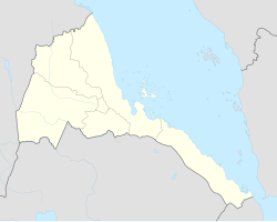
Agordat is a city in Gash-Barka, Eritrea. It was the capital of the former Barka province, which was situated between the present-day Gash-Barka and Anseba regions.

Ráby is a village in the Pardubice Region of the Czech Republic. It has around 560 inhabitants.

Veltruby is a village in the Kolín District in the Czech Republic.
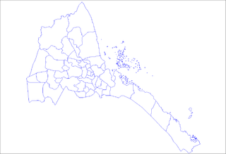
The six regions of Eritrea are divided into administrative subregions.

Barentu is a town in north-western Eritrea, lying south of Agordat, and is the capital of Gash-Barka Region. The town is integrated with different types of tribes: Kunama, Nara, Tigre and Tigrigna being the dominant.

Barka River flows from the Eritrean Highlands to the plains of Sudan. With a length of over 640 km, it rises just outside Asmara and flows in a northwestern direction through Agordat. The river merges with the Anseba River near the border with Sudan.
Nyalam County is a county in Tibet's Shigatse Prefecture. It borders on Nepal.

Koniówko is a village in the administrative district of Gmina Trzebnica, within Trzebnica County, Lower Silesian Voivodeship, in south-western Poland. Prior to 1945 it was in Germany.
Haykota Subregion is a subregion in the western Gash-Barka region of Eritrea. Its capital lies at Haykota.
Foro Subregion is a subregion in the Northern Red Sea region of Eritrea. Its capital lies at Foro.

Elit is a village in western Eritrea approximately 30 km north-east of Teseney. It is located in Haykota District lying 9.8 km (5.3 nmi) north-west of the district capital of Haykota.
Bitama is a village in western Eritrea.
Adendema is a village in western Eritrea. It is located 5.8 miles south-west of the district capital of Haykota in Haykota District in the Gash-Barka region. It lies on the north-east boundary of the Gash-Setit wildlife reserve.

Gash-Setit is a 709 km2 (274 sq mi) designated national wildlife reserve and historical area of western Eritrea. It is located in much of Omhajer District and Haykota District south west of Haykota between the market town of Tesseney in the Gash-Barka region. The name is derived from the two rivers, the Gash and the Setit (Tekezé) River. It is the historical area of the Kunama people and a site of conflict and dispute between the Ethiopians and the Eritreans.
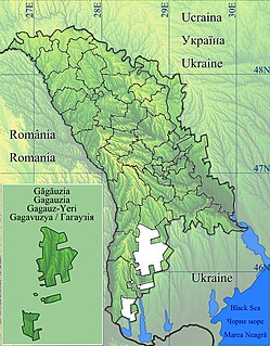
Tomai is a commune and village in the Gagauz Autonomous Territorial Unit of the Republic of Moldova. The 2004 census listed the commune as having a population of 5,014 people. 4,767 of the village residents were Gagauz. Minorities included 36 Moldovans, 80 Russians, 46 Ukrainians, 37 Bulgarians, 28 Roma plus 20 of other ethnicities.
Ouled Brahem is a town and commune in Bordj Bou Arréridj Province, Algeria. According to the 1998 census it has a population of 7,348.

Detuo is a town in the Garzê Tibetan Autonomous Prefecture of Sichuan, China.
Suurküla is a village in Lääne-Harju Parish, Harju County in northern Estonia.
Asprochoma is a village in Messenia, Greece. It is part of the municipality Kalamata.