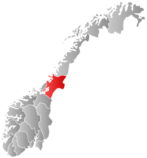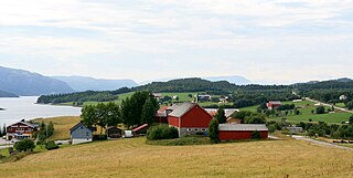
Rennebu is a municipality in Trøndelag county, Norway. It is part of the Orkdalen region. The administrative centre of the municipality is the village of Berkåk, located along European route E6. The majority of the population lives in the villages of Berkåk, Innset, Stamnan, Ulsberg, Voll, and Nerskogen.

Snåsa (Norwegian) or Snåase (Southern Sami) is a municipality in Trøndelag county, Norway. It is part of the Innherred region. The administrative centre of the municipality is the village of Snåsa. Other villages include Agle and Jørstad.

Vikna is a municipality in Trøndelag county, Norway. It is part of the Namdalen region. The administrative centre of the municipality is the village of Rørvik. Other villages in Vikna include Austafjord, Garstad, and Valøya.

Nærøy is a municipality in Trøndelag county, Norway. Nærøy is part of the Namdalen region. Norway's smallest town, Kolvereid, is the administrative centre of the municipality. Some villages in Nærøy include Abelvær, Foldereid, Gravvik, Lund, Ottersøy, Salsbruket, Steine, and Torstad.

Bindal is a municipality in the Helgeland region in the extreme southwest part of Nordland county, Norway. The administrative centre is the village of Terråk. Other villages include Bindalseidet, Holm, Vassås, Horsfjord and Åbygda.

Austra is an island on the border between Trøndelag and Nordland counties in Norway. The 88-square-kilometre (34 sq mi) island is shared between the municipalities of Bindal, Leka, and Nærøy. The highest point is the 588-metre-tall (1,929 ft) Romsskåla. The village of Årset lies on the southeastern shore, along the Årsetfjorden. The village of Bogen lies on the east coast of the island where the bridge connects it to the mainland.

Sør-TrøndelagUrban East Norwegian: [²søːrˌtrœndəlɑːɡ](listen) was a county comprising the southern portion of the present-day Trøndelag county in Norway. It bordered the old Nord-Trøndelag county as well as the counties of Møre og Romsdal, Oppland, and Hedmark. To the west is the Norwegian Sea, and to the east is Jämtland in Sweden. The county was separated into a northern and southern part by the Trondheimsfjord. Slightly over 200,000 of the county's population lives in the city of Trondheim and its suburbs. The Norwegian dialect of the region is Trøndersk.

Nord-Trøndelag was a county constituting the northern part of the present-day Trøndelag county in Norway. The county was established in 1804 when the old Trondhjems amt was divided into two: Nordre Trondhjems amt and Søndre Trondhjems amt. In 2016, the two county councils voted to merge (back) into a single county on 1 January 2018.

Sklinna Lighthouse is a lighthouse in the municipality of Leka in Trøndelag county, Norway. Sklinna Lighthouse is located on the island of Heimøya in the Sklinna island group about 30 kilometres (19 mi) northwest of the island of Leka and about 30 kilometres (19 mi) north of the island of Ytter-Vikna in Vikna municipality. The lighthouse is one of the northernmost points in Trøndelag county.

Leka Church is a parish church of the Church of Norway in Leka municipality in Trøndelag county, Norway. It is located in the village of Leknes on the island of Leka. It is the church for the Leka parish which is part of the Namdal prosti (deanery) in the Diocese of Nidaros. The white, wooden church was built in a long church style in 1867 by the architect Knudt Grudt who used plans made by Jacob Wilhelm Nordan. The church seats about 200 people.

Leknes is the administrative centre of the municipality of Leka in Trøndelag county, Norway. The village is located on the northeastern part of the island of Leka in the northwestern part of Trøndelag county. The local church, Leka Church, sits on the south side of the village. There is also a shop and an elementary school.

Snåsa (Norwegian) or Snåase (Southern Sami) is the administrative center of the municipality of Snåsa in Trøndelag county, Norway. The village is situated on the northern end of the lake of Snåsavatnet, just northeast of the village of Jørstad and southwest of the village of Agle.

Kolvereid is a former municipality in the old Nord-Trøndelag county, Norway. The 433-square-kilometre (167 sq mi) municipality existed from 1838 until its dissolution in 1964. The municipality encompassed the central part of what is now the municipality of Nærøy in Trøndelag county. The municipality included both sides of the central part of the Folda fjord. The administrative centre was the village of Kolvereid where the Kolvereid Church is located.

Gravvik is a former municipality in the old Nord-Trøndelag county, Norway. The 192-square-kilometre (74 sq mi) municipality existed from 1909 until its dissolution in 1964. The municipality covered the northern coastal areas of the present-day municipality of Nærøy in Trøndelag county. The administrative centre of the municipality was the village of Gravvik where the Gravvik Church is located.

Nærøysund is a new municipality that will be located in Trøndelag county, Norway. It will be located in the traditional district of Namdalen. The administrative centre of the municipality has not yet been decided. The municipality will be established on 1 January 2020 after the merger of the old municipalities of Vikna and Nærøy along with the part of Leka Municipality located on the island of Austra. The Lund area of the old Nærøy municipality will not be part of the new Nærøysund municipality, but instead it will join the newly enlarged Namsos Municipality on 1 January 2020.

Leka is the main island in Leka municipality in Trøndelag county, Norway. The 57-square-kilometre (22 sq mi) island makes up about half of the area of the municipality of Leka. The island is surrounded by dozens of smaller islands. The smaller island of Madsøya lies south of Leka, and it is connected to Leka by a short bridge. The larger island of Austra lies about 4 kilometres (2.5 mi) east of Leka. There is a ferry connection between Leka and Austra, and Austra is connected to the mainland by a bridge.


