Meteorological intelligence

Last updated

Meteorological intelligence is information measured, gathered, compiled, exploited, analyzed and disseminated by meteorologists, climatologists and hydrologists to characterize the current state and/or predict the future state of the atmosphere at a given location and time. Meteorological intelligence is a subset of environmental intelligence and is synonymous with the term weather intelligence.

Information that which informs; the answer to a question of some kind; that from which data and knowledge can be derived

Information is the resolution of uncertainty; it is that which answers the question of "what an entity is" and is thus that which specifies the nature of that entity, as well as the essentiality of its properties. Information is associated with data and knowledge, as data is meaningful information and represents the values attributed to parameters, and knowledge signifies understanding of an abstract or concrete concept. The existence of information can be uncoupled from an observer, which refers to that which accesses information to discern that which it specifies; information exists beyond an event horizon for example. In the case of knowledge, the information itself requires a cognitive observer to be accessed.

Meteorology Interdisciplinary scientific study of the atmosphere focusing on weather forecasting

Meteorology is a branch of the atmospheric sciences which includes atmospheric chemistry and atmospheric physics, with a major focus on weather forecasting. The study of meteorology dates back millennia, though significant progress in meteorology did not occur until the 18th century. The 19th century saw modest progress in the field after weather observation networks were formed across broad regions. Prior attempts at prediction of weather depended on historical data. It was not until after the elucidation of the laws of physics and more particularly, the development of the computer, allowing for the automated solution of a great many equations that model the weather, in the latter half of the 20th century that significant breakthroughs in weather forecasting were achieved. An important domain of weather forecasting is marine weather forecasting as it relates to maritime and coastal safety, in which weather effects also include atmospheric interactions with large bodies of water.

Climatology The scientific study of climate, defined as weather conditions averaged over a period of time

Climatology or climate science is the scientific study of climate, scientifically defined as weather conditions averaged over a period of time. This modern field of study is regarded as a branch of the atmospheric sciences and a subfield of physical geography, which is one of the Earth sciences. Climatology now includes aspects of oceanography and biogeochemistry. Basic knowledge of climate can be used within shorter term weather forecasting using analog techniques such as the El Niño–Southern Oscillation (ENSO), the Madden–Julian oscillation (MJO), the North Atlantic oscillation (NAO), the Northern Annular Mode (NAM) which is also known as the Arctic oscillation (AO), the Northern Pacific (NP) Index, the Pacific decadal oscillation (PDO), and the Interdecadal Pacific Oscillation (IPO). Climate models are used for a variety of purposes from study of the dynamics of the weather and climate system to projections of future climate. Weather is known as the condition of the atmosphere over a period of time, while climate has to do with the atmospheric condition over an extended to indefinite period of time.

Contents

The earliest known use of the term "meteorological intelligence" in a written document dates to 1854 on pg. 168 of the Eighth Annual Report of the Board of Regents of the Smithsonian Institution. This report discusses the Smithsonian Institution's initiative to transmit meteorological intelligence via telegraph lines. An early reference to "meteorological intelligence" in England dates an 1866 issue of The Edinburgh Review which was a prominent Scottish journal during the 19th century (Reeve 1866, pg. 75).

Smithsonian Institution Group of museums and research centers administered by the United States government

The Smithsonian Institution, founded on August 10, 1846 "for the increase and diffusion of knowledge," is a group of museums and research centers administered by the Government of the United States. The institution is named after its founding donor, British scientist James Smithson. Originally organized as the "United States National Museum," that name ceased to exist as an administrative entity in 1967.

Telegraphy long distance transmission of textual/symbolic messages without the physical exchange of an object

Telegraphy is the long-distance transmission of textual messages where the sender uses symbolic codes, known to the recipient, rather than a physical exchange of an object bearing the message. Thus flag semaphore is a method of telegraphy, whereas pigeon post is not. Ancient signalling systems, although sometimes quite extensive and sophisticated as in China, were generally not capable of transmitting arbitrary text messages. Possible messages were fixed and predetermined and such systems are thus not true telegraphs.

The Edinburgh Review has been the title of four distinct intellectual and cultural magazines. The best known, longest-lasting, and most influential of the four was the third, which was published regularly from 1802 to 1929.

Another documented, early use of the term dates to 1874 in a historical compilation entitled, "The American Historical Record" (Lossing 1874, pg. 125). In this book, Lossing uses the term to refer to weather observations transmitted over telegraph lines for the purpose of studying the nature of storms with the ultimate goal of enhancing public safety through the issuance of storm warnings. This mission was carried out by the Army Signal Service starting in the 1870s who was responsible for communication (via telegraph) of technical intelligence for the army as well as "meteorological intelligence" for the general welfare of the country (Ingersoll 1879, pg. 156).

Storm any disturbed state of an astronomical bodys atmosphere

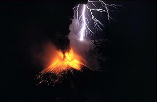
A storm is any disturbed state of an environment or in an astronomical body's atmosphere especially affecting its surface, and strongly implying severe weather. It may be marked by significant disruptions to normal conditions such as strong wind, tornadoes, hail, thunder and lightning, heavy precipitation, heavy freezing rain, strong winds, or wind transporting some substance through the atmosphere as in a dust storm, blizzard, sandstorm, etc.

Signal Corps (United States Army) United States Army division

The United States Army Signal Corps (USASC) is a division of the Department of the Army that creates and manages communications and information systems for the command and control of combined arms forces. It was established in 1860, the brainchild of Major Albert J. Myer, and had an important role in the American Civil War. Over its history, it had the initial responsibility for portfolios and new technologies that were eventually transferred to other U.S. government entities. Such responsibilities included military intelligence, weather forecasting, and aviation.

From the viewpoint of the intelligence community, the term meteorological intelligence is more limited in its use referring to the use of clandestine or technical means to learn about environmental conditions over enemy territory (Shulsky and Schmitt 2002) as in the North Atlantic weather war. In the military intelligence context, weather information is often referred to as meteorological or environmental intelligence (Hinsley 1990, pg. 420; Platt 1957, pg. 14; U.S. Congress, pg. 164).

A clandestine operation is an intelligence or military operation carried out in such a way that the operation goes unnoticed by the general population or specific enemy forces.

North Atlantic weather war

The North Atlantic weather war occurred during World War II. The Allies and Germany tried to gain a monopoly on weather data in the North Atlantic and Arctic Oceans. Meteorological intelligence was important as it affected military planning and the routing of ships and convoys. In some circumstances, visibility was necessary and in others concealment. D-day planning was greatly affected by weather forecasting; it was delayed by one day in the expectation that a storm would blow out and sea conditions would be acceptable. British sources of data included ships at sea and the weather stations at Valentia Observatory and Blacksod Point, in neutral Ireland; German use of weather ships also exposed their secret Enigma codes.

Military intelligence is a military discipline that uses information collection and analysis approaches to provide guidance and direction to assist commanders in their decisions. This aim is achieved by providing an assessment of data from a range of sources, directed towards the commanders' mission requirements or responding to questions as part of operational or campaign planning. To provide an analysis, the commander's information requirements are first identified, which are then incorporated into intelligence collection, analysis, and dissemination.

With regard to private sector meteorology, the term meteorological intelligence is a broad term of art that is primarily associated with observed and forecast weather information provided to decision makers in one of a number of weather sensitive business areas including: Energy, forestry, agriculture, telecommunications, transportation, aviation, entertainment, retail and construction (CMOS 2001, pg. 23) . It is considered a key aspect of weather risk management for the legal and insurance industries.

Forestry economic sector

Forestry is the science and craft of creating, managing, using, conserving, and repairing forests, woodlands, and associated resources for human and environmental benefits. Forestry is practiced in plantations and natural stands. The science of forestry has elements that belong to the biological, physical, social, political and managerial sciences.

Agriculture Cultivation of plants and animals to provide useful products

Agriculture is the science and art of cultivating plants and livestock. Agriculture was the key development in the rise of sedentary human civilization, whereby farming of domesticated species created food surpluses that enabled people to live in cities. The history of agriculture began thousands of years ago. After gathering wild grains beginning at least 105,000 years ago, nascent farmers began to plant them around 11,500 years ago. Pigs, sheep and cattle were domesticated over 10,000 years ago. Plants were independently cultivated in at least 11 regions of the world. Industrial agriculture based on large-scale monoculture in the twentieth century came to dominate agricultural output, though about 2 billion people still depended on subsistence agriculture into the twenty-first.

Telecommunication transmission of information between locations using electromagnetics

Telecommunication is the transmission of signs, signals, messages, words, writings, images and sounds or information of any nature by wire, radio, optical or other electromagnetic systems. Telecommunication occurs when the exchange of information between communication participants includes the use of technology. It is transmitted either electrically over physical media, such as cables, or via electromagnetic radiation. Such transmission paths are often divided into communication channels which afford the advantages of multiplexing. Since the Latin term communicatio is considered the social process of information exchange, the term telecommunications is often used in its plural form because it involves many different technologies.

Notes

    See also

    Business intelligence (BI) comprises the strategies and technologies used by enterprises for the data analysis of business information. BI technologies provide historical, current and predictive views of business operations. Common functions of business intelligence technologies include reporting, online analytical processing, analytics, data mining, process mining, complex event processing, business performance management, benchmarking, text mining, predictive analytics and prescriptive analytics. BI technologies can handle large amounts of structured and sometimes unstructured data to help identify, develop and otherwise create new strategic business opportunities. They aim to allow for the easy interpretation of these big data. Identifying new opportunities and implementing an effective strategy based on insights can provide businesses with a competitive market advantage and long-term stability.

    Weather risk management is a type of risk management done by organizations to address potential financial losses caused by unusual weather.

    Related Research Articles

    Surface weather analysis

    Surface weather analysis is a special type of weather map that provides a view of weather elements over a geographical area at a specified time based on information from ground-based weather stations.

    Weather forecasting application of science and technology to predict the conditions of the atmosphere for a given location and time

    Weather forecasting is the application of science and technology to predict the conditions of the atmosphere for a given location and time. People have attempted to predict the weather informally for millennia and formally since the 19th century. Weather forecasts are made by collecting quantitative data about the current state of the atmosphere at a given place and using meteorology to project how the atmosphere will change.

    The timeline of meteorology contains events of scientific and technological advancements in the area of atmospheric sciences. The most notable advancements in observational meteorology, weather forecasting, climatology, atmospheric chemistry, and atmospheric physics are listed chronologically. Some historical weather events are included that mark time periods where advancements were made, or even that sparked policy change

    Weather satellite type of satellite

    The weather satellite is a type of satellite that is primarily used to monitor the weather and climate of the Earth. Satellites can be polar orbiting, covering the entire Earth asynchronously, or geostationary, hovering over the same spot on the equator.

    Weather map

    A weather map displays various meteorological features across a particular area at a particular point in time and has various symbols which all have specific meanings. Such maps have been in use since the mid-19th century and are used for research and weather forecasting purposes. Maps using isotherms show temperature gradients, which can help locate weather fronts. Isotach maps, analyzing lines of equal wind speed, on a constant pressure surface of 300 or 250 hPa show where the jet stream is located. Use of constant pressure charts at the 700 and 500 hPa level can indicate tropical cyclone motion. Two-dimensional streamlines based on wind speeds at various levels show areas of convergence and divergence in the wind field, which are helpful in determining the location of features within the wind pattern. A popular type of surface weather map is the surface weather analysis, which plots isobars to depict areas of high pressure and low pressure. Cloud codes are translated into symbols and plotted on these maps along with other meteorological data that are included in synoptic reports sent by professionally trained observers.

    <i>Jefferson Bible</i> literary work

    The Life and Morals of Jesus of Nazareth, commonly referred to as the Jefferson Bible, refers to one of two religious works constructed by Thomas Jefferson. The first, The Philosophy of Jesus of Nazareth, was completed in 1804, but no copies exist today. The second, The Life and Morals of Jesus of Nazareth, was completed in 1820 by cutting and pasting with a razor and glue numerous sections from the New Testament as extractions of the doctrine of Jesus. Jefferson's condensed composition is especially notable for its exclusion of all miracles by Jesus and most mentions of the supernatural, including sections of the four gospels that contain the Resurrection and most other miracles, and passages that portray Jesus as divine.

    Intelligence assessment is the development of behavior forecasts or recommended courses of action to the leadership of an organisation, based on wide ranges of available overt and covert information. Assessments develop in response to leadership declaration requirements to inform decision making. Assessment may be executed on behalf of a state, military or commercial organisation with ranges of information sources available to each.

    National Climatic Data Center Active US archive of weather data.

    The United States National Climatic Data Center (NCDC), previously known as the National Weather Records Center (NWRC), in Asheville, North Carolina was the world's largest active archive of weather data. Starting as a tabulation unit in New Orleans, Louisiana in 1934, the climate records were transferred to Asheville in 1951, becoming named the National Weather Records Center (NWRC). It was later renamed the National Climatic Data Center, with relocation occurring in 1993. In 2015, it was merged with the National Geophysical Data Center (NGDC) and the National Oceanic Data Center (NODC) into the National Centers for Environmental Information (NCEI).

    Cleveland Abbe United States meteorologist and advocate of time zones

    Cleveland Abbe was an American meteorologist and advocate of time zones.

    William Healey Dall American naturalist, malacologist, and scientific explorer of interior Alaska

    William Healey Dall was an American naturalist, a prominent malacologist, and one of the earliest scientific explorers of interior Alaska. He described many mollusks of the Pacific Northwest of America, and was for many years America's preeminent authority on living and fossil mollusks.

    Arnold Henry Guyot Swiss-American geologist

    Arnold Henry Guyot was a Swiss-American geologist and geographer.

    Harry Hinsley British historian and cryptanalyst

    Sir Francis Harry Hinsley OBE was an English historian and cryptanalyst. He worked at Bletchley Park during the Second World War and wrote widely on the history of international relations and British Intelligence during the Second World War. He was known as Harry Hinsley.

    The India Meteorological Department (IMD), also referred to as the Met Department, is an agency of the Ministry of Earth Sciences of the Government of India. It is the principal agency responsible for meteorological observations, weather forecasting and seismology. IMD is headquartered in Delhi and operates hundreds of observation stations across India and Antarctica.Regional offices are at Mumbai, Kolkata, Nagpur and Pune.

    The history of surface weather analysis concerns the timetable of developments related to surface weather analysis. Initially a tool of study for the behavior of storms, surface weather analyses became a work in progress to explain current weather and as an aid for short term weather forecasting. Initial efforts to create surface weather analyses began in the mid-19th century by using surface weather observations to analyze isobars, isotherms, and display temperature and cloud cover. By the mid-20th century, much more information was being placed upon the station models plotted on weather maps and surface fronts, per the Norwegian cyclone model, were being analyzed worldwide. Eventually, observation plotting went from a manual exercise to an automated task for computers and plotters. Surface analysis remains a manual and partially subjective exercise, whether it be via hand and paper, or via a workstation.

    Global Volcanism Program American research program

    The Smithsonian Institution's Global Volcanism Program (GVP) documents Earth's volcanoes and their eruptive history over the past 10,000 years. The GVP reports on current eruptions from around the world as well as maintaining a database repository on active volcanoes and their eruptions. In this way, a global context for the planet's active volcanism is presented. Smithsonian reporting on current volcanic activity dates back to 1968, with the Center for Short-Lived Phenomena (CSLP). The GVP is housed in the Department of Mineral Sciences, part of the National Museum of Natural History, on the National Mall in Washington, D.C.

    Joint Polar Satellite System

    The Joint Polar Satellite System (JPSS) is the latest generation of U.S. polar-orbiting, non-geosynchronous, environmental satellites. JPSS will provide the global environmental data used in numerical weather prediction models for forecasts, and scientific data used for climate monitoring. JPSS will aid in fulfilling the mission of the U.S. National Oceanic and Atmospheric Administration (NOAA), an agency of the Department of Commerce. Data and imagery obtained from the JPSS will increase timeliness and accuracy of public warnings and forecasts of climate and weather events, thus reducing the potential loss of human life and property and advancing the national economy. The JPSS is developed by the National Aeronautics and Space Administration (NASA) for the National Oceanic and Atmospheric Administration (NOAA), who is responsible for operation of JPSS. Three to five satellites are planned for the JPSS constellation of satellites. JPSS satellites will be flown, and the scientific data from JPSS will be processed, by the JPSS - Common Ground System (JPSS-CGS).

    Denial and deception (D&D) is a Western theoretical framework for conceiving and analyzing military intelligence techniques pertaining to secrecy and deception. Originating in the 1980s, it is roughly based on the more pragmatic Soviet practices of maskirovka but it has a more theoretical approach compared to the latter.

    References