Related Research Articles

The Mississippi River is the second-longest river and chief river of the second-largest drainage system in North America, second only to the Hudson Bay drainage system. From its traditional source of Lake Itasca in northern Minnesota, it flows generally south for 2,340 miles (3,770 km) to the Mississippi River Delta in the Gulf of Mexico. With its many tributaries, the Mississippi's watershed drains all or parts of 32 U.S. states and two Canadian provinces between the Rocky and Appalachian mountains. The main stem is entirely within the United States; the total drainage basin is 1,151,000 sq mi (2,980,000 km2), of which only about one percent is in Canada. The Mississippi ranks as the thirteenth-largest river by discharge in the world. The river either borders or passes through the states of Minnesota, Wisconsin, Iowa, Illinois, Missouri, Kentucky, Tennessee, Arkansas, Mississippi, and Louisiana.

An oil spill is the release of a liquid petroleum hydrocarbon into the environment, especially the marine ecosystem, due to human activity, and is a form of pollution. The term is usually given to marine oil spills, where oil is released into the ocean or coastal waters, but spills may also occur on land. Oil spills may be due to releases of crude oil from tankers, offshore platforms, drilling rigs and wells, as well as spills of refined petroleum products and their by-products, heavier fuels used by large ships such as bunker fuel, or the spill of any oily refuse or waste oil.

Water pollution is the contamination of water bodies, usually as a result of human activities, so that it negatively affects its uses. Water bodies include lakes, rivers, oceans, aquifers, reservoirs and groundwater. Water pollution results when contaminants are introduced into these water bodies. Water pollution can be attributed to one of four sources: sewage discharges, industrial activities, agricultural activities, and urban runoff including stormwater. It can be grouped into surface water pollution or groundwater pollution. For example, releasing inadequately treated wastewater into natural waters can lead to degradation of these aquatic ecosystems. Water pollution can also lead to water-borne diseases for people using polluted water for drinking, bathing, washing or irrigation. Water pollution reduces the ability of the body of water to provide the ecosystem services that it would otherwise provide.
The Yellow Medicine River is a tributary of the Minnesota River, 107 miles (173 km) long, in southwestern Minnesota in the United States. Via the Minnesota River, it is part of the watershed of the Mississippi River, draining an area of 665 square miles (1,722 km²) in an agricultural region.

The Redwood River is a tributary of the Minnesota River, 127 miles (205 km) long, in southwestern Minnesota in the United States. Via the Minnesota River, it is part of the watershed of the Mississippi River, draining an area of 705 square miles (1,826 km²) in an agricultural region. The river's name is believed to refer to the reddish bark of dogwood growing along streams in the region.

The Lac qui Parle River is a tributary of the Minnesota River, 118 miles (190 km) long, in southwestern Minnesota in the United States. A number of tributaries of the river, including its largest, the West Branch Lac qui Parle River, also flow in eastern South Dakota. Via the Minnesota River, the Lac qui Parle River is part of the watershed of the Mississippi River, draining an area of 1,156 square miles (2,990 km2) in an agricultural region. Slightly more than two-thirds of the Lac qui Parle watershed is in Minnesota. Lac qui parle means "lake which speaks" in the French language, and was a translation of the Sioux name for Lac qui Parle, a lake on the Minnesota River upstream of the mouth of the Lac qui Parle River.

The Pine Bend Refinery is the largest oil refinery in Minnesota, located in the Twin Cities suburbs of Rosemount and Inver Grove Heights next to southern split of U.S. Highway 52 and Minnesota State Highway 55. The refinery is notable for being the largest in the United States to be located in a state without any oil wells. Overall, it ranked 14th in the country as of 2012 by production, with a nameplate capacity of 320,000 barrels (51,000 m3) per day. The facility is owned by Flint Hills Resources (FHR), a subsidiary of Koch Industries.

The Blue Earth River is a tributary of the Minnesota River, 108 miles (174 km) long, in southern Minnesota in the United States. Two of its headwaters tributaries, the Middle Branch Blue Earth River and the West Branch Blue Earth River, also flow for short distances in northern Iowa. By volume, it is the Minnesota River's largest tributary, accounting for 46% of the Minnesota's flow at the rivers' confluence in Mankato. Via the Minnesota River, the Blue Earth River is part of the watershed of the Mississippi River, draining an area of 3,486 square miles (9,030 km2) in an agricultural region. Ninety percent of the river's watershed is in Minnesota. It is a Minnesota Department of Natural Resources designated Water Trail.

The Le Sueur River (lay-SEWER) is a tributary of the Blue Earth River, 111 miles (178 km) long, in southern Minnesota in the United States. Via the Blue Earth and Minnesota Rivers, it is part of the watershed of the Mississippi River, draining an area of 1,089 square miles (2,280 km2). It is the largest tributary of the Blue Earth River, draining 31% of its watershed.

The Watonwan River is a tributary of the Blue Earth River, 113 miles (182 km) long, in southern Minnesota in the United States. Via the Blue Earth and Minnesota rivers, it is part of the watershed of the Mississippi River, draining an area of 878 square miles (2,270 km2) in an agricultural region. The Watonwan drains about a quarter of the Blue Earth River's watershed.

The Cottonwood River is a tributary of the Minnesota River, 152 miles (245 km) long, in southwestern Minnesota in the United States. Via the Minnesota River, it is part of the watershed of the Mississippi River, draining an area of 1,313 square miles (3,400 km2) in an agricultural region. The river's name is a translation of the Dakota name for the river, Wáǧa Ožú Wakpá, for the cottonwood tree groves, which are common along prairie rivers. It has also been known historically as the Big Cottonwood River.
The Pomme de Terre River is a 125-mile-long (201 km) tributary of the Minnesota River in western Minnesota in the United States. Via the Minnesota River, it is part of the watershed of the Mississippi River, draining an area of 875 square miles (2,270 km2) in an agricultural region. The headwaters region of the Pomme de Terre River is the northernmost extremity of the Minnesota River's watershed.
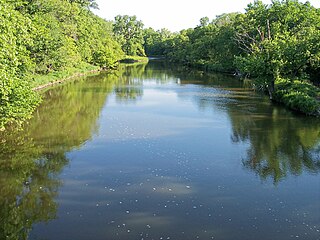
The Prairie River is a river in Itasca County, Minnesota. The river is located in northern Minnesota, near the communities of Taconite, Bovey, Grand Rapids, and La Prairie. It is a tributary of the Mississippi River.

Water pollution in the United States is a growing problem that became critical in the 19th century with the development of mechanized agriculture, mining, and industry, although laws and regulations introduced in the late 20th century have improved water quality in many water bodies. Extensive industrialization and rapid urban growth exacerbated water pollution as a lack of regulation allowed for discharges of sewage, toxic chemicals, nutrients and other pollutants into surface water.
The Minnesota Pollution Control Agency (MPCA) is a Minnesota state agency that monitors environmental quality, offers technical and financial assistance, and enforces environmental regulations for the State of Minnesota. The MPCA finds and cleans up spills and leaks that can affect public health and the environment. The MPCA staff develops statewide policies and supports environmental education, working with such partners as citizens, municipalities, businesses, environmental groups, and educators to prevent pollution and conserve resources.
International Bird Rescue is a nonprofit organization that rehabilitates injured aquatic birds, most notably seabirds affected by oil spills. Founded by Alice Berkner and members of the Ecology Action, including veterinarian James Michael Harris, D.V.M. in 1971 and based in Cordelia, California, the group has developed scientifically-based bird rehabilitation techniques and has led oiled wildlife rescue efforts in more than 200 oil spills worldwide, including the 1989 Exxon Valdez oil spill in Prince William Sound, Alaska, and the 2010 Deepwater Horizon oil spill in the Gulf of Mexico, where International Bird Rescue co-managed oiled bird rehabilitation efforts in four states with Tri-State Bird Rescue and Research.

Climate change in Minnesota encompasses the effects of climate change, attributed to human-caused increases in atmospheric carbon dioxide, in the U.S. state of Minnesota.

Gordon Rosenmeier was an American lawyer and politician who served in the Minnesota Senate from 1941 until 1971. He represented the 53rd district, which at the time consisted of Morrison and Crow Wing counties.
The Line 3 oil spill was a 1.7 million gallon crude oil spill in Minnesota on March 3, 1991. The Line 3 pipeline, then owned by the Lakehead Pipeline Company, ruptured on a wetland near Grand Rapids, Minnesota, spilling oil into the Prairie River, a tributary of the Mississippi River. It was the largest inland oil spill in the history of the United States.
References
- Robert A. Taft Sanitary Engineering Center, Report on Oil Spills Affecting the Minnesota and Mississippi Rivers, Winter of 1962–1963 Cincinnati: N.p., 1963.
- "Blame Oil Slick for Ducks' Deaths," Mankato Free Press, April 1, 1963.
- "3 Million Gallons Soybean Oil Spill When Tank Splits," Mankato Free Press, January 23, 1963.
- Rigger, Don. "Edible Oils: Are They Really That Different?." 1997 International Oil Spill Conference, U.S. Environmental Protection Agency, 1997.
- "A Report on Pollution of the Upper Mississippi River and Major Tributaries." U.S. Department of the Interior, Federal Water Pollution Control Administration Great Lakes Region, Twin Cities- Upper Mississippi River Project, 1966. National Service for Environmental Publication, Washington, D.C.