
East Lindsey is a local government district in Lincolnshire, England. The population of the district council was 136,401 at the 2011 census. The council is based in Manby. Other major settlements in the district include Alford, Wragby, Spilsby, Mablethorpe, Skegness, Horncastle, Chapel St Leonards and Louth. Skegness is the largest town in East Lindsey, followed by Louth and Mablethorpe.

West Lindsey is a local government district in Lincolnshire, England. Its council is based in Gainsborough.

North Kesteven is a local government district in the East Midlands. Just over 100 miles (160 km) north of London, it is east of Nottingham and south of Lincoln. North Kesteven is one of seven districts in Lincolnshire, England and is in the centre of the county. Its council, North Kesteven District Council, is based in Sleaford in the former offices of Kesteven County Council.
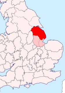
The Parts of Lindsey are a traditional division of Lincolnshire, England, covering the northern part of the county. The Isle of Axholme, which is on the west side of the River Trent, has normally formed part of it. The district's name originated from the Kingdom of Lindsey of Anglo-Saxon times, whose territories were merged with that of Stamford to form Lincolnshire.

Glanford was, from 1974 to 1996, a local government district with borough status in the non-metropolitan county of Humberside, England.

Gainsborough is a constituency in Lincolnshire represented in the House of Commons of the UK Parliament since 1983 by Sir Edward Leigh, a Conservative.
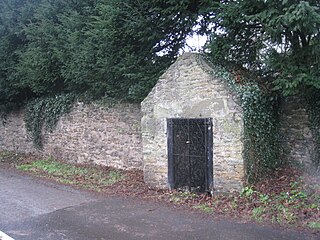
Bottesford Preceptory was sited at Bottesford, just to the south of Scunthorpe, in Lindsey, England. It was on low-lying land, near the Bottesford Beck, about 3 miles (5 km) to the west of the escarpment of the Lincoln Cliff limestone upland, and about the same distance to the east of the River Trent. A preceptory was a community of the Knights Templar who lived on one of that order's estates in the charge of its preceptor. A preceptory also referred to the estate and its buildings. The present Bottesford Manor is believed to have been the gatehouse to the preceptory.
South Killingholme is a village and civil parish in North Lincolnshire, England. The population of the civil parish at the 2011 census was 1,108.

The A18 is a road in England that links Doncaster in South Yorkshire with Ludborough in Lincolnshire, via Scunthorpe and Grimsby. Much of its route has been superseded by the M180 motorway.
The West Riding of Lindsey was a division of the Lindsey part of Lincolnshire in England. It consisted of the north-western part of the county, and included the Isle of Axholme and the Aslacoe, Corringham, Manley, Lawress and Well wapentakes.

Welton was a rural district in Lincolnshire, Parts of Lindsey from 1894 to 1974. It was formed under the Local Government Act 1894 from that part of the Lincoln rural sanitary district which was in Lindsey - the Kesteven part forming the Branston Rural District. It was named after Welton.

Caistor was a rural district in Lincolnshire, Parts of Lindsey from 1894 to 1974.
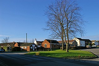
Elkington is a civil parish in the East Lindsey district of Lincolnshire, England. It comprises the village of South Elkington, and the hamlets of North Elkington, Boswell, and Thorpe, and is situated approximately 3 miles (5 km) north-west from the market town of Louth.
Anlaby Common is former common land, now an outer suburb of Kingston upon Hull. The area includes the residential areas which are located on the western urban fringe of Hull; the B1231 road passes through all of Anlaby Common's estates, east to west.

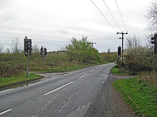
The A158 road is a major route that heads from Lincoln in the west to Skegness on the east coast. The road is located entirely in the county of Lincolnshire and is single carriageway for almost its entirety. The road is approximately 41 miles (66 km) long. The road gets quite congested with holiday traffic during the summer.
Winterton and Thealby railway station was a station built by the North Lindsey Light Railway in Winterton, Lincolnshire, on their line from Scunthorpe to Winteringham. The station was opened on 3 September 1906 and closed to passengers in 1925. The line closed entirely in 1964.
Scunthorpe railway station was a small railway station, the original southern terminus of the North Lindsey Light Railway situated adjacent to the level crossing on Dawes Lane and about 1/2 mile east of the present main line station, opened in 1926, and about 1/8 mile east of Frodingham railway station, Scunthorpe’s first station.

Edlington with Wispington is a civil parish in the East Lindsey district of Lincolnshire, England. It is situated approximately 2 miles (3 km) north-west from the town of Horncastle.
Greetham with Somersby is a civil parish in the East Lindsey district of Lincolnshire, England. It is situated approximately 3 miles (5 km) north-east from the market town of Horncastle.
The south bank of the Humber Estuary in England is a relatively unpopulated area containing large scale industrial development built from the 1950s onward, including national scale petroleum and chemical plants as well as gigawatt scale gas fired power stations.