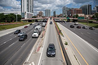
A highway is any public or private road or other public way on land. It is used for major roads, but also includes other public roads and public tracks. In the United States, it is used as an equivalent term to controlled-access highway, or a translation for Autobahn, autoroute, etc.

A trunk road, trunk highway, or strategic road is a major road, usually connecting two or more cities, ports, airports and other places, which is the recommended route for long-distance and freight traffic. Many trunk roads have segregated lanes in a dual carriageway, or are of motorway standard.
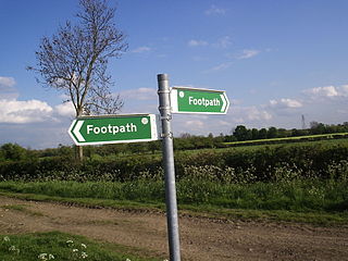
In England and Wales, excluding the 12 Inner London boroughs and the City of London, the right of way is a legally protected right of the public to pass and re-pass on specific paths. The law in England and Wales differs from Scots law in that rights of way exist only where they are so designated, whereas in Scotland any route that meets certain conditions is defined as a right of way, and in addition, there is a general presumption of access to the countryside. Private rights of way or easements also exist.

The Ohio Department of Transportation (ODOT) is responsible for the establishment and classification of a state highway network which includes interstate highways, U.S. highways, and state routes. As with other states, U.S. and Interstate highways are classified as state routes in Ohio. There are no state routes which duplicate an existing U.S. or Interstate highway in Ohio.
Mallee Highway is a highway in south-eastern South Australia and north-western Victoria, running mostly across the Mallee plains. It forms part of the shortest route between Adelaide and Sydney.

A county highway is a road in the United States and in the Canadian province of Ontario that is designated and/or maintained by the county highway department. Route numbering can be determined by each county alone, by mutual agreement among counties, or by a statewide pattern.

The state highway system of the U.S. state of Virginia is a network of roads maintained by the Virginia Department of Transportation (VDOT). As of 2006, the VDOT maintains 57,867 miles (93,128 km) of state highways, making it the third-largest system in the United States.
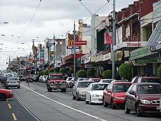
Burke Road is a major north–south thoroughfare in Melbourne, Australia. It runs from Ivanhoe East to Caulfield East and through the major shopping district at Camberwell.
A highway authority is a government organization responsible for public roads.

The state highway system in the U.S. state of California dates back to 1896, when the state took over maintenance of the Lake Tahoe Wagon Road. Before then, roads and streets were managed exclusively by local governments. Construction of a statewide highway system began in 1912, after the state's voters approved an $18 million bond issue for over 3,000 miles (4,800 km) of highways. The last large addition was made by the California State Assembly in 1959, after which only minor changes have been made.

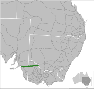
Wimmera Highway is a 345 kilometre highway that connects the towns of Marong, Victoria and Naracoorte, South Australia, through the major junctions of Sunraysia Highway, Henty Highway and Western Highway.

The Federal Aid Highway Act of 1921, also called the Phipps Act, sponsored by Sen. Lawrence C. Phipps (R) of Colorado, defined the Federal Aid Road program to develop an immense national highway system. The plan was crafted by the head of the National Highway Commission, Thomas Harris MacDonald and was the first coherent plan for the nation's future roads. President Warren Harding signed the act into law on November 9, 1921.

The Ministry of Road Transport and Highways (MoRTH) is a ministry of the Government of India, that is the apex body for formulation and administration of the rules, regulations and laws relating to road transport, transport research and in also to increase the mobility and efficiency of the road transport system in India. Through its officers of Central Engineering Services (Roads) cadre it is responsible for the development of National Highways of the country. Road transport is a critical infrastructure for economic development of the country. It influences the pace, structure and pattern of development. In India, roads are used to transport over 60 percent of the total goods and 85 percent of the passenger traffic. Hence, development of this sector is of paramount importance for India and accounts for a significant part in the budget.
The Federal Aid Road Act of 1916, Pub. L.Tooltip Public Law 64–156, 39 Stat. 355, was enacted on July 11, 1916, and was the first federal highway funding legislation in the United States. The rise of the automobile at the start of the 20th century, especially after the low-price Ford Model T in 1908, created a demand for better roads on a national level. The act provided federal subsidies to road-building efforts.

The State Trunkline Highway System consists of all the state highways in Michigan, including those designated as Interstate, United States Numbered, or State Trunkline highways. In their abbreviated format, these classifications are applied to highway numbers with an I-, US, or M- prefix, respectively. The system is maintained by the Michigan Department of Transportation (MDOT) and comprises 9,669 miles (15,561 km) of trunklines in all 83 counties of the state on both the Upper and Lower peninsulas, which are linked by the Mackinac Bridge. Components of the system range in scale from 10-lane urban freeways with local-express lanes to two-lane rural undivided highways to a non-motorized highway on Mackinac Island where cars are forbidden. The longest highway is nearly 400 miles (640 km) long, while the shortest is about three-quarters of a mile. Some roads are unsigned highways, lacking signage to indicate their maintenance by MDOT; these may be remnants of highways that are still under state control whose designations were decommissioned or roadway segments left over from realignment projects.

The Arkansas Highway System is made up of all the highways designated as Interstates, U.S. Highways and State Highways in the US state of Arkansas. The system is maintained by the Arkansas Department of Transportation (ArDOT), known as the Arkansas State Highway Department (AHD) until 1977 and the Arkansas State Highway and Transportation Department (AHTD) from 1977 to 2017. The system contains 16,442.90 miles (26,462.28 km) of Interstates, U.S. Routes, state highways, and special routes. The shortest members are unsigned state highways Arkansas Highway 806 and Arkansas Highway 885, both 0.09 miles (0.14 km) in length. The longest route is U.S. Route 67, which runs 296.95 miles (477.89 km) from Texarkana to Missouri.
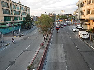
Andres Bonifacio Avenue, also known as A. Bonifacio Avenue, is a 3.784-kilometer (2.351 mi) national secondary road connecting the North Luzon Expressway and Epifanio de los Santos Avenue at Balintawak Interchange in Quezon City and Blumentritt Road at the city's boundary with Manila in a north–south direction.
South Korea has seven highway systems.
- National expressways
- General national highways
- Special Metropolitan City roads and Metropolitan City roads
- Local highways
- Si roads
- Gun roads
- Gu roads

Tandang Sora Avenue, formerly known as Banlat Road, is a major east-west thoroughfare bisecting Quezon City in Metro Manila, the Philippines. It is a two-to-six lane highway and municipal road that runs for 9.6 kilometers (6.0 mi) from its eastern terminus at Magsaysay Avenue in Pansol and U.P. Campus in Diliman to its western terminus at Quirino Highway in Baesa and Talipapa in Novaliches, crossing Barangays Culiat, New Era, Pasong Tamo, Tandang Sora, and Sangandaan.