
Oxford Street is a major thoroughfare in Sydney, New South Wales, Australia, running from Whitlam Square on the south-east corner of Hyde Park in the central business district (CBD) of Sydney to Bondi Junction in the Eastern Suburbs. Close to the CBD in particular, the street is lined with numerous shops, bars and nightclubs. After the 1980s, Oxford Street garnered a reputation as Sydney's primary nightclub strip and subsequently saw a large increase in the number of crimes committed in the area. However, the 2014 lockout laws saw many nightclubs close and the crime rate drop as Sydney's nightlife hubs moved to Darling Harbour and Newtown. The lockout laws ended in 2020 with a focus on small bars and restaurants. Many nightclubs reopened in 2021 especially around Taylor Square.

King Street is a street in central Cambridge, England. It connects between Sussex Street heading west and Hobson Street heading south at the western end and a large roundabout to the east. It runs parallel to and south of Jesus Lane. The roads link together at a roundabout at the eastern end. To the east is Maid's Causeway and then Newmarket Road leading out of Cambridge. To the north is Victoria Avenue between Jesus Green and Midsummer Common. To the south is Short Street, Cambridge, quickly leading into Emmanuel Road past Christ's Pieces.

Robert Sayle was a department store located in Cambridge.
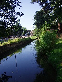
Hobson's Conduit, also called Hobson's Brook, is a watercourse that was built from 1610 to 1614 by Thomas Hobson and others to bring fresh water into the city of Cambridge, England from springs at Nine Wells, a Local Nature Reserve, near the village of Great Shelford. It is now a Scheduled Ancient Monument and historical relic. The watercourse currently runs overground until Cambridge University Botanic Garden and Brookside, where it is at its widest. At the corner of Lensfield Road stands a hexagonal monument to Hobson, which once formed part of the market square fountain, and was moved to this location in 1856, after a fire in the Market. The flow of water runs under Lensfield Road, and subsequently runs along both sides of Trumpington Street in broad gutters towards Peterhouse and St Catharine's College, and also St Andrew's Street. The conduit currently ends at Silver Street.
East Memphis is a region of Memphis, Tennessee with several defined and informal subdivisions and neighborhoods such as Colonial Acres, White Station-Yates, Sherwood Forest, Normal Station, High Point Terrace, Belle Meade, Normandy Meadows, St. Nick, Pleasant Acres, Balmoral, and Ridgeway. The general boundaries are informal:

Charles Webb was an architect working in Victoria, Australia during the 19th century. Notable Webb designs include the iconic Windsor Hotel, Royal Arcade, South Melbourne Town Hall and Tasma Terrace, all listed on the Victorian Heritage Register.

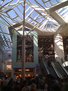
The Grand Arcade is a large shopping centre in St Andrew's Street, Cambridge, England. It is anchored by the John Lewis & Partners department store, which is situated to the southeast of the site and which re-opened, following a major rebuild, on 8 November 2007, prior to the rest of the development, which opened on 27 March 2008.

In architecture, a quadrangle is a space or a courtyard, usually rectangular in plan, the sides of which are entirely or mainly occupied by parts of a large building. The word is probably most closely associated with college or university campus architecture, but quadrangles are also found in other buildings such as palaces. Most quadrangles are open-air, though a few have been roofed over, to provide additional space for social meeting areas or coffee shops for students.
The Lion Yard Shopping Centre is a covered shopping centre in the city centre of Cambridge, England. Construction work on the centre, which is bounded by St Andrew's Street, Corn Exchange Street, and Petty Cury, commenced in 1970 and the development contained a library, multi-storey car park and magistrates' court.
Trumpington Street is a major historic street in central Cambridge, England. At the north end it continues as King's Parade where King's College is located. To the south it continues as Trumpington Road, an arterial route out of Cambridge, at the junction with Lensfield Road.

Trumpington Road is an arterial road in southeast central Cambridge, England. It runs between the junction of Trumpington Street and Lensfield Road at the northern end to the junction of the High Street in the village of Trumpington and Long Road at the southern end. The Fen Causeway leads off to the west near the northern end, over Coe Fen and the River Cam.
Sidney Street is a major street in central Cambridge, England. It runs between Bridge Street at the junction with Jesus Lane to the northwest and St Andrew's Street at the junction with Hobson Street to the southeast.

Regent Street is an arterial street in southeast central Cambridge, England. It runs between St Andrew's Street, at the junction with Park Terrace, to the northwest and Hills Road at the junction with the A603 to the southeast. Regent Terrace runs in parallel immediately to the northeast. Beyond that is Parker's Piece, a large grassed area with footpaths.

Market Hill is the location of the marketplace in central Cambridge, England. Operating as a marketplace since Saxon times, a daily outdoor market with stalls continues to run there.

Market Street is a shopping street in central Cambridge, England. It runs between Market Hill, location of the city's central Market Square to the west and Sidney Street to the east. On the other side of the market square, the street continues west as St Mary's Street north of Great St Mary's, the University church. On the other side of Sidney Street is Hobson's Passage leading east to Hobson Street. To the north is Market Passage and to the south is Petty Cury, a pedestrianised shopping street.
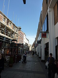
Petty Cury is a pedestrianised shopping street in central Cambridge, England. It connects Market Hill, the location of Cambridge's central outdoor market, and Guildhall Street to the west with the shopping streets of Sidney Street and St Andrew's Street to the east. Hobson Street leads off north on the opposite side of the street at the eastern end, on the corner of Christ's College, one of the historic University of Cambridge colleges.
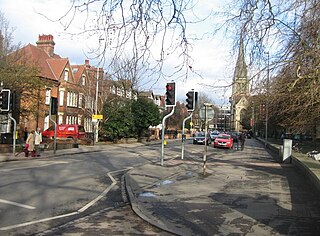
Lensfield Road is a road in southeast central Cambridge, England. It runs between the junction of Trumpington Street and Trumpington Road to the west and the junction of Regent Street and Hills Road to the west. It continues as Gonville Place to the northeast past Parker's Piece, a large grassed area with footpaths.

Christchurch Central City or Christchurch City Centre is the geographical centre and the heart of Christchurch, New Zealand. It is defined as the area within the four avenues and thus includes the densely built up central city, some less dense surrounding areas of residential, educational and industrial usage, and green space including Hagley Park, the Christchurch Botanic Gardens and the Barbadoes Street Cemetery.
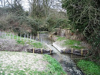
Nine Wells is a 1.2 hectare Local Nature Reserve east of Trumpington, on the southern outskirts of Cambridge. It is owned and managed by Cambridge City Council.

