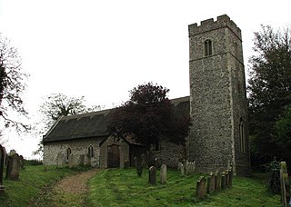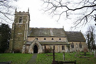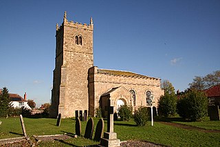
Saunderton is a village in the Saunderton Valley in the Chiltern Hills, Buckinghamshire, England, in the civil parish of Bledlow-cum-Saunderton. The village consists of three main areas: a linear settlement along Bledlow Road about 1+1⁄4 miles (2 km) southwest of Princes Risborough, Saunderton Lee, about 1+1⁄2 miles (2 km) further south and a residential area on the A4010 road around Saunderton railway station, about 4+1⁄2 miles (7 km) northwest of High Wycombe. This residential area, unlike the other two parts of the village, is in the HP14 postcode district, meaning its post town is High Wycombe, not Princes Risborough, the boundary between the two post towns passing just south of Grange Farm.

Worminghall is a village and civil parish in the Aylesbury Vale district of Buckinghamshire, England.

Kilburn is a village in the civil parish of Kilburn High and Low, in the Hambleton District in the county of North Yorkshire, England. It lies on the edge of the North York Moors National Park, and 6.2 miles (10 km) north of Easingwold.

Carlton Colville is a civil parish and suburb of Lowestoft in the English county of Suffolk. It is 3 miles (5 km) south-west of the centre of the town, in the East Suffolk district. The area lies along the A146 Lowestoft to Beccles road.

Edensor is a village and civil parish in Derbyshire, England. The population of the civil parish as of the 2011 census was 145.

Barnby is a village and civil parish in the East Suffolk district of the English county of Suffolk. The village is 5 miles (8.0 km) west of Lowestoft and 3 miles (4.8 km) east of Beccles in the north of the county. It is effectively merged with the village of North Cove which constitutes a separate parish.

Bucknell is a village and civil parish 2+1⁄2 miles (4 km) northwest of Bicester in Oxfordshire, England. The 2011 Census recorded the parish's population as 260.

Gisleham is a village and civil parish in the English county of Suffolk. It is on the edge of Lowestoft, around 4.5 miles (7.2 km) south-west of the town centre. The parish is in the East Suffolk district, situated between Carlton Colville and Kessingland.

East Carlton is a village and civil parish in the county of Northamptonshire, on the southern ridge overlooking the Welland valley to the north and covers 1,645 acres (666 ha) on a long strip of land. It is 2 miles (3.2 km) west of the town of Corby and is administered as part of North Northamptonshire but was previously in the Corby borough until 2021. At the time of the 2001 census, the parish's population was 270, reducing to 259 at the 2011 census. East Carlton is one of the Thankful Villages that suffered no fatalities during World War I. Although in Northamptonshire, the village is in the Leicestershire LE16 postcode area.

St Peter's Church is in the village of Heysham, Lancashire, England. It is recorded in the National Heritage List for England as a designated Grade I listed building. It is an active Anglican parish church in the deanery of Lancaster, the archdeaconry of Lancaster and the diocese of Blackburn.

St John the Baptist's Church is an Anglican church in Crawley, West Sussex, England. It is the parish church of Crawley, and is the oldest building in the town centre, dating from the 1250—although many alterations have been made since, and only one wall remains of the ancient building. In September 2017, a team from St Peter’s Brighton began a new phase in the life of St John’s Crawley. St John's offer a variety of services, traditional and informal, contemporary services.

Great Haseley is a village and civil parish in South Oxfordshire, England. The village is about 4.5 miles (7 km) southwest of Thame. The parish includes the hamlets of Latchford, Little Haseley and North Weston and the house, chapel and park of Rycote. The parish stretches 6 miles (10 km) along a northeast — southwest axis, bounded by the River Thame in the north, Haseley Brook in the south and partly by a boundary hedge with Little Milton parish in the west. The 2011 Census recorded a parish population of 511.

Weston Colville is a village in South Cambridgeshire, 10 miles southeast of Cambridge and 6 miles south of Newmarket, close to the border with Suffolk.

Wilcote is a hamlet about 3+1⁄2 miles (5.6 km) north of Witney in Oxfordshire, England.

St. Peter and St. Paul known commonly as Dagenham Parish Church, is a Church of England parish church in the London Borough of Barking and Dagenham, England, formerly part of Essex. It is of medieval origin, largely rebuilt at the beginning of the nineteenth century.

Old St Peter and St Paul's Church is a former Anglican church near the village of Albury, Surrey, England in the care of The Churches Conservation Trust. It is recorded in the National Heritage List for England as a designated Grade I listed building. The church stands in Albury Park, to the northwest of Albury Hall, and between the villages of Albury and Shere.

Little Carlton is a village and civil parish in the East Lindsey district of Lincolnshire, England. It is situated approximately 6 miles (10 km) east from the town of Louth.

Great Carlton is a village and civil parish in the East Lindsey district of Lincolnshire, England. The population of the civil parish at the 2011 census was 136. It is situated 5 miles (8.0 km) southeast from the market town of Louth, Lincolnshire.

North Carlton is a village and civil parish in the West Lindsey district of Lincolnshire, England. The population of the civil parish at the 2011 census was 172. It is situated about 5 miles (8.0 km) north from the city and county town of Lincoln.

Oulton is a civil parish on the western edge of the town of Lowestoft in the north of the English county of Suffolk. It is in the East Suffolk district. The eastern part of the parish forms part of the suburbs of Lowestoft, whilst the western section extends into The Broads national park, reaching the River Waveney and Oulton Dyke.


