
The Duke of York's Laws for the Government of the Colony of New York were a set of guidelines laid out during the early years of English rule in the Colony of New York. [1]
The Duke of York's Laws for the Government of the Colony of New York were a set of guidelines laid out during the early years of English rule in the Colony of New York. [1]
In March 1665, Governor Richard Nicolls convened a convention at Hempstead, Long Island to draft legislation for the colony. The code of laws was introduced into Yorkshire [2] which included Long Island, Staten Island, Manhattan Island, and the east side of the Hudson River coterminous with Westchester. [3] The change was made much more slowly in the Dutch areas, where certain concessions had been agreed to under the Articles of Capitulation.
The Duke's Laws covered nearly every facet of life in the colony and were published in alphabetical order—from how arrests were to be carried out, how juries were to be picked, to the amount of the bounty paid for dead wolves. [2]
Although directed to English and Dutch colonists, the laws also covered what Indians could and could not do. For example, Indians were required to fence in their corn fields and were specifically barred from practicing their own religion. "No Indian whatsoever shall at any time be suffered to powaw or performe outward worship to the Devil in any Towne within this Government," one section of the laws said.
There are detailed instructions of how churches were to be managed. For instance, a church was to be built in each community, capable of holding 200 people; ministers would have to present their credentials to the government to prove they were not "ignorant pretenders to the Ministry." The minister would be required to preach "constantly every Sunday and shall also pray for the King, Queene, Duke of York and the Royall Family."
Under the laws, a person, "either Christian or Indean," who kills a wolf would receive a payment by bringing the head to a constable. The payment would be "to the value of an Indean coat."
The laws set out rules by which a person could be arrested. For instance, a person could not be arrested on the sabbath. Jurors were to be paid "three shillings six pence per diem."
One provision states, "If any man lyeth with mankind as he lyeth with a woman, they shall be put to Death, unless the one party were Forced or be under fourteen Years of age, in which Case he shall be punished at the Discretion of the Court of Assizes." [4]
The laws also required marks, or brands, for horses in each town. Letters were designated in geographic order from east to west: A for East Hampton, B for Southampton, C for Southold, D for Seatalcott (Setauket), E for Huntington, F for Oyster Bay, G for Hempstead, H for Jamaica, and I for Flushing.[ citation needed ] The letters are still in the seals of Huntington and Brookhaven, which uses Setauket's D. [5]

The Middle Colonies were a subset of the Thirteen Colonies in British America, located between the New England Colonies and the Southern Colonies. Along with the Chesapeake Colonies, this area now roughly makes up the Mid-Atlantic states.
Thomas Dongan, 2nd Earl of Limerick, was a member of the Irish Parliament, Royalist military officer during the English Civil War, and Governor of the Province of New York. He is noted for having called the first representative legislature in New York, and for granting the province's Charter of Liberties. His negotiations and subsequent alliance with the Iroquois Indian Confederacy brought a lasting security from the French and their hostile Indian allies.
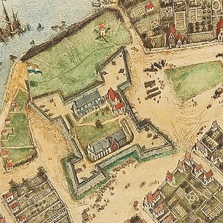
Fort Amsterdam was a fortification on the southern tip of Manhattan Island at the confluence of the Hudson and East rivers. The fort and the island were the center of trade and the administrative headquarters for the Dutch and then British/Colonial rule of the colony, of New Netherland and thereafter the Province of New York. The fort was the nucleus of the settlement on the island and greater area, which was named New Amsterdam by the first Dutch settlers, and eventually renamed New York by the English, and was central to much of New York's early history.

The Province of New York was a British proprietary colony and later a royal colony on the northeast coast of North America from 1664 to 1783.
Cornwall County was a county of the former Province of New York, established on September 5, 1665 from 25,100 square miles (65,000 km2) of land that had been granted to the Duke of York in modern Maine. As established, the grant ran all the way from the St. Lawrence River to the Atlantic Ocean, between the Kennebec and St. Croix rivers, and produced what today is most of Aroostook, Piscataquis, Washington, Hancock, Penobscot, Waldo, Knox, Lincoln, Kennebec, Somerset, and Sagadahoc counties.

Gloucester County, New York is a former county in New York that became part of the state of Vermont. It was a part of Albany County in the Province of New York until 1770 and was lost to Vermont in 1777. At that time, Vermont was holding itself out as the Republic of Vermont and did not become a state until 1791.

Jacob Leisler was a German-born colonist who served as a politician in the Province of New York. He gained wealth in New Amsterdam in the fur trade and tobacco business. In what became known as Leisler's Rebellion following the English Revolution of 1688, he took control of the city, and ultimately the entire province, from appointees of deposed King James II, in the name of the Protestant accession of William III and Mary II.

Leisler's Rebellion was an uprising in late-17th century colonial New York in which German American merchant and militia captain Jacob Leisler seized control of the southern portion of the colony and ruled it from 1689 to 1691. The uprising took place in the aftermath of England's Glorious Revolution and the 1689 Boston revolt in the Dominion of New England, which had included New York. The rebellion reflected colonial resentment against the policies of deposed King James II.
York Shire was the first large governmental unit organized in the English Province of New York soon after English control of the area was established in 1664.
In the United States, a patroon was a landholder with manorial rights to large tracts of land in the 17th century Dutch colony of New Netherland on the east coast of North America. Through the Charter of Freedoms and Exemptions of 1629, the Dutch West India Company first started to grant this title and land to some of its invested members. These inducements to foster colonization and settlement are the basis for the patroon system. By the end of the eighteenth century, virtually all of the American states had abolished primogeniture and entail; thus patroons and manors evolved into simply large estates subject to division and leases.
The Dongan Charter is the 1686 document incorporating Albany, New York, as a city. Albany's charter was issued by Governor Thomas Dongan of the Province of New York, a few months after Governor Dongan issued a similarly worded, but less detailed charter for the city of New York. The city of Albany was created three years after Albany County. The charter is the oldest existing city charter still in force in the United States. According to Stefan Bielinski, former senior historian of the New York State Museum, the charter is also "arguably the longest-running instrument of municipal government in the Western Hemisphere." In 1936 the United States Congress commemorated the charter's 250th anniversary by minting a half dollar coin.
The towns and cities of Downstate New York were created by the U.S. state of New York as municipalities in order to give residents more direct say over local government. Present-day Westchester, Bronx, New York, Richmond, Kings, Queens, Nassau, and Suffolk counties were part of York Shire from 1664-August 1673 and again from February 1674 until 1683 at which point the Province of New York was divided into counties. From August 1673 to February 1674 New York was under Dutch control and English political units were suspended, then restored under English rule. York Shire was divided into three divisions called ridings, the East, West, and North ridings. In 1683 the colony of New York eliminated shires and ridings in favor of counties, the East Riding becoming Suffolk County, West Riding the counties of Richmond and Kings, while the North Riding became the counties of Westchester, New York, and Queens.

The towns and cities of the Hudson Valley were created by the U.S. state of New York as municipalities, in order to perform the services of local government. In 1683, prior to the creation of modern towns, the Province of New York was divided into twelve counties for administrative purposes by the Colonial Governor of New York. In the Hudson Valley, these divisions included Dutchess, Orange, and Ulster counties. Dutchess and Orange remained unorganized until 1713, with Dutchess administered from Ulster; Orange would be administered from New York County. Future counties would be formed and towns exchanged over time, with Rockland County split from Orange in 1799, at which time the southern towns of Ulster were transferred to Orange as compensation for the loss; and Putnam County from Dutchess in 1812, these county's towns can trace their origins to towns and precincts that were formed in their parent counties. Another change that occurred was the transfer of Dutchess County's northern section, the Livingston Manor, to Columbia County. Greene County was formed in 1800 by the combination of the southernmost towns of Albany County with the northernmost towns of Ulster. The history of the towns of Greene and Columbia counties can be found at the Timeline of town creation in New York's Capital District.
The towns and cities of Central New York were created by the U.S. state of New York as municipalities in order to give residents more direct say over local government. Central New York is a six county area–Cayuga, Herkimer, Madison, Oneida, Onondaga, and Oswego.
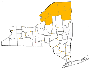
The towns and cities of New York's North Country were created by the U.S. state of New York as municipalities in order to give residents more direct say over local government. The North Country consists of Clinton County, Essex County, Franklin County, Jefferson County, Lewis County, and St. Lawrence County. When counties were first formed in 1683 the entire area was theoretically under the jurisdiction of Albany County though actually wilderness inhabited by Native Americans, by 1764 most of the area became effectively controlled by Albany County. The state would sell off this land to settlers and speculators, most notably as part of the Old Military Tract (1786) to veterans of the US Revolutionary War and as Macomb's Purchase (1791) to Alexander Macomb. In 1772 the northern and western portions of Albany County was divided into two counties– Tryon and Charlotte. Tryon encompassed Lewis, Jefferson, and St. Lawrence counties along with the western section of Franklin; Tryon was renamed Montgomery in 1784. Charlotte encompassed Clinton, Essex, and the majority of Franklin County; the name of the county was changed to Washington County in 1784. In 1788 Clinton County was split from Washington, Essex was formed from Clinton in 1799 and Franklin was formed from Clinton in 1808. Montgomery County's North Country area went to Herkimer County on that county's formation in 1791, but western Franklin and eastern St. Lawrence were returned to Montgomery in 1797. In 1798 Lewis, Jefferson, and western St. Lawrence became part of the newly formed Oneida County from Herkimer in 1798, leaving only central St. Lawrence County as part of Herkimer. In 1801 the future St. Lawrence and Franklin counties which were portions of Montgomery, Herkimer, and Oneida were transferred to Clinton County; the next year in 1802 St. Lawrence was formed as a county. In 1805 both Lewis and Jefferson counties were formed from Oneida County.
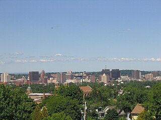
The history of Albany, New York from 1664 to 1784 begins with the English takeover of New Netherland and ends with the ratification of the Treaty of Paris by the Congress of the Confederation in 1784, ending the Revolutionary War.
The Charter of Liberties and Privileges was an act passed by the New York General Assembly during its first session in 1683 that laid out the political organization of the colony, set up the procedures for election to the assembly, created 12 counties, and guaranteed certain individual rights for the colonists. The colony operated under the Charter until May 1686 when Thomas Dongan, the governor of New York, received instructions from King James II that New York would be assimilated into the Dominion of New England. After the Glorious Revolution William III and Mary II appointed a new governor, who convened the colonial assembly on April 5, 1691.

During the American colonial era, the colonies of New York and Connecticut often disputed the precise location of their shared border, leading to a border dispute that eventually gave the colonies their modern shapes. Though the dispute was officially resolved in 1731, effects of the boundary conflict persisted until well after both colonies gained statehood as part of the United States following the American Revolution.
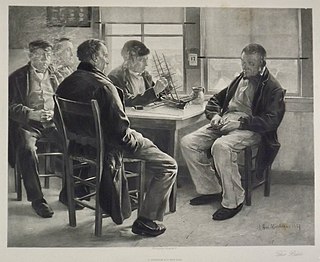
Sandy Hook Pilots are licensed maritime pilots that are members of the Sandy Hook Pilots Association for the Port of New York and New Jersey, the Hudson River, and Long Island Sound. Sandy Hook pilots guide oceangoing vessels, passenger liners, freighters, and tankers in and out of the harbor. The peninsulas of Sandy Hook, and Rockaway in Lower New York Bay define the southern entrance to the port at the Atlantic Ocean.
Thomas Penniston was a privateer who operated out of New England. He was known for sailing alongside Adrian Claver and Regnier Tongrelow.
| | This article relating to the history of the United States is a stub. You can help Wikipedia by expanding it. |