
The Shire of Nillumbik is a local government area in Victoria, Australia. It contains outer northern suburbs of Melbourne and rural localities beyond the urban area. It has an area of 432 square kilometres and at the 2021 census, the Shire had a population of 62,895. It was formed in 1994 from the merger of parts of the Shires of Eltham, Diamond Valley, Healesville and the City of Whittlesea. The Shire uses the tag-line The Green Wedge Shire. The Nillumbik Council offices are located in Civic Drive, Greensborough.

The City of Whittlesea is a local government area located in the outer northern suburbs of Melbourne, the state capital of Victoria, Australia. The city covers an area of 490 square kilometres (189.2 sq mi), and in June 2018, it had a population of 223,322.

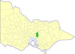
The Shire of Murrindindi is a local government area in the Hume region of Victoria, Australia, located in the north-east part of the state. It covers an area of 3,880 square kilometres (1,500 sq mi) and, in June 2018, had a population of 14,478. It includes the towns of Alexandra, Buxton, Eildon, Flowerdale, Kinglake, Marysville, Molesworth, Strath Creek, Taggerty, Yarck and Yea. It was formed in 1994 from the amalgamation of the Shire of Alexandra, Shire of Yea, and parts of the Shire of Broadford, Shire of Eltham, Shire of Euroa, Shire of Healesville and City of Whittlesea.

Eltham is a suburb of Melbourne, Victoria, Australia, 20 km north-east of the Central Business District, located within the Shire of Nillumbik local government area. Eltham recorded a population of 18,847 at the 2021 census.

Bear's Castle is a small faux castle constructed in approx 1846 in Yan Yean, Victoria, Australia.
Yan Yean was a steam-era railway station on the Whittlesea line in Yan Yean, Victoria, Australia. It is now located on private property.

Whittlesea was the original terminus station on the Whittlesea line, located in Victoria, Australia. It opened in 1889, operating until the closure of the line in 1959.
Whittlesea is a semi-rural town situated in the Hewu district, 37 km south of Queenstown, Eastern Cape Province, South Africa. The town is made up of the townships Ekuphumleni, Bhede, Extension 4, Extension 5 and Sada. The town falls under the Enoch Mgijima Local Municipality which is under the Chris Hani District Municipality. Surrounding Whittlesea are 36 villages which make up the Hewu district.
Aurora is a housing estate in Melbourne, Victoria, Australia designed to provide homes with higher levels of energy and water efficiency. The plan is to build it over 15 years and to have 8500 residences.
Monjolos is a Brazilian municipality located in the northeast of the state of Minas Gerais. Its population in 2020 was 2,202, with a total area of 652 square kilometres (252 sq mi). The city belongs to the statistical mesoregion of Central Mineira and to the statistical microregion of Curvelo. It became a municipality in 1962.
The Electoral district of Whittlesea was an electoral district of the Legislative Assembly in the Australian state of Victoria.

The Shire of Diamond Valley was a local government area about 20 kilometres (12 mi) northeast of Melbourne, the state capital of Victoria, Australia. The shire covered an area of 74.38 square kilometres (28.72 sq mi), and existed from 1964 until 1994.

The City of Preston was a local government area about 11 kilometres (7 mi) north-northeast of Melbourne, the state capital of Victoria, Australia. The city covered an area of 37.05 square kilometres (14.31 sq mi), and existed from 1871 until 1994.

The Shire of Eltham was a local government area about 25 kilometres (16 mi) northeast of Melbourne, the state capital of Victoria, Australia. The shire covered an area of 277.13 square kilometres (107.0 sq mi), and existed from 1856 until 1994.
The Shire of Yea was a local government area about 110 kilometres (68 mi) northeast of Melbourne, the state capital of Victoria, Australia. The shire covered an area of 1,392.32 square kilometres (537.6 sq mi), and existed from 1869 until 1994. The shire's population was dominated by the town of Yea.

The Shire of Alexandra was a local government area located about 130 kilometres (81 mi) northeast of Melbourne, the state capital of Victoria, Australia. The shire covered an area of 2,197.31 square kilometres (848.4 sq mi), and existed from 1868 until 1994.
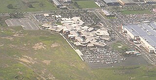
The Northern Hospital in Epping, Melbourne, Australia, is major community hospital. It lies in the north of Melbourne, next to Pacific Epping.
The Lakes South Morang P–college School is situated in the Northern Suburbs of Melbourne, Australia and is part of a rapidly growing corridor in the City of Whittlesea. The school is a diverse community with a representative mix of many cultures, however there is no one dominant culture within the school. The School SFO index is .541 with approximately 25% of parents receiving EMA.
South Morang was a steam-era railway station on the Whittlesea line, which operated until the closure of the line beyond Lalor station on 28 November 1959, following the electrification of the line to Lalor. The line to Epping station was electrified and re-opened on 30 November 1964, and the remaining section of track, from Epping to Whittlesea, was dismantled in the 1970s, although the former right-of-way remained intact. All that remained of the original South Morang station was the platform mound.
Bacon Township is a township in Vernon County, in the U.S. state of Missouri.