Related Research Articles
Bergen County is the most populous county in the U.S. state of New Jersey. As of the 2019 Census estimate, the county's population was 932,202, an increase of 3.0% from the 2010 census, which in turn represented an increase of 20,998 (2.4%) from the 884,118 counted in the 2000 Census. Located in the northeastern corner of New Jersey and its Gateway Region, Bergen County is part of the New York City Metropolitan Area and is directly across the Hudson River from Manhattan, to which it is connected by the George Washington Bridge.
Route 17 is a state highway in Bergen County, New Jersey, United States, that provides a major route from the George Washington Bridge, Lincoln Tunnel and other northeast New Jersey points to the New York State Thruway at Suffern, New York. It runs 27.20 mi (43.77 km) from an intersection with Route 7 and County Route 507 (CR 507) in North Arlington north to the New York border along Interstate 287 (I-287) in Mahwah, where New York State Route 17 (NY 17) continues into New York. Between Route 7 and Route 3 in Rutherford, Route 17 serves as a local road. From Route 3 north to the junction with U.S. Route 46 (US 46) in Hasbrouck Heights, the road is a suburban arterial with jughandles. The portion of Route 17 from US 46 to I-287 near the state line in Mahwah is a limited-access road with all cross traffic handled by interchanges, and many driveways and side streets accessed from right-in/right-out ramps from the right lane. For three miles (5 km) north of Route 4, well over a hundred retail stores and several large shopping malls line the route in the borough of Paramus. The remainder of this portion of Route 17 features lighter suburban development. The northernmost portion of Route 17 in Mahwah runs concurrently with I-287 to the New York border.

Saddle Brook is a township in Bergen County, New Jersey, United States. As of the 2010 United States Census, the township's population was 13,659, reflecting an increase of 504 (+3.8%) from the 13,155 counted in the 2000 Census, which had in turn declined by 141 (-1.1%) from the 13,296 counted in the 1990 Census.

Teterboro is a borough in Bergen County, in the U.S. state of New Jersey. As of the 2010 United States Census, the borough's population was 67, reflecting an increase of 49 (+272.2%) from the 18 counted in the 2000 Census, which had in turn declined by 4 (−18.2%) from the 22 counted in the 1990 Census. As of 2010, it is the fourth-smallest municipality, by population, in New Jersey.

Prior to the 2015 election Barrie was a federal electoral district in Ontario, Canada, that has been represented in the House of Commons of Canada since 2004. It consisted of the City of Barrie in the County of Simcoe. It was created in 2003 when its predecessor, Barrie—Simcoe—Bradford, was redistributed. Barrie—Simcoe—Bradford consisted of the City of Barrie and the towns of Bradford West Gwillimbury and Innisfil. It had been formed in 1996 as Barrie—Simcoe from Simcoe Centre and York—Simcoe ridings, but its name was changed before an election was held.

Wetaskiwin was a federal electoral district in Alberta, Canada, that was represented in the House of Commons of Canada from 1925 to 2015.

The Bergen County Line is a commuter rail line and service owned and operated by New Jersey Transit in the U.S. state of New Jersey. The line loops off the Main Line between the Meadowlands and Glen Rock, with trains continuing in either direction along the Main Line. It is colored on NJT system maps in pale blue, and its symbol is a cattail.

Sault Ste. Marie is a federal electoral district in Ontario, Canada, that has been represented in the House of Commons of Canada since 1968.
New Barbadoes Township was a township that was formed in 1710 and existed in its largest extent in pre-American Revolutionary War times in Bergen County, New Jersey. The Township was created from territories that had been part of Essex County that were removed by royal decree and added to Bergen County. After many departures, secessions and deannexations over the centuries, New Barbadoes Township exists today as Hackensack, which adopted its present name in 1921.
Interstate 80 (I-80) is a major Interstate Highway in the United States, running from San Francisco, California eastward to the New York City Metropolitan Area. In New Jersey, I-80 runs for 68.54 miles (110.30 km) from the Delaware Water Gap Toll Bridge at the Pennsylvania state line to its eastern terminus at I-95 in Teaneck, Bergen County. I-95 continues from the end of I-80 to the George Washington Bridge for access to New York City. The highway runs parallel to U.S. Route 46 (US 46) through rural areas of Warren and Sussex counties before heading into more suburban surroundings in Morris County. As the road continues into Passaic and Bergen counties, it heads into more urban areas. The New Jersey Department of Transportation (NJDOT) identifies I-80 within the state as the Christopher Columbus Highway.
Lodi Township was a township that existed in Bergen County, New Jersey, United States, from 1826 to 1935.

New Jersey's 5th congressional district is represented by Democrat Josh Gottheimer, who has served in Congress since 2017.
Ridgefield Township was a township that existed in Bergen County, New Jersey. The township was created in 1871, when Hackensack Township was trisected to form Palisades Township in the northernmost third, Englewood Township in the central strip and Ridgefield Township encompassing the southernmost portion, stretching from the Hudson River on the east to the Hackensack River, with Hudson County to the south. Much of the area had been during the colonial area known as the English Neighborhood. As described in the 1882 book, History of Bergen and Passaic counties, New Jersey,
Ridgefield is the first township in Bergen County which the traveler enters in passing up the Palisades. His first impressions are much like those of old Hendrick Hudson in speaking of a wider extent of country: "A very good land to fall in with, and a pleasant land to see." The valley of the Hackensack invited early settlers in the seventeenth century, and the valley of the Overpeck Creek, a navigable arm of the Hackensack, also attracted settlers quite as early in this direction. Sloops and schooners can pass up this creek nearly to the northern boundary of the township. Ridgefield is bounded on the north by Englewood, on the east by the Hudson, on the south by Hudson County, and on the west by the Hackensack River. The southern boundary is less than two miles in extent, and the northern less than four, and the length of the township from north to south does not exceed four miles. Bellman's Creek, forming part of the southern boundary, the Hackensack, the Overpeck, the Hudson, with more than a dozen other smaller streams and rivulets, bountifully supply the whole township with water. From the western border of the Palisades the land descends to the Overpeck, forming a most beautiful valley, with the land again rising to a high ridge midway between the Overpeck and the Hackensack. From this long ridge, extending far to the north beyond this township, it took its name of Ridgefield.
The New York, Susquehanna and Western, formerly the Midland Railroad, the Jersey City and Albany Railroad, and the Northern Railway of New Jersey—all running northward through the township— afford ample railroad accommodations. The Susquehanna enters the township at Bellman's Creek, and the Northern at about one hundred feet south of the creek, and at a point north and east of the Susquehanna. The Albany road in this locality is not yet constructed, diverging at present from the track of the Susquehanna between Little Ferry and Bogota stations. It has, however, an independent line projected and now under construction to New York City.
Early Settlements. Ridgefield embraces the earliest settlements in the ancient township of Hackensack, antedating even the organization of that township in 1693, and of the county of Bergen in 1675. There seems to have been no town or village compactly built, like the village of Bergen, but there were settlements both of Dutch and English in and about what was subsequently known as English Neighborhood prior to 1675. The Westervelts, the Zimcrmans, the Bantas, and the Blauvelts, all coming from Holland, settled in the middle of the seventeenth century in that locality. The ancestors of Jacob P. Westervelt, now of Hackensack Village, with himself, were born in English Neighborhood. His father was born there in 1776, and was the son of Christopher Westervelt, who was born there certainly as early as 1690, and he was the son of the original ancestor of this family, who came from Holland and settled on Overpeck Creek, within the present limits of Ridgefield township, probably about 1670.
Hackensack Township was a township that was formed in 1693 within Bergen County, New Jersey, United States. The township was created by the New Jersey Legislature as one of the first group of townships in New Jersey. Bergen County, which had been created in 1682, was thus split into two parts: Hackensack Township to the north, and Bergen Township to the south.
County Route 503 is a county highway in the U.S. state of New Jersey. The highway extends 17.95 miles from Paterson Plank Road in East Rutherford to the New York state line at the Montvale NJ/Pearl River NY border, where it continues as New York State Route 304. It parallels the Hackensack River and New Jersey Transit's Pascack Valley Line for much of its route.
Bergen was a city that existed in Hudson County, New Jersey, United States, from 1855 to 1870.
Harrison Township was created by an act of the New Jersey Legislature on April 13, 1840, and was part of Hudson County which was created from portions of Bergen County, on February 22, 1840.
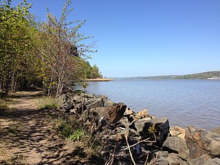
The English Neighborhood was the colonial-era name for the towns in eastern Bergen County, New Jersey, along the Hudson Palisades between the Hudson River and the Hackensack River, particularly around its main tributary, Overpeck Creek. The region had been part of the Dutch New Netherland colony of Bergen, whose main town was located at Bergen Square in today's Jersey City. The name speaks to the geography of the region, bergen being the Dutch word for hills. Earlier attempts at settlement at Achter Col and Vriessendael had been compromised in conflicts with the precolonial population, phratries of the Lenape known by their exonyms, the Hackensack and the Tappan.

Sainte-Anne is a civil parish in Madawaska County, New Brunswick, Canada.

Southesk is a civil parish in Northumberland County, New Brunswick, Canada.
References
- 1 2 3 4 "The Story of New Jersey's Civil Boundaries: 1606-1968", John P. Snyder, Bureau of Geology and Topography; Trenton, New Jersey; 1969. p. 194.
- ↑ Jersey, New (1893). Acts of the Legislature of the State of New Jersey. Secretary of State of New Jersey. pp. 559–560. Retrieved 02-08-2011.
Bergen Township new jersey February 21, 1893.
Check date values in:|access-date=(help)