
Route 27 is a state highway in New Jersey, United States. It runs 38.53 mi (62.01 km) from U.S. Route 206 (US 206) in Princeton, Mercer County northeast to an interchange with Route 21 and Broad Street in Newark, Essex County. The route passes through many communities along the way, including New Brunswick, Highland Park, Edison, Metuchen, Rahway, and Elizabeth. Route 27 is a two- to four-lane undivided highway for most of its length, passing through a variety of urban and suburban environments. It intersects many roads along the way, including Route 18 in New Brunswick, Interstate 287 (I-287) in Edison, the Garden State Parkway in Woodbridge Township, Route 35 in Rahway, Route 28 in Elizabeth, and U.S. Route 22 in Newark. Route 27 crosses the Raritan River on the Albany Street Bridge, which connects Highland Park on the east with New Brunswick on the west.

Route 29 is a state highway in the U.S. state of New Jersey. Signed north-south, it runs 34.76 mi (55.94 km) from an interchange with Interstate 295 (I-295) in Hamilton Township in Mercer County, where the road continues east as I-195, northwest to Route 12 in Frenchtown, Hunterdon County. Between the southern terminus and I-295 in Ewing Township, the route is a mix of expressway and boulevard that runs along the Delaware River through Trenton. This section includes a truck-restricted tunnel that was built along the river near historic houses and Riverview Cemetery. North of I-295, Route 29 turns into a scenic and mostly two-lane highway. North of the South Trenton Tunnel, it is designated the Delaware River Scenic Byway, a New Jersey Scenic Byway and National Scenic Byway, that follows the Delaware River in mostly rural sections of Mercer County and Hunterdon County. The obsolete Delaware & Raritan Canal usually stands between the river and the highway. Most sections of this portion of Route 29 are completely shaded due to the tree canopy. Route 29 also has a spur, Route 129, which connects Route 29 to U.S. Route 1 (US 1) in Trenton.

Route 31 is a state highway in New Jersey, United States. It runs 48.93 mi (78.75 km) from Bus. US 1 / US 206 in Trenton, Mercer County, north to an intersection with US 46 in Buttzville in White Township, Warren County. Along the way, Route 31 heads through the communities of Flemington, Clinton, and Washington. Most of the highway is state-maintained; however, the section within the city limits of Trenton is maintained by the city. Much of Route 31 is a two-lane highway that passes through farmland, woodland, and mountainous areas. Two portions of the route—from Trenton to Pennington and from Ringoes to Clinton—consist of more development.

Route 33 is a state highway in the central part of the US state of New Jersey. The highway extends 42.03 miles (67.64 km), from an interchange with U.S. Route 1 (US 1) in Trenton, Mercer County, east to an intersection with Route 71 in Neptune, Monmouth County. Route 33 is a major route through Central New Jersey, as it runs from the greater state capital area in the Delaware Valley Region, through a mixture of farmland, housing, and commercial developments in the lower Raritan Valley Region, en route to the greater Asbury Park area on the Jersey Shore. The route traverses through historic towns such as Hightstown, Monroe, Manalapan, Freehold, and Tinton Falls. There are several intersections on Route 33 with future developments.

U.S. Route 130 is a U.S. Highway that is a spur route of US 30, located completely within the state of New Jersey. It is signed with north and south cardinal directions, following a general northeast–southwest diagonal path, with north corresponding to the general eastward direction and vice versa. The route runs 83.46 mi (134.32 km) from Interstate 295 (I-295) and U.S. Route 40 at Deepwater in Pennsville Township, Salem County, where the road continues south as Route 49, north to U.S. Route 1 in North Brunswick, Middlesex County, where Route 171 continues north into New Brunswick. The route briefly runs concurrent with US 30 near Camden, about one-third of the way to New Brunswick. The road runs within a close distance of I-295 south of Bordentown and a few miles from the New Jersey Turnpike for its entire length, serving as a major four- to six-lane divided local road for most of its length. US 130 passes through many towns including Penns Grove, Bridgeport, Westville, Camden, Pennsauken, Burlington, Bordentown, Hightstown, and North Brunswick.

Route 129 is a north-south expressway in the capital city of Trenton, New Jersey. The highway runs along Canal Boulevard through portions of Trenton, serving as an alternative highway to its parent, Route 29. The route begins at an intersection with South Lamberton Road in Hamilton Township, and heads northward along NJ Transit's River Line until terminating at an interchange with U.S. Route 1.

U.S. Route 206 is a 130.2-mile-long (209.5 km) north–south U.S. highway in New Jersey and Pennsylvania, United States. Only about a 1⁄2 mile (0.80 km) of its length is in Pennsylvania; the Milford–Montague Toll Bridge carries it over the Delaware River into New Jersey, where it connects to the remainder of the route. Its southern terminus is at an intersection of White Horse Pike and Bellevue Avenue in Hammonton. The highway's northern terminus is at an intersection of US 209 near Milford, Pennsylvania; some sources and signs show an overlap with US 209 to end at its parent route US 6. For much of its length, US 206 is a rural two-lane undivided road that passes through the Pine Barrens, agricultural areas, and the Appalachian Mountains of Northwestern New Jersey, with some urban and suburban areas. The route connects several cities and towns, including Bordentown, Trenton, Princeton, Somerville, Roxbury, Netcong, and Newton.
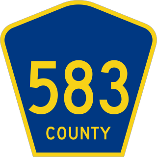
County Route 583 is a county highway in the U.S. state of New Jersey. Its northern end is at an intersection with Route 27 in Princeton; its southern end is in a concurrency with U.S. Route 1 Business and U.S. Route 206 at an intersection with County Route 653 in Trenton.
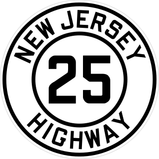
Route 25 was a major state highway in New Jersey, United States prior to the 1953 renumbering, running from the Benjamin Franklin Bridge in Camden to the Holland Tunnel in Jersey City. The number was retired in the renumbering, as the whole road was followed by various U.S. Routes: US 30 coming off the bridge in Camden, US 130 from the Camden area north to near New Brunswick, US 1 to Tonnele Circle in Jersey City, and US 1 Business to the Holland Tunnel.

Interstate 295 (I-295) in Delaware, New Jersey, and Pennsylvania is an auxiliary Interstate Highway, designated as a bypass around Philadelphia, and a partial beltway of Trenton.

The Calhoun Street Toll Supported Bridge is a historic bridge connecting Calhoun Street in Trenton, New Jersey across the Delaware River to East Trenton Avenue in Morrisville, Bucks County, Pennsylvania, United States. It was constructed by the Phoenix Bridge Company of Phoenixville, Pennsylvania, in 1884, replacing an earlier bridge built in 1861. The bridge was part of the Lincoln Highway until 1920, and was later connected to Brunswick Circle by the Calhoun Street Extension as part of a bypass of downtown Trenton. Before 1940, trolleys of the Trenton-Princeton Traction Company, utilized this bridge to cross into Pennsylvania. The bridge is owned by the Delaware River Joint Toll Bridge Commission, and is maintained with tolls from other bridges. It carries Light vehicle traffic, and streetcars until 1940.

U.S. Route 1 Business is a four-lane surface road that provides an alternate route to the Trenton Freeway (US 1) northeast of Trenton in Mercer County, New Jersey. The route is 2.73 miles (4.39 km) long and runs between US 1 in Trenton and Lawrence Township. On the border of Trenton and Lawrence Township, US 1 Bus. intersects the northbound direction of US 206 at the Brunswick Circle. The route was once part of a longer U.S. Route 1 Alternate, which continued southwest through downtown Trenton and into Morrisville, Pennsylvania.
As the Lincoln Highway was one of the earliest transcontinental highways for automobiles across the United States and was widely publicized since its inception, the route of the Lincoln Highway was determined not only by civil engineering considerations but also by politics. In many regions, there was general consensus among those who had power or interest in influencing the route. But in a few regions the choice of route was a contentious topic during the 1920s. The highway took the following route:

County Route 546 is a county highway in the U.S. state of New Jersey. The highway begins at Route 29 within the Titusville, New Jersey section of Hopewell Township and extends 9.98 miles (16.06 km) to U.S. Route 1 (US 1) in Lawrence Township. The road runs entirely within Mercer County.

County Route 535 is a county highway in the U.S. state of New Jersey. The highway extends 32.31 miles (52.00 km) from Logan Avenue, at the boundary between Trenton and Hamilton Township in Mercer County to an interchange with U.S. Route 9 (US 9) and Route 35 in South Amboy, Middlesex County.
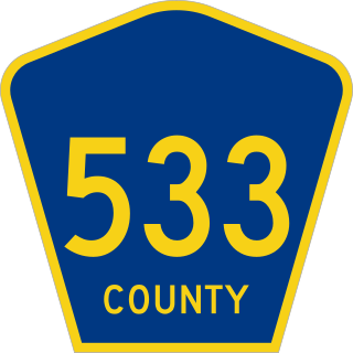
County Route 533 is a county highway in the U.S. state of New Jersey. The highway extends 32.7 miles (52.6 km) from the White Horse Circle, in Hamilton to Lincoln Boulevard on the border of Bound Brook and Middlesex Borough. CR 533 shares a long concurrency with US 206 through Princeton and Montgomery, while portions of the roadway in Somerset County are part of the Millstone River Valley Scenic Byway.

Interstate 95 (I-95) is a major north–south Interstate Highway that runs along the East Coast of the United States from Miami, Florida, north to the Canada–United States border at Houlton, Maine. In the state of Pennsylvania, it runs 51.00 miles (82.08 km) from the Delaware state line near Marcus Hook in Delaware County in the southeastern part of the state northeast to the Delaware River–Turnpike Toll Bridge at the New Jersey state line near Bristol in Bucks County, closely paralleling the New Jersey state line for its entire length through Pennsylvania.

County Route 518 is a county highway in the U.S. state of New Jersey. The highway extends 20.58 miles (33.12 km) from Route 29/Route 165 in Lambertville to Lincoln Highway in Franklin Township. It is also known as the Georgetown Franklin Turnpike.
U.S. Route 1 (US 1) is a U.S. Route which parallels the East Coast of the United States, running from Key West, Florida, in the south to Fort Kent, Maine, at the Canadian border in the north. Of the entire length of the route, 66.06 miles (106.31 km) of it runs through New Jersey. It enters the state from Pennsylvania on the Trenton–Morrisville Toll Bridge over the Delaware River in the state capital of Trenton, running through the city on the Trenton Freeway. From here, US 1 continues northeast as a surface divided highway through suburban areas, heading into Middlesex County and passing through New Brunswick and Edison. US 1 merges with US 9 in Woodbridge, and the two routes continue through northern New Jersey as US 1/9 to the George Washington Bridge over the Hudson River in Fort Lee. At this point, the road continues into New York City along with I-95.
U.S. Route 1 (US 1) is a major north–south U.S. Route, extending from Key West, Florida, in the south to Fort Kent, Maine, at the Canada–United States border in the north. In the U.S. state of Pennsylvania, US 1 runs for 81 miles (130 km) from the Maryland state line near Nottingham northeast to the New Jersey state line at the Delaware River in Morrisville, through the southeastern portion of the state. The route runs southwest to northeast and serves as a major arterial road through the city of Philadelphia and for many of the suburbs in the Delaware Valley metropolitan area. South of Philadelphia, the road mostly follows the alignment of the Baltimore Pike. Within Philadelphia, it mostly follows Roosevelt Boulevard. North of Philadelphia, US 1 parallels the route of the Lincoln Highway. Several portions of US 1 in Pennsylvania are freeways, including from near the Maryland state line to Kennett Square, the bypass of Media, the concurrency with Interstate 76 and the Roosevelt Expressway in Philadelphia, and between Bensalem Township and the New Jersey state line.

