Cerro Palenque

Last updated

Cerro Palenque is an archaeological site in the department of Cortés in Honduras. The city was founded in the Late Classic (500-800 AD) but reached its peak population and grew to over 500 structures in the Terminal Classic (850-1100 AD).

Honduras republic in Central America

Honduras, officially the Republic of Honduras, is a country in Central America. In the past, it was sometimes referred to as "Spanish Honduras" to differentiate it from British Honduras, which later became modern-day Belize. The republic of Honduras is bordered to the west by Guatemala, to the southwest by El Salvador, to the southeast by Nicaragua, to the south by the Pacific Ocean at the Gulf of Fonseca, and to the north by the Gulf of Honduras, a large inlet of the Caribbean Sea.

Contents

Archaeologists cannot determine how the people who lived at Cerro Palenque would have identified themselves since unlike the Maya of Copan and far western Honduras, they left no writing. Over the years archaeologists have tried to ascertain the identity of the people who lived on the lower Ulua river drainage at various times in terms of populations known to have existed at the time of the Spanish conquest (1536). Popular candidates include the Tol (formerly Jicaque), Lenca, and Maya. Unfortunately, archaeologists cannot currently determine if it was one of these groups, or some other unnamed group.

Maya civilization Mesoamerican civilization

The Maya civilization was a Mesoamerican civilization developed by the Maya peoples, and noted for its logosyllabic script—the most sophisticated and highly developed writing system in pre-Columbian Americas—as well as for its art, architecture, mathematics, calendar, and astronomical system. The Maya civilization developed in an area that encompasses southeastern Mexico, all of Guatemala and Belize, and the western portions of Honduras and El Salvador. This region consists of the northern lowlands encompassing the Yucatán Peninsula, and the highlands of the Sierra Madre, running from the Mexican state of Chiapas, across southern Guatemala and onwards into El Salvador, and the southern lowlands of the Pacific littoral plain.

Location and context

The site today is found on top of the hill known as Cerro Palenque (232 meters above sea level), above the town of Santiago, near the confluence of the Ulua, Humuya (Comayagua) and Blanco rivers, and on several hilltops to the north. It is located some 40 kilometers from the city of San Pedro Sula in Honduras.

San Pedro Sula Place in Cortés, Honduras

San Pedro Sula is the capital of Cortés Department, Honduras. It is located in the northwest corner of the country in the Sula Valley, about 50 kilometres (31 mi) south of Puerto Cortés on the Caribbean Sea. With a census population of 719,063 in 2013, and 1,445,598 people living in its metropolitan area in 2010, it is the nation's primary industrial center and second largest city after the capital Tegucigalpa.

The first part of the site to be settled was on the top of the hill, Cerro Palenque, and along its sides. This part was developed in the Late Classic (500 to 800 AD) and remained fairly small, but impressive. In the Terminal Classic (850-1100 AD) the city moved to the lower hill tops north of Cerro Palenque. In the Terminal Classic, this was the largest city in the lower Ulua river valley.

Because of its location where the major rivers enter the valley from the south and southwest, Cerro Palenque was in a strategic position where it could have mediated access from the interior of the country to goods produced along the coast, and coming in trade with Belize and Yucatan.

The Maya of Yucatan told the Spanish, in the 16th century, that the Ulua River valley was the land of feathers and honey. They also valued it for its chocolate (cacao). Pottery, and other kinds of artifacts, tell us that there was trade between various cities in the Ulua river valley, and the Maya of Belize and Yucatan because artifacts from these Maya centers have been found in cities in the valley at this time, and in turn, artifacts made in the valley have turned up in Maya cities in Belize and Yucatan.

Belize country in Central America

Belize is a country located on the eastern coast of Central America. Belize is bordered on the northwest by Mexico, on the east by the Caribbean Sea, and on the south and west by Guatemala. It has an area of 22,970 square kilometres (8,867 sq mi) and a population of 387,879 (2017). Its mainland is about 180 mi (290 km) long and 68 mi (110 km) wide. It has the lowest population and population density in Central America. The country's population growth rate of 1.87% per year (2015) is the second highest in the region and one of the highest in the Western Hemisphere.

The valley is formed by the Ulúa, Comayagua, and Chamelecón rivers, which provided natural transport routes into the rest of present Honduras as well as Central America. The Gulf of Honduras facilitated easy access to Yucatán and Belize. The valley was agriculturally fertile, and had access through nearby supplies or long distance exchange to luxury goods like spondylus and other marine shells, copper (in the postClassic), feathers (especially quetzal), obsidian, jade, and turquoise.

Gulf of Honduras A large inlet of the Caribbean Sea, indenting the coasts of Belize, Guatemala, and Honduras.

The Gulf or Bay of Honduras is a large inlet of the Caribbean Sea, indenting the coasts of Belize, Guatemala, and Honduras. From north to south, it runs for approximately 200 km from Dangriga, Belize, to La Ceiba, Honduras.

Yucatán Peninsula peninsula in North America

The Yucatán Peninsula, in southeastern Mexico, separates the Caribbean Sea from the Gulf of Mexico, with the northern coastline on the Yucatán Channel. The peninsula lies east of the Isthmus of Tehuantepec, a northwestern geographic partition separating the region of Central America from the rest of North America. It is approximately 181,000 km2 (70,000 sq mi) in area, and is almost entirely composed of limestone.

<i>Spondylus</i> genus of molluscs

Spondylus is a genus of bivalve molluscs, the only genus in the family Spondylidae. They are known in English as spiny oysters.

Excavations and findings

The fact that there were ruins on the top of Cerro Palenque has been known for a long time. Its first mention may be in A Ladies Ride across Spanish Honduras published in 1884.

Dorothy Popenoe excavated at the Late Classic portion of Cerro Palenque in the 1920s but died before she published the results of her excavations. Doris Stone included her analysis of the materials Popenoe excavated in her Archaeology of the North Coast of Honduras (1941)

Dorothy Popenoe English botanist and archaeologist

Dorothy Popenoe was an English archaeologist and botanist.

In 1979, John S. Henderson began a project authorized by the Honduran Institute of Anthropology and History (Instituto Hondureño de Antropología e Historia - IHAH) to survey and test more than 2400 square kilometers of the valley, to record all of the archaeological sites within it, and perform a series of excavations to understand the chronology of settlement (who lived where, when). In this context, Rosemary A. Joyce did survey work and rediscovered the site. As part of her dissertation fieldwork, she mapped, and excavated at Cerro Palenque in 1982 and 1983. Her dissertation, and the book listed below are some of the results from that work. Most recently, Julia Hendon has been conducting excavations in the elite residential groups off the ballcourt.

The earliest settlement of this city, in the site called CR-44, atop Cerro Palenque itself, is Late Classic (500-850 AD). As a new city center was built to the north, this part of the site was abandoned. The new center was on top of a lower set of hills north of Cerro Palenque in the Terminal Classic (850-1100 AD). This new center includes a 300 meter long plaza and a large ball-court. There are also the remains of two causeways leading to residential groups off the main plaza. In the Terminal Classic, Cerro Palenque grew to be the largest city in the valley, with over 500 buildings.

Settlement patterns shifted in the post-Classic (1150-1536) and Cerro Palenque was abandoned in favor of settlements right down along the river banks. The valley itself remains an important resource area for the Maya of Yucatan and Belize for chocolate, feathers, and honey.

Conservation and development

The Honduran Institute of Anthropology and History (IHAH) obtained 1.09 km² of land in 1997 to create an archaeological park. The intent of the park is to develop tourism infrastructure as well as benefit rural Honduran communities around the settlement. In 2005 the IHAH contracted with an outside firm to develop a management plan for Cerro Palenque. The consultants wrote an unrealistic plan that called for a 10 year development program with a cost of more than $6,000,000. A link to that plan, in Spanish, is included in the references below (see "Plan de Manejo").

In 2007 the IHAH proposed a project that would develop a visitor's center and interpretive panels for Cerro Palenque, and is in the process of seeking funds to develop this park. The 2009 coup in Honduras stopped these efforts.

See also

Related Research Articles

Xunantunich Ancient Maya archaeological site in western Belize

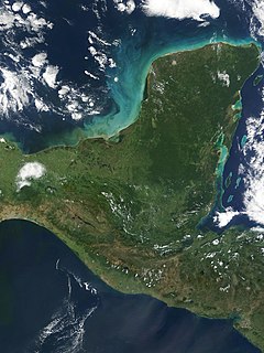
Xunantunich is an Ancient Maya archaeological site in western Belize, about 70 miles (110 km) west of Belize City, in the Cayo District. Xunantunich is located atop a ridge above the Mopan River, well within sight of the Guatemala border – which is a mere 0.6 miles (1 km) to the west. It served as a Maya civic ceremonial center in the Late and Terminal Classic periods to the Belize Valley region. At this time, when the region was at its peak, nearly 200,000 people lived in Belize.

Nim Li Punit archaeological site in Belize

Nim Li Punit is a Maya Classic Period site in the Toledo District of the nation of Belize, located 40 kilometres north of the town of Punta Gorda, at 16° 19' N, 88° 47' 60W. Nim Li Punit is sometimes known as Big Hat or Top Hat; the name is Kekchi Maya for "Big Hat", referring to the large elaborate head-dress on a stela sculpture found on site depicting one of the site's ancient kings.

Sayil locality of Mexico

Sayil is a Maya archaeological site in the Mexican state of Yucatán, in the southwest of the state, south of Uxmal. It was incorporated together with Uxmal as a UNESCO World Heritage Site in 1996.

Metallurgy in pre-Columbian Mesoamerica

The emergence of metallurgy in pre-Columbian Mesoamerica occurred relatively late in the region's history, with distinctive works of metal apparent in West Mexico by roughly AD 800, and perhaps as early as AD 600. Metallurgical techniques likely diffused northward from regions in Central or South America via maritime trade routes; recipients of these metallurgical technologies apparently exploited a wide range of material, including alloys of copper-silver, copper-arsenic, copper-tin and copper-arsenic-tin.

Cerros

Cerros is an Eastern Lowland Maya archaeological site in northern Belize that functioned from the Late Preclassic to the Postclassic period. The site reached its apogee during the Mesoamerican Late Preclassic and at its peak, it held a population of approximately 1,089 people. The site is strategically located on a peninsula at the mouth of the New River where it empties into Chetumal Bay on the Caribbean coast. As such, the site had access to and served as an intermediary link between the coastal trade route that circumnavigated the Yucatán Peninsula and inland communities. The inhabitants of Cerros constructed an extensive canal system and utilized raised-field agriculture.

Travesía is an important pre-Columbian archaeological sites in the Ulua river valley of Honduras. The city reached its largest size in the Late Classic (500-850) but was founded earlier. How early, we don't know because of the destruction of the site in the 20th century and subsequent looting to find pieces for the thriving illegal antiquities market.

Trade in Maya civilization transfer of ownership of goods and services

Trade in Maya civilization was a crucial factor in renaming Maya cities.

El Puente, or the Parque Arqueológico El Puente, is a Maya archaeological site in the department of Copán in Honduras. Once an independent Maya city, the city of El Puente became a tributary to the nearby city of Copán between the 6th and 9th centuries AD. The site contains more than 200 structures that include tombs, religious structures, and living quarters, but only a few have been excavated, including a large Maya step pyramid.

Pre-Columbian Belize

The Pre-Columbian Belize history is the period from initial indigenous presence, across millennia, to the first contacts with Europeans - the Pre-Columbian or before Columbus period - that occurred on the region of the Yucatán Peninsula that is present day Belize.

The San Estevan archaeological site is located in northern Belize 1 km from the modern community of San Estevan, Belize. The site is a Maya civilization site occupied during the Formative and Classic eras of Mesoamerican chronology. San Estevan is located on the New River half way between the sites of Cerros and Lamanai. Beginning in the Late Formative period, San Estevan was a regional political center.

Nohmul pre-Columbian Maya archaeological site

Nohmul is a pre-Columbian Maya archaeological site located on the eastern Yucatán Peninsula, in what is today northern Belize. The name Nohmul may be translated as "great mound" in Yucatec Maya. It is the most important Maya site in northern Belize. The site included a large pyramid, about 17 meters (56 ft) tall, built around 250 BC. Most of the pyramid was destroyed in May 2013 by contractors tearing it apart for rocks and gravel to use to fill roads, leaving only the core of the pyramid behind.

Santa Rita is a Maya ruin and an archaeological reserve on the outskirts of Corozal, Belize. Historical evidence suggests that it was probably the ancient and important Maya city known as Chetumal.

Pusilhá is an archaeological site in Belize. The location of this Late Classic Maya urban complex along the east and west flow of trade afford archaeologist a historical view of a secondary Maya site. Continuing excavation has changed the overall picture of Maya social and political relationships between larger and smaller cities. The research conducted at Pusilhá began at the beginning of the 20th century and continues to this day.

Yarumela was one of the sites located in Honduras and based around the Middle Formative era in Mesoamerican history, occupied between 1000 BC and AD 200. It was a popular trade center, especially for precious commodities.

Baking Pot

Baking Pot is a Maya archaeological site located in the Belize River Valley on the southern bank of the river, northeast of modern-day town of San Ignacio in the Cayo District of Belize; it is 6 kilometres (3.7 mi) downstream from the Barton Ramie and Lower Dover archaeological sites. Baking Pot is associated with an extensive amount of research into Maya settlements, community-based archaeology, and of agricultural production; the site possesses lithic workshops, and possible evidence of cash-cropping cacao as well as a long occupation from the Preclassic through to the Postclassic period.

Playa de los Muertos

Playa de los Muertos is an archaeological site from the Middle Formative period and is located on the Honduras north coast, in the Ulua valley, however it has "had a continuous history going back as early as any sedentary society yet documented in Mesoamerica". Thought to at one time have been a village, Playa de los Muertos is primarily known through its burials and ceramics. Archaeologists have identified a strong Aztec and Mayan influence on the early inhabitants at Playa de los Muertos, however it is considered a distinct culture. The site is most notable for its finely made ceramic figurines, famously excavated by Dorothy Popenoe. These figurines, in particular those depicting the female form, have helped archaeologists interpret gender roles at the site. Archaeologists believe that people at Playa de los Muertos likely participated in long-distance trade networks which reach from Guatemala to the Gulf Coast Olmec centers.

Maritime trade in the Maya civilization

The extensive trade networks of the Ancient Maya contributed largely to the success of their civilization spanning three millennia. The Maya royals control and wide distribution of foreign and domestic commodities for both population sustenance and social affluence are hallmarks of the Maya visible throughout much of the iconography found in the archaeological record. In particular, moderately long distance trade of foreign commodities from the Caribbean and Gulf Coasts provided the larger inland Maya cities with the resources they needed to sustain settled population levels in the several thousands. Though the ruling class essentially controlled the trade economy, a middle merchant class supervised import and export from cities and trade ports. Not much is known of the Maya merchant class; however, merchants of royal lineage are sometimes represented in the iconography. Notably, a canoe paddle often accompanies the royal merchant depictions, signifying their association with marine resources. Water lilies are also a recognizable feature of Maya iconography, appearing on ceramics and murals in landlocked cities like Palenque where the lilies cannot grow, further indicating the important political symbolism of water connections. The dugout style canoes of the Maya and other small watercraft are also represented in various codices, sometimes ferrying royal figures or deities. The rich tradition of maritime trade has continued into the modern era, exemplified by the resource exploitation of the coastal lagoons and cay locations along the Caribbean coast of Mexico, Belize, Guatemala, and Honduras.

History of the Maya civilization

The history of Maya civilization is divided into three principal periods: the Preclassic, Classic and Postclassic periods; these were preceded by the Archaic Period, which saw the first settled villages and early developments in agriculture. Modern scholars regard these periods as arbitrary divisions of chronology of the Maya civilization, rather than indicative of cultural evolution or decadence. Definitions of the start and end dates of period spans can vary by as much as a century, depending on the author. The Preclassic lasted from approximately 2000 BC to approximately 250 AD; this was followed by the Classic, from 250 AD to roughly 950 AD, then by the Postclassic, from 950 AD to the middle of the 16th century. Each period is further subdivided:

The Middle American Research Institute was established at Tulane University in 1924.

References