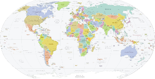
A country is a distinct territorial body or political entity. It may be an independent sovereign state or part of a larger state, as a non-sovereign or formerly sovereign political division, a physical territory with a government, or a geographic region associated with sets of previously independent or differently associated peoples with distinct political characteristics. It is not inherently sovereign. The largest country in the world by geographical area is Russia, while the most populous is China. The smallest and the least populous is the microstate Vatican City.
The National Geographic Society (NGS), headquartered in Washington, D.C., United States, is one of the largest non-profit scientific and educational organizations in the world. Founded in 1888, its interests include geography, archaeology, and natural science, the promotion of environmental and historical conservation, and the study of world culture and history. The National Geographic Society's logo is a yellow portrait frame—rectangular in shape—which appears on the margins surrounding the front covers of its magazines and as its television channel logo. Through National Geographic Partners, the Society operates the magazine, TV channels, a website, worldwide events, and other media operations.
In geography, regions are areas that are broadly divided by physical characteristics, human impact characteristics, and the interaction of humanity and the environment. Geographic regions and sub-regions are mostly described by their imprecisely defined, and sometimes transitory boundaries, except in human geography, where jurisdiction areas such as national borders are defined in law.

The Ottawa River is a river in the Canadian provinces of Ontario and Quebec. It is named in honour of the Algonquin word 'to trade', as it was the major trade route of Eastern Canada at the time. For most of its length, it defines the border between these two provinces. It is a major tributary of the St. Lawrence River and the longest river in Quebec.
Toponymy, toponymics, or toponomastics is the study of toponyms, their origins and meanings, use and typology. Toponym is the general term for a proper name of any geographical feature, and full scope of the term also includes proper names of all cosmographical features.

The Hawaiian Islands are an archipelago of eight major islands, several atolls, and numerous smaller islets in the North Pacific Ocean, extending some 1,500 miles from the island of Hawaiʻi in the south to northernmost Ocean Island. Formerly the group was known to Europeans and Americans as the Sandwich Islands, a name that James Cook chose in honor of the 4th Earl of Sandwich, the then First Lord of the Admiralty. Cook came across the islands by chance when crossing the Pacific Ocean on his Third Voyage, on board HMS Resolution; he was later killed on the islands on a return visit. The contemporary name of the islands, dating from the 1840s, is derived from the name of the largest island, Hawaiʻi Island.

National Geographic is a popular American monthly magazine published by the National Geographic Society. Known for its photojournalism, it is one of the most widely read magazines of all time.

The Geographic Names Information System (GNIS) is a database of name and locative information about more than two million physical and cultural features throughout the United States and territories, Antarctica, and the associated states of the Marshall Islands, Federated States of Micronesia, and Palau. It is a type of gazetteer. It was developed by the United States Geological Survey (USGS) in cooperation with the United States Board on Geographic Names (BGN) to promote the standardization of feature names.

The United States Board on Geographic Names (BGN) is a federal body operating under the United States Secretary of the Interior. The purpose of the board is to establish and maintain uniform usage of geographic names throughout the federal government of the United States.
The Advisory Committee on Antarctic Names is an advisory committee of the United States Board on Geographic Names responsible for recommending commemorative names for features in Antarctica.
An endonym is a common, native name for a geographical place, group of people, individual person, language or dialect, meaning that it is used inside that particular place, group, or linguistic community in question; it is their self-designated name for themselves, their homeland, or their language.
The UK Antarctic Place-Names Committee is a United Kingdom government committee, part of the Foreign and Commonwealth Office, responsible for recommending names of geographical locations within the British Antarctic Territory (BAT) and the South Georgia and the South Sandwich Islands (SGSSI). Such names are formally approved by the Commissioners of the BAT and SGSSI respectively, and published in the BAT Gazetteer and the SGSSI Gazetteer maintained by the Committee. The BAT names are also published in the international Composite Gazetteer of Antarctica maintained by SCAR.
The Geographical Names Board of New South Wales, a statutory authority of the Department of Customer Service in the Government of New South Wales, is the official body for naming and recording details of places and geographical names in the state of New South Wales, Australia.
The GEOnet Names Server (GNS), sometimes also referred to in official documentation as Geographic Names Data or geonames in domain and email addresses, is a service that provides access to the United States National Geospatial-Intelligence Agency's (NGA) and the US Board on Geographic Names's (BGN) database of geographic feature names and locations for locations outside the US. The database is the official repository for the US Federal Government on foreign place-name decisions approved by the BGN. Approximately 20,000 of the database's features are updated monthly. Names are not deleted from the database, "except in cases of obvious duplication". The database contains search aids such as spelling variations and non-Roman script spellings in addition to its primary information about location, administrative division, and quality. The accuracy of the database had been criticised.
The BC Geographical Names is a geographic name web service and database for the Canadian province of British Columbia run by the Base Mapping and Geomatic Services Branch of the Integrated Land Management Bureau. The database contains official names and spellings of towns, mountains, rivers, lakes, and other geographic places. The database often has other useful information, such as the history of geographic names, and their use in history.
Suburbs and localities are the names of geographic subdivisions in Australia, used mainly for address purposes. The term locality is used in rural areas, while the term suburb is used in urban areas. Australian postcodes closely align with the boundaries of localities and suburbs.

Geography is a field of science devoted to the study of the lands, features, inhabitants, and phenomena of the Earth and planets. The first person to use the word γεωγραφία was Eratosthenes. Geography is an all-encompassing discipline that seeks an understanding of Earth and its human and natural complexities—not merely where objects are, but also how they have changed and come to be.

A continent is any of several large landmasses. Generally identified by convention rather than any strict criteria, up to seven geographical regions are commonly regarded as continents. Ordered from largest in area to smallest, these seven regions are: Asia, Africa, North America, South America, Antarctica, Europe, and Australia. Variations with fewer continents may merge some of these, for example some systems include Afro-Eurasia, America or Eurasia as single continents. Zealandia, a largely submerged mass of continental crust, has also been described as a continent.

The Composite Gazetteer of Antarctica (CGA) of the Scientific Committee on Antarctic Research (SCAR) is the authoritative international gazetteer containing all Antarctic toponyms published in national gazetteers, plus basic information about those names and the relevant geographical features. The Gazetteer includes also parts of the International Hydrographic Organization (IHO) General Bathymetric Chart of the Oceans (GEBCO) gazetteer for under-sea features situated south of 60° south latitude.