Lists of ecoregions in the United States may refer to:
- List of ecoregions in the United States (EPA), United States Environmental Protection Agency system
- List of ecoregions in the United States (WWF), World Wildlife Fund system
Lists of ecoregions in the United States may refer to:

An ecoregion or ecozone is an ecologically and geographically defined area that is smaller than a bioregion, which in turn is smaller than a biogeographic realm. Ecoregions cover relatively large areas of land or water, and contain characteristic, geographically distinct assemblages of natural communities and species. The biodiversity of flora, fauna and ecosystems that characterise an ecoregion tends to be distinct from that of other ecoregions. In theory, biodiversity or conservation ecoregions are relatively large areas of land or water where the probability of encountering different species and communities at any given point remains relatively constant, within an acceptable range of variation.

The Nearctic realm is one of the eight biogeographic realms constituting the Earth's land surface.
The Global 200 is the list of ecoregions identified by the World Wide Fund for Nature (WWF), the global conservation organization, as priorities for conservation. According to WWF, an ecoregion is defined as a "relatively large unit of land or water containing a characteristic set of natural communities that share a large majority of their species dynamics, and environmental conditions". For example, based on their levels of endemism, Madagascar gets multiple listings, ancient Lake Baikal gets one, and the North American Great Lakes get none.

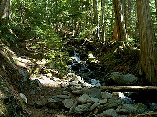
The Mount Baker–Snoqualmie National Forest in Washington is a National Forest extending more than 140 miles (230 km) along the western slopes of the Cascade Range from the Canada–US border to the northern boundary of Mount Rainier National Park. Administered by the United States Forest Service, the forest is headquartered in Everett. There are local ranger district offices in North Bend and Skykomish.

The Boston Mountains is a Level III ecoregion designated by the Environmental Protection Agency (EPA) in the U.S. states of Arkansas and Oklahoma. Part of the Ozarks, the Boston Mountains are a deeply dissected plateau. The ecoregion is steeper than the adjacent Springfield Plateau to the north, and bordered on the south by the Arkansas Valley. The Oklahoma portion of the range is locally referred to as the Cookson Hills.

The Sonoran Desert is a North American desert and ecoregion that covers large parts of the southwestern United States, as well as the northwestern Mexican states of Sonora, Baja California, and Baja California Sur. It is the hottest desert in both Mexico and the United States. It has an area of 260,000 square kilometers (100,000 sq mi).

The ecology of California can be understood by dividing the state into a number of ecoregions, which contain distinct ecological communities of plants and animals in a contiguous region. The ecoregions of California can be grouped into four major groups: desert ecoregions, Mediterranean ecoregions, forested mountains, and coastal forests.

The Intermountain West, or Intermountain Region, is a geographic and geological region of the Western United States. It is located between the front ranges of the Rocky Mountains on the east and the Cascade Range and Sierra Nevada on the west.

British Columbia mainland coastal forests is a temperate coniferous forest ecoregion the Pacific coast of North America, as defined by the World Wildlife Fund (WWF) categorization system.

The following outline is provided as an overview of and topical guide to Mexico:

The Willamette Valley ecoregion is a Level III ecoregion designated by the United States Environmental Protection Agency in the U.S. states of Oregon and Washington. Slightly larger than the Willamette Valley for which it is named, the ecoregion contains fluvial terraces and floodplains of the Willamette River system, scattered hills, buttes, and adjacent foothills. It is distinguished from the neighboring Coast Range, Cascades, and Klamath Mountains ecoregions by lower precipitation, lower elevation, less relief, and a different mosaic of vegetation. Mean annual rainfall is 37 to 60 inches, and summers are generally dry. Historically, the region was covered by rolling prairies, oak savanna, coniferous forests, extensive wetlands, and deciduous riparian forests. Today, it contains the bulk of Oregon's population, industry, commerce, and agriculture. Productive soils and a temperate climate make it one of the most important agricultural areas in Oregon.

The Cascades ecoregion is a Level III ecoregion designated by the United States Environmental Protection Agency (EPA) in the U.S. states of Washington, Oregon, and California. Somewhat smaller than the Cascade mountain range for which it is named, the ecoregion extends north to Snoqualmie Pass, near Seattle, and south to Hayden Pass, near the Oregon-California border, including the peaks and western slopes of most of the High Cascades. A discontiguous section is located on Mount Shasta in California.
Wikipedia has articles relating to two separate ecoregion classification systems:

The Northern Lakes and Forests are an ecoregion in northern Minnesota, northern Wisconsin, and northern Michigan in the United States. It is a Level III ecoregion in the United States Environmental Protection Agency's (EPA's) classification system, where it is designated as ecoregion number 50. The ecoregion is characterized by coniferous and northern hardwoods forests, morainal hills, large lake basins, and broad areas of sandy outwash plains, with numerous lakes and wetlands. The Northern Lakes and Forests are less well-suited to agriculture than ecoregions to the south, owing to shorter growing seasons, lower temperatures, and soils formed mainly from nutrient-poor sandy and loamy glacial drift material.

The Southeastern Wisconsin Till Plains is an ecoregion in southeastern Wisconsin and northeastern Illinois in the United States. It is a Level III ecoregion in the classification system of the United States Environmental Protection Agency (EPA), where it is designated as ecoregion number 53. The ecoregion represents a transition between the hardwood forests and oak savannas to the west and the tallgrass prairie ecoregions to the south; it is today mostly covered by cropland.