
A ghost town, deserted city, extinct town or abandoned city is an abandoned village, town, or city, usually one that contains substantial visible remaining buildings and infrastructure such as roads. A town often becomes a ghost town because the economic activity that supported it has failed or ended for any reason. The town may also have declined because of natural or human-caused disasters such as floods, prolonged droughts, extreme heat or extreme cold, government actions, uncontrolled lawlessness, war, pollution, or Nuclear and radiation accidents and incidents. The term can sometimes refer to cities, towns, and neighborhoods that, though still populated, are significantly less so than in past years; for example, those affected by high levels of unemployment and dereliction.

An abandoned village is a village that has, for some reason, been deserted. In many countries, and throughout history, thousands of villages have been deserted for a variety of causes. Abandonment of villages is often related to epidemic, famine, war, climate change, economic depressions, environmental destruction, or deliberate clearances.
Emory Creek Provincial Park is a provincial park in British Columbia, Canada, located on the west side of the Fraser River just south of the town of Yale. It commemorates the location of a large boomtown, variously known as Emory, Emory Bar or Emory City, that first rose during the Fraser Canyon Gold Rush but became a major construction town during the building of the Canadian Pacific Railway in the 1880s.
Emory Creek in 1858 was a tent and shack camp, established by miners in search of gold. When it became evident that the gold was not available in the amounts estimated, the miners started moving north on the Fraser River. A few Chinese remained in the area. The area came into the hands of a man named Walker, who felt Emory Creek would become the head of riverboat navigation on the Fraser. Eventually, he sold the land to the Oppenheimer Brothers in early 1879. In the fall of 1879, Emory was chosen by the C.P.R. as the western terminus. In a short time it became Emory Creek. The town consisted of thirteen streets with its own newspaper, various shops, a brewery, nine saloons and a sawmill. When Yale was made the terminus, Emory was all but abandoned by 1885, with the completion of the railway. Today, it is an easily accessible treed campground with paved roads and flush outhouses.

The County of Forty Mile No. 8 is a municipal district in south eastern Alberta, Canada. It is located in Census Division 1, southwest of Medicine Hat. Its municipal office is located in the Village of Foremost.

In geography, statistics and archaeology, a settlement, locality or populated place is a community of people living in a particular place. The complexity of a settlement can range from a minuscule number of dwellings grouped together to the largest of cities with surrounding urbanized areas. Settlements may include hamlets, villages, towns and cities. A settlement may have known historical properties such as the date or era in which it was first settled, or first settled by particular people. The process of settlement involves human migration.

This is a list of lists of ghost towns in the United States by state.
Crichton is an unincorporated community within the Rural Municipality of Wise Creek No. 77, Saskatchewan, Canada. It is located between Admiral and Cadillac on the historic Red Coat Trail, also known as Highway 13. Like so many towns along the Red Coat Trail, Crichton has become a ghost town with only one family remaining and many empty buildings scattered throughout the town site.

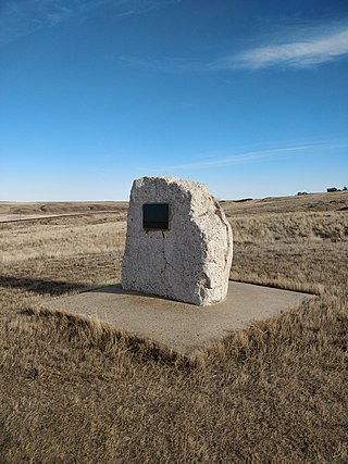
Nemiscam, also known as Nemiskam, and originally known as Bingham, is an unincorporated community within the County of Forty Mile No. 8 in southern Alberta, Canada. The community is about 5 km east of Foremost and west of Etzikom, Alberta on Highway 61 and is administered by the County of Forty Mile No. 8.

Bromhead is an unincorporated community and ghost town in Souris Valley Rural Municipality No. 7, Saskatchewan, Canada. The community is approximately 5 km (3.1 mi) north of Highway 18 and 45 km (28 mi) west of the City of Estevan.
This page is based on this
Wikipedia article Text is available under the
CC BY-SA 4.0 license; additional terms may apply.
Images, videos and audio are available under their respective licenses.
