Queensland is the second largest state in Australia. It contains 472 separate protected areas with a total land area of 69,388 km2 (26,791 sq mi). 223 of these are National parks, which is the highest number of any Australian state or territory, totaling 65,871 km2 (25,433 sq mi). Seven others are Scientific National Parks, totaling 522 km2 (202 sq mi).

The Main Range is a mountain range and national park in Queensland, Australia, located predominantly in Tregony, Southern Downs Region, 85 kilometres (53 mi) southwest of Brisbane. It is part of the World Heritage Site Gondwana Rainforests of Australia. It protects the western part of a semicircle of mountains in South East Queensland known as the Scenic Rim. This includes the largest area of rainforest in South East Queensland. The park is part of the Scenic Rim Important Bird Area, identified as such by BirdLife International because of its importance in the conservation of several species of threatened birds.

Mount Walsh is a national park in Queensland, Australia, 230 km northwest of Brisbane.

The Mount Lindesay Highway is an Australian national highway located in Queensland, also known as National Route 13. The highway runs southwest from Brisbane, where it leaves Ipswich Road in the suburb of Moorooka, to the Queensland – New South Wales border and is approximately 116 kilometres (72 mi) in length. For most of its length it is roughly aligned with the Sydney–Brisbane rail corridor. At its southern end these transport routes take different passes over the Scenic Rim into the Northern Rivers region.

The McPherson Range is an extensive mountain range, a spur of the Great Dividing Range, heading in an easterly direction from near Wallangarra to the Pacific Ocean coastline. It forms part of the Scenic Rim on the border between the states of New South Wales and Queensland. Further west of the McPherson Range is the Main Range. Towards the coast the range continues into the Border Ranges and other mountainous terrain formed by the Tweed Volcano.

Central Queensland is an ambiguous geographical division of Queensland that centres on the eastern coast, around the Tropic of Capricorn. Its major regional centre is Rockhampton. The region extends from the Capricorn Coast west to the Central Highlands at Emerald, north to the Mackay Regional Council southern boundary, and south to Gladstone. The region is also known as Capricornia. It is one of Australia's main coal exporting regions.

Mount Pleasant is a rural locality in the Moreton Bay Region, Queensland, Australia. In the 2016 census, Mount Pleasant had a population of 332 people. Mount Pleasant is also a mountain in the north-east of the locality which is part of the D'Aguilar Range.
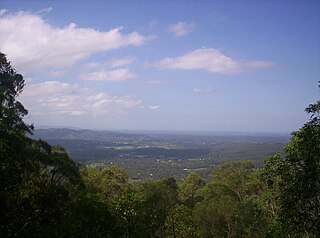
The D'Aguilar Range is a mountain range near Brisbane, Queensland, Australia. The town of Dayboro is situated on the lower foothills midway along the range and the Sunshine Coast Hinterland town of Mooloolah lies at the northernmost point of the range. Many residential areas line its eastern slopes including the town of Samford and the suburb of Ferny Hills. In the west, numerous ridges and gullies are heavily forested and designated as state forest or national park.

Mount Glorious is a rural locality in the Moreton Bay Region, Queensland, Australia. In the 2016 census, Mount Glorious had a population of 296 people.
The Scenic Rim is a group of forested mountain ranges of the Great Dividing Range, located south of Brisbane agglomeration, straddling the border between south-eastern Queensland and north-eastern New South Wales, Australia.
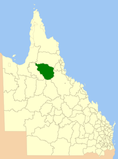
The Shire of Etheridge is a local government area in Far North Queensland, Australia in what is known as the Savannah Gulf region. Its economy is based on cattle grazing and mining.

The Bloomfield River is a river located in the Wet Tropics of Far North Queensland, Australia, noted for its Bloomfield River cod fish species, found only in the river.

Mount Warren Park is a residential suburb in the outer eastern area of City of Logan, Queensland, Australia. The mountain Mount Warren is within the suburb. In the 2016 census, Mount Warren Park had a population of 5,791 people.

The Flinders Peak Group is an unnamed range of hills located on the northern edge of the Scenic Rim Region, south west of Logan City and south east of the City of Ipswich in South East Queensland, Australia. The summit in the Range is Flinders Peak reaching 680 metres (2,230 ft) above sea level.
Mount Lofty is a locality on the edge of the suburban area of Toowoomba, Toowoomba Region, Queensland, Australia, located 3 kilometres (2 mi) north-east of the city centre.
Mount Binga National Park is a national park at Mount Binga in the Toowoomba Region of the Darling Downs region in southern Queensland, Australia. The park lies within the catchment area of Emu Creek, a tributary of the Brisbane River and belongs to the South East Queensland bioregion.

Mount Gipps is a locality in the Scenic Rim Region, Queensland, Australia. It borders New South Wales and is one end of the Queensland rabbit-proof fence.
Ramsay is a rural locality in the Toowoomba Region, Queensland, Australia. In the 2016 census Ramsay had a population of 348 people.

Macalister is an electoral district of the Legislative Assembly in the Australian state of Queensland. It was created in the 2017 redistribution, and was first contested at the 2017 Queensland state election. It is named after the second Queensland Premier, Arthur Macalister.
Gulngai is a rural locality in the Cassowary Coast Region, Queensland, Australia. In the 2016 census, Gulngai had a population of 0 people.