
The geography of France consists of a terrain that is mostly flat plains or gently rolling hills in the north and west and mountainous in the south and the east. Metropolitan France has a total size of 551,695 km2 (213,011 sq mi). It is the third largest country in Europe by area and the largest in Western Europe.
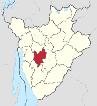
Mwaro Province is one of the 19 provinces of Burundi. Its capital is Mwaro.

The Wright Valley is a large east–west trending valley, formerly occupied by a glacier but now ice free except for Wright Upper Glacier at its head and Wright Lower Glacier at its mouth, in Victoria Land, Antarctica. It was named by the VUWAE (1958-59) for Sir Charles Wright, for whom the BrAE (1910-13) named the glacier at the mouth of this valley.

Cenes de la Vega is a municipality located in the province of Granada, Spain. According to the 2020 census (INE), the city has a population of 8153 inhabitants.

Padrones de Bureba is a municipality and town located in the province of Burgos, Castile and León, Spain. According to the 2004 census (INE), the municipality has a population of 59 inhabitants.
Tocumbo is a municipality in the Mexican state of Michoacán. The municipality has an area of 506.85 square kilometres (195.70 sq mi) and is bordered to the north by Tingüindín, to the east by Los Reyes, to south by the state of Jalisco, and to the west by Cotija. The municipality had a population of 8,820 inhabitants according to the 2005 census. Its municipal seat is the city of the same name. The economy of the municipality is mostly based on agriculture and ranching.
Gisozi, also Kisozi is a settlement in central Burundi and capital of the commune of the same name. It is located in Mwaro Province, to the southeast of Bujumbura and southwest of Gitega.
These are some of the articles related to Burundi on the English Wikipedia:
The Porthos Range is the second range south in the Prince Charles Mountains of Antarctica, extending for about 30 miles in an east-to-west direction between Scylla Glacier and Charybdis Glacier. First visited in December 1956 by the Australian National Antarctic Research Expeditions (ANARE) southern party under W.G. Bewsher (1956-57) and named after Porthos, a character in Alexandre Dumas, père's novel The Three Musketeers, the most popular book read on the southern journey.

Ibimirim is a city in the state of Pernambuco, Brazil. The population in 2020, according with IBGE was 29,412 inhabitants and the total area is 1906.44 km².
On the continent of Antarctica, the Aramis Range is the third range south in the Prince Charles Mountains, situated 11 miles southeast of the Porthos Range and extending for about 30 miles in a southwest–northeast direction. It was first visited in January 1957 by Australian National Antarctic Research Expeditions (ANARE) southern party led by W.G. Bewsher, who named it for a character in Alexandre Dumas' novel The Three Musketeers, the most popular book read on the southern journey.

Watson Peninsula is a narrow peninsula 4 km (2.5 mi) long separating Macdougal and Marr Bays on the north coast of Laurie Island, in the South Orkney Islands of Antarctica. It was charted in 1903 by the Scottish National Antarctic Expedition under Bruce, who named it for G.L. Watson, yacht designer and redesigner of the expedition ship Scotia.
The Terra Firma Islands are a small group of islands lying 8 nautical miles north of Cape Berteaux, off the west coast of Graham Land in West Antarctica.
The commune of Bisoro is a commune of Mwaro Province in central Burundi. The capital lies at the village Bisoro.
The commune of Gisozi is a commune of Mwaro Province in central Burundi. The capital lies at Gisozi.
The commune of Kayokwe is a commune of Mwaro Province in central Burundi. The capital lies at Kayokwe.
The commune of Ndava is a commune of Mwaro Province in central Burundi. The capital lies at Ndava.
The commune of Nyabihanga is a commune of Mwaro Province in central Burundi. The capital lies at Nyabihanga.
The commune of Rusaka is a commune of Mwaro Province in central Burundi. The capital lies at Mwaro (Rusaka).In recent years forest development in this agricultural commune has resulted in arid soils in some parts. In June 2003, FDD combatants killed three civilians and burned local government buildings and a cooperative in the commune.
This page is based on this
Wikipedia article Text is available under the
CC BY-SA 4.0 license; additional terms may apply.
Images, videos and audio are available under their respective licenses.
