Newfoundland T'Railway

Last updated

The Newfoundland T'Railway Provincial Park is a rail trail located in the Canadian province of Newfoundland and Labrador.

Contents

Protected as a linear park under the provincial park system, the Newfoundland T'Railway consists of the railbed of the historic Newfoundland Railway, later renamed Terra Transport as transferred from its most recent owner, Canadian National Railway (CN), to the provincial government after rail service was abandoned on the island of Newfoundland in 1988. The rail corridor stretches from Channel-Port aux Basques in the west to St. John's in the east with branches to Stephenville, Lewisporte, Bonavista, Placentia and Carbonear.

The Newfoundland T'Railway forms part of the Trans Canada Trail system and covers a distance of 883 km (549 mi). [1]

History

Construction of the railway began in 1881. The first passenger train traveled from St. John's to Channel-Port aux Basques on June 29, 1898. The railway was abandoned in September 1988 and the last rails removed in 1990, whereby the Government of Newfoundland and Labrador acquired the property from CN. [2] The Newfoundland T'Railway was established in July 1997 as a rail trail. This linear park uses both the railbed and bridges.

In February 2008, the provincial government announced that they were closing every bridge and trestle along the route pending safety inspections. Government officials admitted that regular inspections are not performed on the structures. Transport Canada inspected 14 structures and found them to be in a wide state of disrepair. In some cases debris is starting to fall off bridges. The Federal government got involved due to its responsibility to ensure the safety of navigable waters. [3] By 2010 all 130 bridges had been upgraded under a $3 million program funded by the federal government's Atlantic Canada Opportunities Agency, the Government of Newfoundland and Labrador and the Trans Canada Trail Foundation. [4]

Sections of the Newfoundland T'Railway in the Clarenville-Bonavista area were washed out on September 21, 2010 due to heavy rain resulting from Hurricane Igor with subsequent repairs taking several years to complete. Sections in the Gander-Clarenville area were washed out on October 10, 2016 due to heavy rain with repairs lasting into summer 2017.

The trail is still[ when? ] a work in progress. To date,[ when? ] about 20% of it has been resurfaced with crusher dust or asphalt (mostly near urban areas) making it suitable for walking, running, cross-country skiing, cycling, wheelchairs, horseback riding, all terrain vehicles, and snowmobiles. The remaining 80% of the trail surface is still large crushed stone railway track ballast with conditions varying from region to region. Several bridges and culverts are usually undergoing repair or replacement every year. Trail signs have been posted in most urban areas.

In 2020, a 20-kilometre stretch near Maccles Lake was approved for temporary use by heavy forestry harvesting equipment. [5]

Missing sections

When CN abandoned the rail system on Newfoundland in September 1988, the main line was contiguous between St. John's in the east and Channel-Port aux Basques in the west and most branches were contiguous from their junction points with the main line to their respective termini. However, the Newfoundland T'Railway is not a contiguous system due to land use changes that have impacted several locations along the former rail corridor.

Corner Brook

The majority of the Newfoundland T'Railway is missing within the city of Corner Brook. A 2 km (1.2 mi) gap exists in the Curling neighbourhood between Hilliards Road in the west and Barretts Road in the east. This gap is partly due to a culvert washout, as well as appropriation of the rail corridor for public streets, including a section of Griffin Drive, Barry Place and Star Street. A 0.6 km (0.37 mi) gap exists in the Westside neighbourhood between Leggos Avenue through to the east end of St Aldens Road, partly due to appropriation of the rail corridor for public streets and partly due to non-development of the rail corridor into a trail which has resulted in it being impassable. A 4.4 km (2.7 mi) gap exists in the city's downtown and Humbermouth neighbourhoods, between Pier Road in the west through to Humber Road in the east. This is partly due to non-development of the rail corridor as it passes the pulp mill and Port of Corner Brook, as well as appropriation of the rail corridor for public streets, including a section of Riverside Drive. The port property largely occupies the former railway yard and the trail is non-existent in this area.

Corner Brook to Pasadena

The Government of Newfoundland and Labrador received an $800 million settlement from the federal government to allow abandonment of the railway in 1988. This funding was delivered through several programs, one of which was named the Trans-Canada Highway Program and was intended solely for upgrading Newfoundland and Labrador Route 1, which carries the Trans-Canada Highway designation on the island of Newfoundland.

During the mid-1990s before the establishment of the Newfoundland T'Railway, the Government of Newfoundland and Labrador used some of the funding from the Trans-Canada Highway Program to upgrade Route 1 between Corner Brook and Deer Lake from 2-lanes to 4-lanes. A section of the abandoned rail corridor between the Humbermouth neighbourhood of Corner Brook to Pasadena was removed in order to accommodate the highway expansion and realignment. This occurred in the narrow Humber River valley as well as along the southwest shore of Deer Lake. Some sections of the former rail corridor were also appropriated for public roads to access residential subdivisions. These developments have resulted in a gap on the Newfoundland T'Railway of approximately 25 km (16 mi) between Humber Road in the west through to the end of Tipping Drive in the east.

Gander

A 0.6 km (0.37 mi) section of the rail corridor within the town of Gander has been appropriated for a retail development, however, the town has built a 1.1 km (0.68 mi) bypass for the trail around this property, keeping the contiguity of the trail intact through the town.

Clarenville

A 0.25 km (0.16 mi) section of the main line in the Shoal Harbour neighbourhood of the town of Clarenville has been realigned due to construction of Shoal Harbour Drive. This road has also resulted in a gap of 0.25 km (0.16 mi) of the Bonavista branch between Thistle Place and Huntley Drive.

Additional gaps exist on the main line in Conception Bay South as well as on the Carbonear branch.

See also

Related Research Articles

<span class="mw-page-title-main">Trans Canada Trail</span> Network of multiuse trails across Canada

The Trans Canada Trail, officially named The Great Trail between September 2016 and June 2021, is a cross-Canada system of greenways, waterways, and roadways that stretches from the Atlantic to the Pacific to the Arctic oceans. The trail extends over 24,000 km (15,000 mi); it is now the longest recreational, multi-use trail network in the world. The idea for the trail began in 1992, shortly after the Canada 125 celebrations. Since then it has been supported by donations from individuals, corporations, foundations, and all levels of government.

Clarenville is a town on the east coast of Newfoundland in the province of Newfoundland and Labrador, Canada. Clarenville was incorporated in 1951. It is located in the Shoal Harbour valley, fronting an arm of the Atlantic Ocean called Random Sound.

<span class="mw-page-title-main">Trans-Labrador Highway</span> Highway in Newfoundland and Labrador, Canada

The Trans-Labrador Highway (TLH) is the primary public road in Labrador, the mainland portion of the province of Newfoundland and Labrador, Canada. The highway's total length is 1,149 km (714 mi). The paving of the entire highway was completed in July 2022.

<span class="mw-page-title-main">Newfoundland Railway</span> Defunct narrow-gauge railway

The Newfoundland Railway operated on the island of Newfoundland from 1898 to 1988. With a total track length of 906 miles (1,458 km), it was the longest 3 ft 6 in narrow-gauge railway system in North America.

Snook, the alter-ego of Pete Soucy, is a Newfoundland comedian and actor. He is the face of NLClassifieds.com.

<span class="mw-page-title-main">Humber East</span> Provincial electoral district in Newfoundland and Labrador, Canada

Humber East is a former provincial electoral district for the House of Assembly of Newfoundland and Labrador, Canada.

Route 1 is a highway in the Canada province of Newfoundland and Labrador, and is the easternmost stretch of the Trans-Canada Highway. Route 1 is the primary east–west road on the island of Newfoundland.

<span class="mw-page-title-main">Curling, Newfoundland and Labrador</span> Neighbourhood in Corner Brook, Newfoundland and Labrador, Canada

Curling is a mainly residential neighbourhood of the city of Corner Brook, Newfoundland and Labrador. It is situated just west of the main part of the city. Located in the Humber Arm of the Bay of Islands, Curling was originally a fishing community. It is the oldest section of Corner Brook.

<span class="mw-page-title-main">Railway Coastal Museum</span> Railway museum in St. Johns, Newfoundland and Labrador

The Railway Coastal Museum is a transport museum located in St. John's, Newfoundland and Labrador, Canada. It is located in the historic Newfoundland Railway terminal on Water Street and contains exhibits detailing the history of the Newfoundland Railway and the history of coastal water transportation in the province.

<span class="mw-page-title-main">Newfoundland and Labrador Route 230</span>

Route 230 is the main Bonavista Peninsula Highway, commencing from Route 1 at Thorburn Lake, about 10-15 kilometres north of Clarenville and proceeding all the way to Bonavista at the end of the Peninsula. The highway also carries the designation of Discovery Trail.

The Bonavista Peninsula is a large peninsula on the east coast of the island of Newfoundland in the Canadian province of Newfoundland and Labrador. It consists of 50 incorporated towns/unincorporated communities which have a population of 12,176 as of the 2016 Canadian Census. Bonavista is the largest population centre on the peninsula.

Transportation in North America is performed through a varied transportation system, whose quality ranges from being on par with a high-quality European motorway to an unpaved gravelled back road that can extend hundreds of miles. There is also an extensive transcontinental freight rail network, but passenger railway ridership is lower than in Europe and Asia.

<span class="mw-page-title-main">College of the North Atlantic</span>

College of the North Atlantic is one of the largest post-secondary educational and skills training centres in Atlantic Canada, with a history dating back 50 years. The college has 17 campus locations throughout the province of Newfoundland and Labrador in Canada, various partner universities in China and formerly operated a technical education college for the State of Qatar in the Middle East. The enabling legislation is the College Act.

<span class="mw-page-title-main">Outline of Newfoundland and Labrador</span> Overview of and topical guide to Newfoundland and Labrador

The following outline is provided as an overview of and topical guide to Newfoundland and Labrador.

<span class="mw-page-title-main">Newfoundland and Labrador Route 450</span> Highway in Newfoundland and Labrador

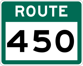
Route 450 is a highway in the Canadian province of Newfoundland and Labrador. The highway starts at an interchange at Route 1 in Corner Brook. When approaching O'Connell Drive, motorists can turn left to continue their journey along the route. The route terminates at a cul-de-sac in Lark Harbour.

Route 230A, also known as Old Bonavista Highway, is a 16.2-kilometre-long (10.1 mi) alternate route of Route 230 at the southwestern corner of the Bonavista Peninsula on the island of Newfoundland. It represents the former route of Route 230 through Clarenville, Milton, and George's Brook.

Milton is a designated place in the Canadian province of Newfoundland and Labrador that is a neighbourhood within the Town of George's Brook-Milton. Originally named King's Cove, it changed its name to Milton in 1910.

References

  1. "Newfoundland T'Railway". Newfoundland T'Railway Council. Archived from the original (Web) on 2006-12-31. Retrieved 2007-06-19.
  2. "T'Railway". Government of Newfoundland and Labrador. Archived from the original (Web) on 2007-04-26. Retrieved 2007-06-19.
  3. No regular inspections of T’Railway structures: province. February 19, 2008. The Telegram (St. John's).
  4. "About the Newfoundland T'Railway". Government of Newfoundland and Labrador. Archived from the original (Web) on 2017-07-24. Retrieved 2017-11-11.
  5. "Portion of T'Railway in central Newfoundland approved for use by heavy equipment". SaltWire Network. June 16, 2020.

Further reading