
The Chesapeake Bay is an estuary in the U.S. states of Maryland and Virginia. The Bay is located in the Mid-Atlantic region and is primarily separated from the Atlantic Ocean by the Delmarva Peninsula with its mouth located between Cape Henry and Cape Charles. With its northern portion in Maryland and the southern part in Virginia, the Chesapeake Bay is a very important feature for the ecology and economy of those two states, as well as others. More than 150 major rivers and streams flow into the Bay's 64,299-square-mile (166,534 km2) drainage basin, which covers parts of six states and all of Washington, D.C.

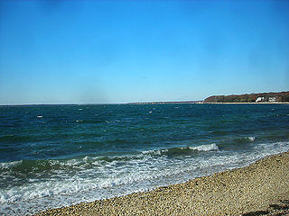
Great South Bay, actually a lagoon, is situated between Long Island and Fire Island, in the State of New York. It is approximately 45 miles (72 km) long and protected from the Atlantic Ocean by Fire Island, a barrier island, as well as the eastern end of Jones Beach Island and Captree Island.

In geography, a sound is a large sea or ocean inlet, deeper than a bight and wider than a fjord; or a narrow sea or ocean channel between two bodies of land.
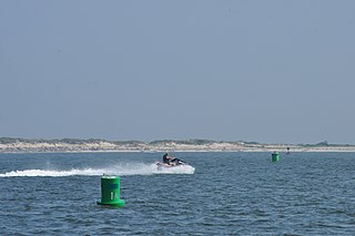
South Oyster Bay or East Bay is a natural harbor along the western portion of the south shore of Long Island in New York in the United States. The harbor is formed by Jones Beach Island, a barrier island on the southern side of Long Island. It is approximately 3 mi (5 km) wide between the two islands, and approximately 15 mi (24 km) long. It links to Great South Bay on its eastern end and opens to the Atlantic Ocean through inlets on either side of Jones Beach Island.

Tomales Bay is a long, narrow inlet of the Pacific Ocean in Marin County in northern California in the United States. It is approximately 15 miles (25 km) long and averages nearly 1.0 miles (1.6 km) wide, effectively separating the Point Reyes Peninsula from the mainland of Marin County. It is located approximately 30 miles (48 km) northwest of San Francisco. The bay forms the eastern boundary of Point Reyes National Seashore. Tomales Bay is recognized for protection by the California Bays and Estuaries Policy. On its northern end it opens out onto Bodega Bay, which shelters it from the direct current of the Pacific. The bay is formed along a submerged portion of the San Andreas Fault.

Barnegat Bay is a small brackish arm of the Atlantic Ocean, approximately 42 miles (67.2 km) long, along the coast of Ocean County, New Jersey in the United States. It is separated from the Atlantic by the long Barnegat Peninsula, as well as by the north end of Long Beach Island, popular segments of the Jersey Shore. The bay is fed by several small rivers, including the Toms River and Metedeconk River, which empty into the bay through small estuaries along its inner shore. The communities of Toms River, Silverton, and Forked River sit along the river estuaries on the bay.
The Peconic Bay is the parent name for two bays between the North Fork and South Fork of Long Island in the U.S. state of New York. It is separated from Gardiners Bay by Shelter Island.

The North Shore of Long Island is the area along the northern coast of New York's Long Island bordering Long Island Sound. Known for its extreme wealth and lavish estates, the North Shore exploded into affluence at the turn of the 20th century, earning it the nickname the Gold Coast. Historically, this term refers to the coastline communities in the towns of North Hempstead, Oyster Bay, and Huntington, in Nassau and western Suffolk County. The easternmost Gold Coast mansion is the Geissler Estate, located just west of Indian Hills Country Club in Fort Salonga, within the Town of Huntington.
Saccostrea glomerata, the Sydney rock oyster, New Zealand rock oyster, or Auckland oyster,, is an oyster species endemic to Australia and New Zealand. In Australia it is found in bays, inlets and sheltered estuaries from Wingan Inlet in eastern Victoria, along the east coast of New South Wales, and north to Hervey Bay, Queensland, around northern Australia and south along the west coast to Shark Bay in Western Australia. Also, a small population exists on the islands in the Furneaux archipelago Flinders Island, in Bass Strait, Tasmania. The spat for these oysters travels down the east coast of Australia on the East Australia Current. and in Albany on the south west coast of Western Australia, where they are farmed. In New Zealand, where the species is not farmed, it is known as the New Zealand rock oyster or Auckland oyster. The Sydney rock oyster is closely related to Saccostrea cucullata, the hooded oyster, which is common on Indo-Pacific rocky shores.
The Outer Barrier, also known as the Long Island and New York City barrier islands, refers to the string of barrier islands that divide the lagoons south of Long Island, New York from the Atlantic Ocean. These islands include Coney Island, Long Beach Barrier Island, Island Park, Jones Beach Island, Fire Island and Westhampton Island. The outer barrier extends 75 miles (121 km) along the South Shore of Long Island, from the Rockaway Peninsula in New York City to the east end of Shinnecock Bay in Suffolk County.

Reynolds Channel is a strait in Nassau County, New York that separates Long Beach Barrier Island, which contains the City of Long Beach and the villages of Atlantic Beach, Lido Beach, and Point Lookout, from Long Island, Barnum Island, Harbor Isle, and various uninhabited islands between Long Beach Island and Long Island. The channel begins at the East Rockaway Inlet and ends at Point Lookout, where it merges with the Jones Inlet. Four bridges cross the channel: the Atlantic Beach Bridge, the Long Island Rail Road's Long Beach Branch bridge, the Long Beach Boulevard Bridge, and the Loop Parkway Bridge. The channel is named after William Reynolds, a developer and former State Senator who greatly built up Long Beach Island in the early 20th century.

Oyster Bay is the terminus on the Oyster Bay Branch of the Long Island Rail Road. The station is located off Shore Avenue between Maxwell and Larabee Avenues. It is a sheltered concrete elevated platform that stands in the shadows of the original station, which was accessible from the ends of Maxwell, Audrey, and Hamilton Avenues. Both stations exist along the south side of Roosevelt Park.

Totten Inlet lies in the southern end of Puget Sound in the U.S. state of Washington. The inlet extends 9 miles (14 km) southwest from the western end of Squaxin Passage, and much of the county line between Mason and Thurston counties runs down the center of it. A spit extends west for about 300 feet (91 m) from Steamboat Island. The inlet shoals gradually to near Burns Point, 100 feet high, on the south shore, where it bares at low tide.

Chincoteague Bay is a lagoon between the Atlantic barrier islands of Assateague and Chincoteague and the mainland of Worcester County, Maryland and northern Accomack County, Virginia. At the bay's northern end, where it narrows between Assateague and Sinepuxent Neck, it becomes Sinepuxent Bay; Chincoteague Bay's southern end drains into the Atlantic Ocean via Queen Sound and Chincoteague Inlet. No major river flows into Chincoteague Bay—its largest tributaries are Newport Creek in Worcester County and Swans Gut Creek in Accomack County.

The Otis Pike Fire Island High Dune Wilderness, also known as the Otis G. Pike Wilderness Area or the Fire Island Wilderness, is a federally protected wilderness area located on Fire Island, a barrier island off the south shore of Long Island, New York, United States. The 1,380-acre wilderness is contained within the larger Fire Island National Seashore.
Jones Inlet is located at the westernmost end of the 17-mile (27 km) long Jones Beach barrier island that runs along Long Island's south shore. The inlet separates Jones Beach State Park's West End from the community of Point Lookout and connects South Oyster Bay with the Atlantic Ocean. In 2006, the inlet handled approximately 10,000 tons of commercial tonnage.
Tobay Beach is a restricted access recreational beach located in the middle of Jones Beach Island, a barrier island off the South Shore of Long Island, New York in Nassau County, New York within the Massapequa 11758 Zipcode. Its name is an acronym for the Town of Oyster Bay, which owns and manages the beach. Residents of the town are allowed entry, with limited access for non-residents.

