Related Research Articles

U.S. Route 5 is a north–south United States highway running through the New England states of Connecticut, Massachusetts, and Vermont. Significant cities along the route include New Haven, Connecticut; Hartford, Connecticut; and Springfield, Massachusetts. From Hartford northward to St. Johnsbury, Vermont, the road closely follows the route of the Connecticut River.
Long Wharf is a waterfront district and neighborhood of the city of New Haven, Connecticut, United States.

Mott Haven is a primarily residential neighborhood in the southwestern section of the New York City borough of the Bronx. Its boundaries, starting from the north and moving clockwise, are East 149th Street to the north, the Bruckner Expressway to the east, the Bronx Kill waterway to the south, and the Harlem River to the west. East 138th Street is the primary east–west thoroughfare through Mott Haven.

Randolph Street is a street in Chicago. It runs east–west through the Chicago Loop, carrying westbound traffic west from Michigan Avenue across the Chicago River on the Randolph Street Bridge, interchanging with the Kennedy Expressway (I-90/I-94), and continuing west. It serves as the northern boundary of Grant Park and the Chicago Landmark Historic Michigan Boulevard District. Several large theaters, as well as city and state government buildings are on and adjacent to Randolph. Metra's Millennium Station is located under Randolph Street.

City Point is an area in what is now The Hill neighborhood of the city of New Haven, Connecticut, located in the southwestern portion of the city. The City Point area was, when settled and through the 18th century, a relatively narrow peninsula extending south into New Haven Harbor, located where the West River empties into the harbor. Areas adjacent to the original peninsula have since been filled in, broadening its shoulders, and Interstate 95 has cut across it. The Oyster Point Historic District is a 26-acre (11 ha) historic district encompassing an area of relatively old buildings in City Point south of I-95.
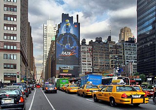
Eighth Avenue is a major north–south avenue on the west side of Manhattan in New York City, carrying northbound traffic below 59th Street. While the avenue has different names at different points in Manhattan, it is actually one continuous stretch of road.
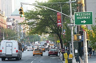
Ninth Avenue, known as Columbus Avenue between West 59th and 110th Streets, is a thoroughfare on the West Side of Manhattan in New York City. Traffic runs downtown (southbound) along the full stretch from Chelsea to the Upper West Side, except for the lowermost three blocks where traffic runs northbound carrying traffic from Greenwich Street.
Fair Haven Heights, or simply the Heights, is a residential and light industrial neighborhood in the eastern part of the city of New Haven, Connecticut, located east of the Quinnipiac River. Fair Haven Heights is not to be confused with the adjacent Fair Haven neighborhood west of the river. The area is bordered on the west by the Quinnipiac River, on the north by Route 80, on the east by the town of East Haven, and on the south by Ferry Street and Warwick Avenue. The main through routes are Quinnipiac Avenue, East Grand Avenue, and Eastern Street

Connecticut's 3rd congressional district is a congressional district in the U.S. state of Connecticut. Located in the central part of the state, the district includes the city of New Haven and its surrounding suburbs.

Western Avenue is a street within the city of Chicago. Western Avenue extends south as a continuous road to the Dixie Highway at Sibley Boulevard in Dixmoor, giving the road a total length of 27.38 miles (44.06 km). Western Avenue, after turning into Asbury Ave, runs out on the north side at Green Bay Road in Evanston and on the south side at Crete-Monee Road in Crete. However, Western Avenue extends intermittently through the Southland to the Will / Kankakee county border in unincorporated Will Township. Within Chicago's grid street system, Western Avenue is 2400 West, three miles west of State Street.
The Near East Side is a neighborhood located near downtown Columbus, Ohio, made up of several neighborhoods: Beatty Park, King-Lincoln (Bronzeville), Eastgate, Franklin Park, Nelson Park, Olde Towne East, and Woodland Park.
Columbus, Ohio has numerous neighborhoods within the city limits.

Old North Columbus is a neighborhood located just north of the Ohio State University in Columbus, Ohio. It was founded in 1847 where, at the time, it was a stand-alone city out of the confines of Columbus until it was incorporated into the City of Columbus in 1871. In its early years the city was a popular stagecoach stop with people traveling from Worthington to Columbus. Today Old North Columbus is popular for its local music and its unique "untouched architecture" which is reminiscent of its old roots.
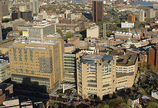
The Hill is the southwestern-most neighborhood of New Haven, Connecticut. As early as 1800, this area was known as "Sodom Hill". Located directly south of Downtown New Haven, the neighborhood is now home to New Haven Union Station as well as Yale-New Haven Hospital and the Yale School of Medicine.
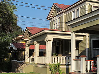
Hampton Park Terrace is the name both of a neighborhood and a National Register district located in peninsular Charleston, South Carolina. The neighborhood is bounded on the west by The Citadel, on the north by Hampton Park, on the east by Rutledge Ave., and on the south by Congress St. In addition, the one block of Parkwood Ave. south of Congress St. is considered, by some, to be included. The National Register district, on the other hand, is composed of the same area with two exceptions: (1) the northeasternmost block is excluded and (2) an extra block of President St. is included.

Prospect Hill is a neighborhood of the city of New Haven, Connecticut located in the north central portion of the city, directly north of Downtown New Haven. The neighborhood contains residences, institutional buildings of Albertus Magnus University and a portion of the main campus of Yale University, including the Science Hill area, the Hillhouse Avenue area and the Yale Peabody Museum. The City of New Haven defines the neighborhood to be the region bounded by the town of Hamden in the north, Winchester Avenue in the west, Munson Street/Hillside Place/Prospect Street in the southwest, Trumbull Street in the south, and Whitney Avenue in the east. Prospect Street is the main thoroughfare through the neighborhood.
Fairlawn–Nettleton Historic District is a state-designated historic district in New Haven, Connecticut.
Elm Street Historic District is a state historic district in the downtown area of New Haven, Connecticut. The area is eligible for listing, but not yet listed, on the National Register of Historic Places. The district is roughly bounded by Wall, Orange, Elm, and College streets. It includes the New Haven Free Public Library, the New Haven County Courthouse, The Eli, the Union and New Haven Trust Building, the Yale School of Music, and the Yale University Press building.
References
- 1 2 "Redfield & West Streets Historic District". New Haven Historical Trust.