1945 season

| 1940s North Indian Ocean cyclone seasons | |
|---|---|
| Seasonal boundaries | |
| First system formed | 1940 |
| Last system dissipated | 1949 |
| Seasonal statistics | |
| Depressions | 46 |
| Total fatalities | 7,500+ |
| Total damage | Unknown |
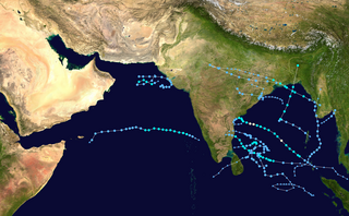
The years between 1940 and 1949 featured the 1940s North Indian Ocean cyclone seasons. Each season was an ongoing event in the annual cycle of tropical cyclone formation. The North Indian tropical cyclone season has no bounds, but they tend to form between April and December, peaks in May and November. These dates conventionally delimit the period of each year when most tropical cyclones form in the northern Indian Ocean. Below are the most significant cyclones in the time period. Because much of the North Indian coastline is near sea level and prone to flooding, these cyclones can easily kill many with storm surge and flooding. These cyclones are among the deadliest on earth in terms of numbers killed. On 27 April 1949, India Meteorological Department (IMD) became a member of the World Meteorological Organization after independence. [1]
In November 1940, A Severe Cyclone Struck Mumbai, Gusts reached 121 km/h in Colaba, There were bodies floating in floodwaters, The Cyclone cost the city 25 Lakh Rupees [3] [4]
On 27 July 1944, a cyclone left some 20,000 people homeless in Karachi. [10]

This significant storm killed 750 people and led to a loss of 30,000 cattle. [11]
3 Cyclonic storms came in the Vicinity of Mumbai [12]


A cyclonic storm lasted from May 17–19 before moving ashore current-day Bangladesh between Noakhali and Chittagong, killing 1,200 people and 20,000 cattle. [13]
In 1948, a tropical storm made landfall along the Makran coast in Balochistan province in Pakistan. [14] [15]
On November 21, 1948 a strong cyclone struck Bombay (present-day Mumbai) Gusts in Juhu reached 151 kilometres per hour or 94 miles per hour or 42 metres per second. [16] Torrential rains lashed the metropolis, The storm left 38 people dead and 47 missing [17] Mumbai wouldn't be hit again until 72 years later [18] The city was paralyzed, Trees were uprooted, The city reported 5 inches or 127 millimetres of rain in 24 hours [19] There was floods due to torrential rains and the power supply was disrupted, The Bombay station of All India Radio was also affected, and local transport came to a standstill, The fierce storm reportedly impacted Bombay for 20 hours and put the city in a Standstill [20]

On 28 October 1949, a severe cyclone struck the Andhra coast near Masulipatam. Lowest pressure reported was 976.9 mb and about 800 people lost their lives and thousands were left homeless as a result of the cyclone. Map showing the track of the cyclone was published by IMD. [21] [22]
The climate of Mumbai is tropical, with defined wet and dry seasons. The mean annual temperature is 27.7 °C or 81.9 °F. Average annual rainfall is 2,213.4 millimetres or 87 inches in Colaba, which represents South Mumbai and 2,502.3 millimetres or 99 inches in Santacruz, which represents central and suburban Mumbai. The mean maximum average temperatures is about 32 °C (90 °F) in summer and 30 °C (86 °F) in winter, while the average minimums are 26 °C (79 °F) in summer and 18 °C (64 °F) in winter. The city experiences a lengthy, practically rainless dry season, and a relatively short, but extremely rainy wet season; due to the Southwest Monsoon and orographic influences from the nearby Western Ghats.

In the Indian Ocean north of the equator, tropical cyclones can form throughout the year on either side of the Indian subcontinent, although most frequently between April and June, and between October and December.

This is a timeline of the 2009 North Indian Ocean cyclone season, which contains details of when a depression forms, strengthens, weakens, makes landfalls, and dissipates during the 2009 North Indian Ocean cyclone season. It also includes information from post-storm analysis by the Joint Typhoon Warning Center (JTWC), and the India Meteorological Department (IMD) who run the Regional Specialized Meteorological Center in New Delhi, India. RSMC New Delhi's area of responsibility is officially between 45°E and 100E which is east of the Horn of Africa and west of the Malay Peninsula. There are two main seas within the North Indian Ocean, the Arabian Sea and the Bay of Bengal. For storms, these are abbreviated as BOB and ARB by the IMD.

Cyclonic Storm Phyan developed as a tropical disturbance to the southwest of Colombo in Sri Lanka on November 4, 2009. Over the next couple of days, the disturbance gradually developed before weakening as it made landfall on Southern India on November 7. After the disturbance emerged into the Arabian Sea, it rapidly became more of a concern to the India Meteorological Department (IMD) reporting early on November 9 that the disturbance had intensified into a Depression, and designated it as Depression ARB 03 whilst the Joint Typhoon Warning Center (JTWC) issued a Tropical Cyclone Formation Alert. Later that day, the JTWC designated the system as Cyclone 04A. During the next day, the Depression turned towards the northeast the IMD reported that it had intensified into a Cyclonic Storm and named it as Phyan.

India is a country in the north of Indian Ocean that is the most vulnerable to getting hit by tropical cyclones in the basin, from the east or from the west. On average, 2–3 tropical cyclones make landfall in India each year, with about one being a severe tropical cyclone or greater.

The 1961 North Indian Ocean cyclone season had no bounds, but cyclones tend to form between April and December, with peaks in May and November. These dates conventionally delimit the period of each year when most tropical cyclones form in the northern Indian Ocean. There are two main seas in the North Indian Ocean—the Bay of Bengal to the east of the Indian subcontinent and the Arabian Sea to the west of India. The official Regional Specialized Meteorological Centre in this basin is the India Meteorological Department (IMD), while the Joint Typhoon Warning Center releases unofficial advisories. An average of four to six storms form in the North Indian Ocean every season with peaks in May and November. Cyclones occurring between the meridians 45°E and 100°E are included in the season by the IMD.

The 1962 North Indian Ocean cyclone season had no official bounds, but cyclones tend to form between April and December. These dates conventionally delimit the period of each year when most tropical cyclones form in the northern Indian Ocean. There are two main seas in the North Indian Ocean—the Bay of Bengal to the east of the Indian subcontinent and the Arabian Sea to the west of India. The official Regional Specialized Meteorological Centre in this basin is the India Meteorological Department (IMD), while the Joint Typhoon Warning Center releases unofficial advisories. An average of four to six storms form in the North Indian Ocean every season with peaks in May and November. The IMD includes cyclones occurring between the meridians 45°E and 100°E in the season.

The 1964 North Indian Ocean cyclone season had no bounds, but cyclones tend to form between April and December, with peaks in May and November. The season has no official bounds but cyclones tend to form between April and December. These dates conventionally delimit the period of each year when most tropical cyclones form in the northern Indian Ocean. There are two main seas in the North Indian Ocean—the Bay of Bengal to the east of the Indian subcontinent and the Arabian Sea to the west of India. The official Regional Specialized Meteorological Centre in this basin is the India Meteorological Department (IMD), while the Joint Typhoon Warning Center releases unofficial advisories. An average of four to six storms form in the North Indian Ocean every season with peaks in May and November. Cyclones occurring between the meridians 45°E and 100°E are included in the season by the IMD.

The 1963 North Indian Ocean cyclone season had no bounds, but cyclones tend to form between April and December, with peaks in May and November. These dates conventionally delimit the period of each year when most tropical cyclones form in the northern Indian Ocean. There are two main seas in the North Indian Ocean—the Bay of Bengal to the east of the Indian subcontinent and the Arabian Sea to the west of India. The official Regional Specialized Meteorological Centre in this basin is the India Meteorological Department (IMD), while the Joint Typhoon Warning Center releases unofficial advisories. An average of four to six storms form in the North Indian Ocean every season with peaks in May and November. Cyclones occurring between the meridians 45°E and 100°E are included in the season by the IMD.

The 2020 North Indian Ocean cyclone season was the costliest North Indian Ocean cyclone season on record, mostly due to the devastating Cyclone Amphan. The North Indian Ocean cyclone season has no official bounds, but cyclones tend to form between April and November, with peaks in late April to May and October to November. These dates conventionally delimit the period of each year when most tropical cyclones form in the northern Indian Ocean. The season began on May 16 with the designation of Depression BOB 01 in the Bay of Bengal, which later became Amphan. Cyclone Amphan was the strongest storm in the Bay of Bengal in 21 years and would break Nargis of 2008's record as the costliest storm in the North Indian Ocean. The season concluded with the dissipation of Cyclone Burevi on December 5. Overall, the season was slightly above average, seeing the development of five cyclonic storms.

The 2021 North Indian Ocean cyclone season was an average season, the North Indian Ocean cyclone season has no official bounds, but cyclones tend to form between April and December, peaking between May and November. These dates conventionally delimit the period of each year when most tropical cyclones form in the northern Indian Ocean. The season began on April 2, when a depression designated as BOB 01 was formed in the north Andaman Sea and quickly made landfall in Myanmar. The basin remained quiet for over a month before Cyclone Tauktae formed. It rapidly intensified into an extremely severe cyclonic storm before making landfall in Gujarat, become the strongest storm ever to strike that state since the 1998 Gujarat cyclone. Later that month, BOB 02 formed and later strengthened into Cyclone Yaas. Yaas rapidly intensified into a very severe cyclonic storm before making landfall in northwestern Odisha. The season's strongest tropical cyclone was Cyclone Tauktae, with maximum wind speeds of 185 km/h (115 mph) and a minimum barometric pressure of 950 hPa (28.05 inHg).
The 2022 North Indian Ocean cyclone season was an event in the annual cycle of tropical cyclone formation. It was an above-average season in terms of depressions and average in terms of deep depressions, but slightly below average in terms of cyclonic storms. It was also the least deadly North Indian Ocean cyclone season since 1988, according to official data. The season's strongest tropical cyclone was Cyclone Asani, with maximum wind speeds of 100 km/h and a minimum barometric pressure of 982 hPa. The North Indian Ocean cyclone season has no official bounds, but cyclones tend to form between April and December, with the peak from May to November. These dates conventionally delimit the period of each year when most tropical cyclones form in the northern Indian Ocean.

Severe Cyclonic Storm Nisarga was the strongest tropical cyclone to strike the Indian state of Maharashtra in the month of June since 1891. It was also the first cyclone to impact Raigad & Mumbai since Phyan of 2009. The third depression and second named cyclone of the 2020 North Indian Ocean cyclone season, Nisarga originated as a depression in the Arabian Sea and moved generally northward. On 2 June, the India Meteorological Department (IMD) upgraded the system to a cyclonic storm, assigning the name Nisarga. On the next day, Nisarga further intensified to a severe cyclonic storm and turned to the northeast, ultimately making landfall approximately 95 km (60 mi) south of Mumbai. Nisarga rapidly weakened once inland and dissipated on 4 June.
The years between 1950 and 1959 featured the 1950s North Indian Ocean cyclone seasons. Each season was an ongoing event in the annual cycle of tropical cyclone formation. The North Indian tropical cyclone season has no bounds, but they tend to form between April and December, peaks in May and November. These dates conventionally delimit the period of each year when most tropical cyclones form in the northern Indian Ocean. Below are the most significant cyclones in the time period. Because much of the North Indian coastline is near sea level and prone to flooding, these cyclones can easily kill many with storm surge and flooding. These cyclones are among the deadliest on earth in terms of numbers killed. At the time, only one RSMC, the India Meteorological Department (IMD), monitored the basin. However, in 1959, the Joint Typhoon Warning Center (JTWC) was founded, resulting in it releasing unofficial advisories for the basin.
The following is a list of North Indian Ocean tropical cyclones from 1930 to 1939. Records from before the 1970s were extremely unreliable, and storms that stayed at sea were often only reported by ship reports.
The following is a list of North Indian Ocean tropical cyclones from 1920 to 1929. Records from before the 1970s were extremely unreliable, and storms that stayed at sea were often only reported by ship reports.
This article encompasses the 1890s North Indian Ocean cyclone seasons.
{{cite web}}: CS1 maint: archived copy as title (link){{cite journal}}: Cite journal requires |journal= (help)