
Dunfermline is a town, parish and former Royal Burgh, in Fife, Scotland, on high ground 3 miles (5 km) from the northern shore of the Firth of Forth. The town currently has an estimated population of 58,508. According to the National Records of Scotland, the Greater Dunfermline area has a population of 76,210.
Cupar is a town, former royal burgh and parish in Fife, Scotland. It lies between Dundee and Glenrothes. According to a 2011 population estimate, Cupar had a population around 9,000, making it the ninth-largest settlement in Fife, and the civil parish a population of 11,183. It is the historic county town of Fife, although the council now sits at Glenrothes.

Seacroft is an outer-city suburb/township consisting mainly of council estate housing covering an extensive area of east Leeds, West Yorkshire, England. It lies in the LS14 Leeds postcode area, around 4 miles (6.4 km) east of Leeds city centre.
Leven is a seaside town in Fife, set in the east Central Lowlands of Scotland. It lies on the coast of the Firth of Forth at the mouth of the River Leven, 8.1 miles (13.0 km) north-east of the town of Kirkcaldy and 6.4 miles (10.3 km) east of Glenrothes.
Falconwood is an area of south east London within both the London Boroughs of Bexley and Greenwich. It is north east of Eltham and south west of Welling.

Dunfermline and West Fife is a county constituency represented in the House of Commons of the Parliament of the United Kingdom. It was created for the 2005 general election from all of the old Dunfermline West and parts of the old Dunfermline East constituencies. The current MP is Douglas Chapman of the Scottish National Party (SNP).
Crossford is a village in West Fife, Scotland. It is 1 mile west of Dunfermline, east of Cairneyhill, astride the A994, at 56°03′51″N03°29′47″W.
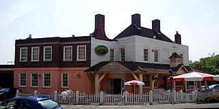
Woodmill High School is a local authority ran high school in Dunfermline, Scotland. It is one of the city's four high schools.

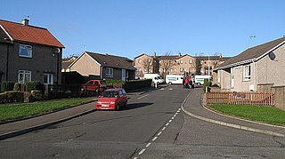
Townhill is a small village that lies just north of Dunfermline, Fife, Scotland. The origin of the community is thought to be from the coal-mining industry. There is a Church of Scotland parish church, which shares a minister with nearby Kingseat.

Crossgates is a village in Fife, Scotland. It is located close to the junction of the M90 and A92, about two miles east of Dunfermline and a similar distance south west of Cowdenbeath. The village name means 'crossroads': it is situated at the point where the main Dunfermline-Kirkcaldy road crosses the old Great North Road from Inverkeithing to Perth.

Duloch, or Duloch Park, is a residential suburb of Dunfermline, in Fife, Scotland.

Oakley is a village in Fife, Scotland located at the mutual border of Carnock and Culross parishes, Fife, 5+1⁄2 miles west of Dunfermline on the A907.

Goldington is an electoral ward within the town of Bedford, Bedfordshire, England. It encompasses much of the historic village and parish of Goldington that was merged with Bedford in 1934, although some parts of the old village are within the neighbouring Newnham ward. It also includes two modern estates that are part of Renhold Parish.
St Columba's RC High School is a six-year comprehensive Roman Catholic secondary school, located in Dunfermline in Fife, Scotland.

Ballingry ; Scots: Ballingry, Bingry, Scottish Gaelic: Baile Iongrach) is a small town in Fife, Scotland. It is near the boundary with Perth and Kinross, north of Lochgelly. It has an estimated population (2016) of 5,940. The once separate villages of Ballingry, Lochore, Crosshill, and Glencraig are now somewhat joined together as the part of the Benarty area. Ballingry, along with its neighbour Lochgelly, is one of Fife's 'regeneration areas' and is classed as in need of regeneration economically and socially.
Wellwood is a small village to the north of Dunfermline, Fife, Scotland. It was named after the Wellwoods who used to own coalmines in the area. It has a leisure centre and a golf course (Canmore). It is nearby the Town Loch and also is partially bordered by Queen Anne High School. It was formerly known as Hawkiesfauld.

Halbeath is a village northeast of Dunfermline, Fife, Scotland. It derives its name from the Gaelic choil beath, which means "wood of birches", and began as a colliery village. In the summer of 1789, a coal pit was sunk at Halbeath, two and a half miles northeast of Dunfermline, and by 1821, 841 people were reported to be living in the village.
McLean Primary School is located in the centre of Dunfermline, Fife. The head teacher is Carol Newton. Pupils from the school progress onto Queen Anne High School. The building is a category C listed building.

Kingseat is a village in Fife, Scotland, approximately 1.5 miles (2.4 km) northeast of Dunfermline. It was originally a coal mining village with the first pits sunk in the area in 1800. The name of the village is thought locally to have originated from when the king would visit the area to look out onto the River Forth and to Arthur's Seat.
