
Slovenia is situated at the crossroads of central and southeast Europe, touching the Alps and bordering the Adriatic Sea. The Alps—including the Julian Alps, the Kamnik–Savinja Alps and the Karawank chain, as well as the Pohorje massif—dominate northern Slovenia along its long border to Austria. Slovenia's Adriatic coastline stretches approximately 47 km (29 mi) from Italy to Croatia. Its part south of Sava river belongs to Balkan peninsula – Balkans.
Karlovac County is a county in central Croatia, with the administrative center in Karlovac.

Zadar County is a county in Croatia, it encompasses northern Dalmatia and southeastern Lika. Its seat is the city of Zadar.

Krk is a Croatian island in the northern Adriatic Sea, located near Rijeka in the Bay of Kvarner and part of Primorje-Gorski Kotar county. Krk is tied with Cres as the largest Adriatic island, depending on the methodology used to measure the coastline. Krk is the most populous island in the Adriatic, with multiple towns and villages that contain a total of 19,916 (2021) inhabitants.

Malinska is a settlement (naselje) in the northwestern part of the island Krk in Croatia and an important tourist town. It lies on the coast of the Adriatic Sea, in the picturesque bay facing Opatija and Rijeka.

Kraljevica is a town in the Kvarner region of Croatia, located between Rijeka and Crikvenica, approximately thirty kilometers from Opatija and near the entrance to the bridge to the island of Krk. The population of the settlement of Kraljevica itself is 2,857 with a total of 4,618 in the area of the Town of Kraljevica, which is part of Primorje-Gorski Kotar County, and includes Šmrika. The town is known for its shipyard which has built a number of ships for the Croatian navy.

Primošten is a village and municipality in Šibenik-Knin County, Croatia. It is situated in the south, between the cities of Šibenik and Trogir, on the Adriatic coast.
Rivanj is an Adriatic Sea island in the Zadar Archipelago, between the islands of Sestrunj and Ugljan, with an area of 4.4 square kilometres (1.7 sq mi) ; population 31 (2011); highest peak Lukocina. The only village is Rivanj, located in the interior of the island; below it, on the south-western coast, is a small harbour with a hamlet. The island is largely covered with underbrush and thicket. Rivanj has a daily ferry and ship line with Zadar. The present village was allegedly founded by the inhabitants of the island of Ugljan. Rivanj is frequented by boaters. There are only 2 family surnames in Rivanj, Radulić and Fatović, and there is a church of St. Jelena on the island.

Kaprije is an island in the Croatian part of the Adriatic Sea. It is situated in Šibenik archipelago. It has area of 7.11 km2 (2.75 sq mi) and population of 189, in the eponymous single settlement on the island. The island is composed of hills divided by transversal and longitudinal valleys where grass and sparse pine forests grow. Grapes and olives are cultivated there. The main industries are agriculture, fishing and tourism. Automobiles are not allowed on the island.

Rava is an island in the Croatian part of the Adriatic Sea. It is situated in the Zadar Archipelago, between Iž and Dugi Otok, 16 nautical miles (30 km) from Zadar. Its area is 3.6 km2, and it has a population of 117. The only settlements on the island are Vela Rava and Mala Rava. The coast of the island is very indented with 13 bays and 15.45 kilometres of coastline. The island is composed of dolomite. The primary industries are agriculture and fishing.

Zverinac is a small Croatian island in the Zadar Archipelago of the Adriatic Sea. It occupies 4.2 km2 and is populated by 43 people, with a population density of 10.29 persons per square kilometer. Its highest peak is 111 metres high.
Abbott Run is a de facto river in the U.S. state of Massachusetts and Rhode Island. It flows approximately 10 miles (16 km).

Jadranska Avenue is a mostly six-lane controlled-access avenue in the Novi Zagreb – zapad city district of southwestern Zagreb, Croatia. Legally designated as a part of County road Ž1040, it runs between the Remetinec Roundabout and the Zagreb bypass, acting as an important thoroughfare both for commuters from southwestern suburbs of Lučko and Stupnik and for travellers coming to the city by A1 motorway. The avenue experiences high amounts of seasonal traffic in summer resulting in traffic jams sometimes spanning the whole length of the avenue. The daily traffic has also been rising in recent years due to former bedroom communities in Zagreb County from the 1990s becoming new outer suburbs in the 2000s. Novi Zagreb neighborhoods Blato, Botinec and Lanište are located directly south of the avenue. The intersection with Lanište Road was recently converted into an interchange.

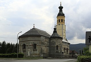
Grižane Castle is a ruined castle and site near Grižane in Vinodol, in the northern part of the Adriatic coast, western Croatia. The castle of Grižane had an odd, rectangular form with circular towers, and this irregularity was caused by the peculiar structure of the field.
Kajzerica is a neighborhood located in the Novi Zagreb – zapad city district of Zagreb, the capital of Croatia. It is located west of Bundek Lake and east of the Western Rotary and Adriatic Bridge. It has a population of 4,387 (2011).

Žut is an uninhabited island in the Croatian part of the Adriatic Sea, in central Dalmatia. With an area of 14.83 km2 (5.73 sq mi) it is the 28th largest island in Croatia and the second largest island in the Kornati archipelago, after Kornat. Although most of the archipelago, composed of 89 islands, islets and rocks, is included in the Kornati National Park, the island of Žut is not.
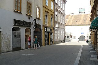
Krvavi most is a street in the heart of Zagreb, capital of Croatia. It is named after the former bridge over the Medveščak creek, which was rendered useless after the covering of the creek. Although the bridge became the street, the name stayed because of historical reasons – as a reminder of history and a witness of Zagreb's past.

The Ethnographic Museum is located at 14 Ivan Mažuranić Square in Zagreb, Croatia. It was founded in 1919 by Salamon Berger. It lies in the Secession building of the one-time Trades Hall of 1903, designed by the architect Vjekoslav Bastl. The statues in the central part of the façade are the work of Rudolf Valdec. The frescoes on the interior part of the cupola were painted by Oton Iveković.
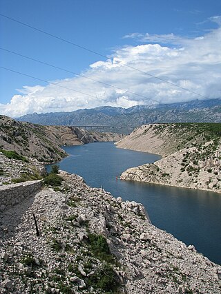
Novsko Ždrilo is a strait of the Adriatic Sea in Croatia between the Novigrad Sea and the Velebit Channel. There are two bridges across the strait bearing the same name, Maslenica Bridge.

