Related Research Articles

Dilmun, or Telmun, was an ancient East Semitic-speaking civilization in Eastern Arabia mentioned from the 3rd millennium BC onwards. Based on contextual evidence, it was located in the Persian Gulf, on a trade route between Mesopotamia and the Indus Valley civilisation, close to the sea and to artesian springs. Dilmun encompassed Bahrain, Kuwait, and eastern Saudi Arabia. This area is certainly what is meant by references to "Dilmun" among the lands conquered by King Sargon II and his descendants.

An alley or alleyway is a narrow lane, path, or passageway, often reserved for pedestrians, which usually runs between, behind, or within buildings in the older parts of towns and cities. It is also a rear access or service road, or a path, walk, or avenue in a park or garden.

A townhouse, townhome, town house, or town home, is a type of terraced housing. A modern townhouse is often one with a small footprint on multiple floors. In a different British usage, the term originally referred to any type of city residence of someone whose main or largest residence was a country house.

The Eastern Province, also known as the Eastern Region, is the easternmost of the 13 provinces of Saudi Arabia. It is the nation's largest province by area and the third most populous after the Riyadh and Mecca provinces. In 2017, the population was 4,900,325. Of these, 3,140,362 were Saudi citizens and 1,759,963 were foreign nationals The province accounts for 15.05% of the entire population of Saudi Arabia and is named for its geographical location relative to the rest of the kingdom.

A terrace, terraced house (UK), or townhouse (US) is a kind of medium-density housing that first started in 16th century Europe with a row of joined houses sharing side walls. In the United States and Canada these are sometimes known as row houses or row homes.

A company town is a place where practically all stores and housing are owned by the one company that is also the main employer. Company towns are often planned with a suite of amenities such as stores, houses of worship, schools, markets and recreation facilities.

The Bahrain National Museum is the largest and oldest public museum in Bahrain. It is situated in Manama, adjacent to the National Theatre of Bahrain. Opened on 15 December 1988 by the Emir of Bahrain Isa bin Salman Al Khalifa, the $30 million museum complex covers 27,800 sq meters and is the country's most popular tourist attraction. It is believed to be the region's first modern museum.

Eastern Arabia (Bahrain), is a region stretched from Basra to Khasab along the Persian Gulf coast and included parts of modern-day Bahrain, Kuwait, Iraq, Eastern Saudi Arabia, United Arab Emirates, Qatar, Oman. The entire coastal strip of Eastern Arabia was known as "Bahrain" for a millennium.

Otterbein is a small neighborhood of historic rowhouses in Baltimore, Maryland, United States. Otterbein is immediately southwest of, and in close walking distance to, the Inner Harbor. The neighborhood is very compact, entirely located between Hanover Street and Sharp Street, and between Barre Street and Henrietta Street. It is in small parts of zip codes 21201 and 21230. It is named for Old Otterbein Church, located immediately north of the neighborhood.

Mayfield is a quaint and historic community in northeast Baltimore, Maryland. It is bounded by Erdman Avenue on the south, Chesterfield Avenue on the north, Crossland Avenue on the east and Lake Montebello on the north and west. Homeowners belong to the Mayfield Improvement Association.

The Qal'at al-Bahrain, also known as the Bahrain Fort or Portuguese Fort, is an archaeological site located in Bahrain. Archaeological excavations carried out since 1954 have unearthed antiquities from an artificial mound of 12 m (39 ft) height containing seven stratified layers, created by various occupants from 2300 BC up to the 18th century, including Kassites, Greeks, Portuguese and Persians. It was once the capital of the Dilmun civilization and was inscribed as a UNESCO World Heritage Site in 2005.

A laneway house is a form of detached secondary suites in Canada built into pre-existing lots, usually in the backyard and opening onto the back lane. Most laneway houses are small. However, public concern has been raised in some communities about the impact that larger forms of this type of housing may have on privacy. Laneway houses are found in densely populated areas in Canadian cities, including Edmonton, Toronto, and Vancouver.

Baltimore Heritage is an American nonprofit historic-preservation organization headquartered in Baltimore, Maryland.

The Holmes–Foster–Highlands Historic District is a national historic district located in State College, Centre County, Pennsylvania. It was added to the National Register of Historic Places in 1995.
The modern Bahraini art movement emerged in the 1950s, with the establishment of an Arts and Literature club in 1952. The club served as an umbrella group for professional and amateur artists, musicians, and actors in Bahrain. In 1956, the first art exhibition was held in the Bahraini capital, Manama. Expressionism and surrealism, as well as calligraphic art are the popular forms of art in the country. Abstract expressionism has gained popularity in recent decades.

Poppleton is a neighborhood in west Baltimore, Maryland. The neighborhood is bounded on the north by West Mulberry Street, on the south by West Baltimore Street, on the west by North Carey Street, and on the east by the Martin Luther King Jr. Boulevard. Previously, Poppleton was construed in a broader sense extending further south to West Pratt Street or Lombard Street, but today this area is commonly described as the separate neighborhood of Hollins Market.

The Long's Lane Precinct, also Longs Lane Precinct, comprise a series of heritage-listed terrace houses located at 130 Cumberland Street, 132–134 Cumberland Street, 136-138 Cumberland Street, and 140–142 Cumberland Street, in the inner-city Sydney suburb of The Rocks in the City of Sydney local government area of New South Wales, Australia. The terrace houses were built from 1888 to 1914, and they are also known as 130 Cumberland Street,132–134 Cumberland Street, 136–138 Cumberland Street, Watson's Butchery, and 140–142 Cumberland Street. The properties are owned by NashCap, an Australian-based real estate private equity firm. The precinct and the terrace houses were added to the New South Wales State Heritage Register on 10 May 2002.
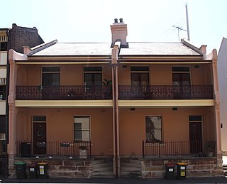
113–115 Gloucester Street, The Rocks is a heritage-listed terrace house located in the Long's Lane Precinct at 113–115 Gloucester Street, in the inner city Sydney suburb of The Rocks in the City of Sydney local government area of New South Wales, Australia. It was built during 1881. It is also known as Longs Lane Terraces/Precinct. The property is owned by Property NSW, an agency of the Government of New South Wales. It was added to the New South Wales State Heritage Register on 10 May 2002.

117–117a Gloucester Street, The Rocks is a heritage-listed terrace houses located in the Long's Lane Precinct at 117–117a Gloucester Street, in the inner city Sydney suburb of The Rocks in the City of Sydney local government area of New South Wales, Australia. It was designed by W. Foggitt and built from 1912 to 1915. It is also known as Longs Lane Terraces/Precinct (Long's). The property is owned by Property NSW, an agency of the Government of New South Wales. It was added to the New South Wales State Heritage Register on 10 May 2002.

A chronographer was a graphical representation of historical information devised by American educator Emma Willard in the mid-19th century. The chronographers intended to show historical information in a geographic and chronological context. The first graphic was Picture of Nations, published in 1835, which showed civilizations as streams running through time, becoming wider and narrower as they gained or lost influence. She developed another chronographer, the Chronographer of American History, in 1844, showing the history of the United States as events marked on the branches of a tree.
References
- ↑ Mosher, Anne E.; Holdsworth, Deryck W. (April 1992). "The meaning of alley housing in industrial towns: examples from late-nineteenth and early-twentieth century Pennsylvania". Journal of Historical Geography. 18 (2): 174–189. doi:10.1016/0305-7488(92)90130-2.
- ↑ Wagner, Rose (July 29, 2021). "Alley houses, now an 'endangered species,' were once the core of working-class Baltimore". The Baltimore Sun . Retrieved December 8, 2021.
- ↑ Zhong, Xiaohua; Leung, Ho Hon (March 18, 2019). "Exploring participatory microregeneration as a sustainable renewal of built heritage community: two case studies in Shanghai". Sustainability. 11 (6): 1617. doi: 10.3390/su11061617 .
- ↑ Lajoie, Étienne (2021-09-14). "Laneway living means she can stay close (but not too close) to her parents". Toronto Life. Retrieved 2022-06-25.
- ↑ Killick, Robert; Blakeney, Sara; Farid, Shahina; Hicks, Alison; Hicks, Martin; Kiely, Jennifer; Wasse, Alex (1997). "London-Bahrain archaeological expedition: 1994 and 1995 excavations at Saar, Bahrain" (PDF). Arabian Archaeology and Epigraphy. 8: 96–98. doi:10.1111/j.1600-0471.1997.tb00148.x. hdl:2027.42/74907.
- ↑ Harding, Vanessa (2007). "Families and housing in seventeenth-century London". Parergon. 24 (2): 115–138. doi:10.1353/pgn.2008.0015. S2CID 144867766.
- ↑ Fair, Justin (May 2020). Tiny houses and the Black experience in Baltimore (Master of City and Regional Planning). Morgan State University School of Architecture and Planning.
- ↑ Borchert, James (1973). "Alley life in Washington: an analysis of 600 photographs". Records of the Columbia Historical Society, Washington, D.C. 49. D.C. History Center: 244–259. JSTOR 40067743.
- ↑ Dickinson, Joan Younger (1966). "Aspects of Italian immigration to Philadelphia". The Pennsylvania Magazine of History and Biography. 90 (4): 445–465. JSTOR 20089965.
- ↑ Bearman, Camilo Llorens (February 14, 2000). Modal shifts: row houses and alley houses in Old Town, Alexandria, Virginia (Master of Architecture). Virginia Polytechnic Institute and State University.
- ↑ Mosher, Anne E.; Holdsworth, Deryck W. (April 1992). "The meaning of alley housing in industrial towns: examples from late-nineteenth and early-twentieth century Pennsylvania". Journal of Historical Geography. 18 (2): 174–189. doi:10.1016/0305-7488(92)90130-2.
- ↑ Lands, LeeAnn (August 15, 2011). The Culture of Property: Race, Class, and Housing Landscapes in Atlanta, 1880-1950. University of Georgia Press. p. 47. ISBN 9780820342238.
- ↑ Beasley, Ellen (2006). The Alleys and Back Buildings of Galveston: An Architectural and Social History. Texas A&M University Press. pp. 109–111. ISBN 9781585445820.
- ↑ Schultz, Stanley K. (September 1981). "Organizing Dixie: Alabama Workers in the Industrial Era. By Philip Taft. Edited by Gray Fink. Westport, Ct: Greenwood press, 1981, Pp. xxv, 228. $35.00. (Reviews of Books)". The Journal of Economic History. 41 (3): 702–703. doi:10.1017/S0022050700044697. S2CID 154058794.
- ↑ McKenzie, R. D. (September 1921). "The neighborhood: a study of local life in the city of Columbus, Ohio". American Journal of Sociology. 27 (2): 486–509. doi:10.1086/213301. S2CID 144681917.
- ↑ Hubka, Thomas C.; Kenny, Judith T. (2000). "The workers' cottage in Milwaukee's Polish community: housing and the process of Americanization, 1870-1920". Perspectives in Vernacular Architecture. 8. Vernacular Architecture Forum: 33–52. doi:10.2307/3514406. JSTOR 3514406.