
Interstate 49 (I-49) is a north–south Interstate Highway that exists in multiple segments: the original portion entirely within the state of Louisiana with an additional signed portion extending from I-220 in Shreveport to the Arkansas state line, three newer sections in Arkansas, and a new section that opened in Missouri. Its southern terminus is in Lafayette, Louisiana, at I-10 while its northern terminus is in Kansas City, Missouri, at I-435 and I-470. Portions of the remaining roadway in Louisiana, Arkansas, and Texas, which will link Kansas City with New Orleans, are in various stages of planning or construction.

Interstate 540 (I-540) is a freeway spur route of I-40 in the US state of Arkansas in Fort Smith. The total length is 14.71 miles (23.67 km). At first, I-540 was a short spur connecting Fort Smith and Van Buren to I-40 as one of the original five Arkansas Interstates. The route ran just over 14 miles (23 km) to U.S. Highway 271 (US 271) near the Oklahoma state line. The growing Northwest Arkansas area and the University of Arkansas needed an Interstate connection to Little Rock, and through traffic north to Kansas City had also outgrown the winding US 71 north from I-40. The route was extended north to Mountainburg in the late 1990s on an all-new alignment with the route being completed to Bella Vista in January 1999. However, the segment north of I-40 became a part of I-49 in 2014.

Highway 22 is an east–west state highway in the Arkansas River Valley. It is maintained by the Arkansas State Highway and Transportation Department (AHTD). The highway runs 75.60 miles (121.67 km) from US 64/US 71B east to Highway 7 in Dardanelle. Following the historic stagecoach line of the cross-country Butterfield Trail, the highway is one of the original 1926 state highways. It is designated by the AHTD as the True Grit Trail.
The Vermont Agency of Transportation (VTrans) is a government agency of the state of Vermont that is responsible for planning, constructing, and maintaining a variety of transportation infrastructure in the state. This includes roads, bridges, state-owned railroads, airports, park and ride facilities, bicycle facilities, pedestrian paths, public transportation facilities and services, and Department of Motor Vehicles operations and motor carrier enforcement.

Arkansas Highway 12 is an east–west state highway in Northwest Arkansas. The route runs 56.60 miles (91.09 km) from Oklahoma State Highway 116 near Cherokee City east to Arkansas Highway 23 near Clifty.

Highway 127 is a designation for four state highways in Northwest Arkansas. One route of 4.13 miles (6.65 km) begins at Madison County Road 3345 (CR 3345) and runs northwest to Highway 23 at Aurora. A second route of 4.86 miles (7.82 km) begins at US Highway 412 (US 412) at Old Alabam and runs north to Highway 23 at Forum. A third route of 8.58 miles (13.81 km) begins at Highway 12 and runs north to Highway 12 near Clifty. A fourth route of 5.82 miles (9.37 km) begins at Lost Bridge Village and runs north to US Highway 62 in Garfield. Highway 127 Spur is a spur route of 0.25 miles (0.40 km) near the southern terminus of the Lost Bridge Village route that provides access to Lost Bridge Marina. All routes are maintained by the Arkansas State Highway and Transportation Department (AHTD).
The South Carolina Department of Transportation (SCDOT) is a government agency in the US state of South Carolina. Its mission is to build and maintain roads and bridges and administer mass transit services.

Interstate 69 (I-69) is a proposed Interstate Highway that will pass through the southeastern part of the US state of Arkansas. The only section of Future I-69 that is currently open to traffic is the 8.5-mile (13.7 km) eastern leg of the Monticello Bypass. This section of the Monticello Bypass is currently two lanes and signed as U.S. Highway 278 Bypass.

Interstate 49 (I-49) is an Interstate Highway in the state of Arkansas. There are two main sections of the highway across different sides of the state. The southern section starts at the Louisiana state line, then runs to Texarkana, at the Texas state line. The northern section begins at I-40 and at U.S. Highway 71 (US 71) in Alma and runs north to the Missouri state line, where the freeway continues into Missouri.
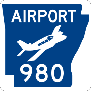
Highway 980 is a state highway designation for all state maintained airport roads in Arkansas.

Highway 9 is a designation for two north–south state highways in Arkansas. A southern segment of 51.44 miles (82.78 km) begins at U.S. Route 79 at Eagle Mills and heads north to U.S. Route 67 in Malvern before terminating. The northern segment of 174.17 miles (280.30 km) runs from AR 5 to U.S. Route 63 in Mammoth Spring. The route was created during the 1926 Arkansas state highway numbering, and has seen only minor extensions and realignments since. Pieces of both routes are designated as Arkansas Heritage Trails for use during the Civil War and the Trail of Tears.

Highway 206 is a designation for three east–west state highways in the Ozark Mountains. Each segment was created during periods of state highway systemwide expansions ordered by the Arkansas General Assembly to add system mileage in every county, first in 1957, and again in 1973. All are low-traffic highways providing connectivity between rural communities and major highways in the area. All are maintained by the Arkansas Department of Transportation (ArDOT).

U.S. Route 62 is a U.S. highway running from El Paso, Texas northeast to Niagara Falls, New York. In the U.S. state of Arkansas, the route runs 329.9 miles from the Oklahoma border near Summers east to the Missouri border in St. Francis, serving the northern portion of the state. The route passes through several cities and towns, including Fayetteville, Springdale, Bentonville, Harrison, Mountain Home, Pocahontas, and also Piggott. US 62 runs concurrent with several highways in Arkansas including Interstate 49 and U.S. Route 71 between Fayetteville and Bentonville, U.S. Route 412 through much of the state, U.S. Route 65 in the Harrison area, and with U.S. Route 63 and U.S. Route 67 in northeast Arkansas.

Arkansas Highway 124 is a designation for two state highways in Central Arkansas. The western segment of 72.17 miles (116.15 km) runs from Russellville to Rose Bud. An eastern segment of 9.17 miles (14.76 km) runs east in White County from Pangburn to AR 157.

The Arkansas Highway System is made up of all the highways designated as Interstates, U.S. Highways and State Highways in the US state of Arkansas. The system is maintained by the Arkansas Department of Transportation (ArDOT), known as the Arkansas State Highway Department (AHD) until 1977 and the Arkansas State Highway and Transportation Department (AHTD) from 1977 to 2017. The system contains 16,442.90 miles (26,462.28 km) of Interstates, U.S. Routes, state highways, and special routes. The shortest members are unsigned state highways Arkansas Highway 806 and Arkansas Highway 885, both 0.09 miles (0.14 km) in length. The longest route is U.S. Route 67, which runs 296.95 miles (477.89 km) from Texarkana to Missouri.

Highway 318 is a designation for two state highways in Phillips County, Arkansas. One route of 4.39 miles (7.07 km) begins at Highway 85 at Oneida and runs east to Highway 44. A second route of 15.12 miles (24.33 km) begins at Highway 1 and runs east to Highway 20. A portion of the route between Watkins Corner and Lambrook is designated as part of the Great River Road National Scenic Byway.

Highway 78 is a designation for two state highways in the Arkansas Delta. One route of 24.03 miles (38.67 km) begins at Highway 306 near Hunter and runs southeast to US Highway 79 (US 79). A second route of 4.30 miles (6.92 km) begins at Highway 121 and runs west to a junction with Lee County Route 132 (CR 132) and CR 173. A short spur route in Moro, Highway 78 Spur connects the parent route to Highway 238. All routes are maintained by the Arkansas State Highway and Transportation Department (AHTD).

Highway 171 is a designation for three state highways in Southwest Arkansas. One route of 1.2 miles (1.9 km) runs from US Highway 67 (US 67) to Wine Dot Road near an industrial facility. A second route of 12.9 miles (20.8 km) begins at Highway 84 in Malvern and runs east to Lake Catherine State Park. A third route of 4.91 miles (7.90 km) begins at US Highway 270 (US 270) and runs north, with state maintenance ending at Tigre Mountain Road. All routes are maintained by the Arkansas State Highway and Transportation Department (AHTD).

Highway 369 is a designation for three north–south state highways in Arkansas. All are maintained by the Arkansas Department of Transportation (ArDOT). One segment provides connectivity in the Ouachita Mountains, with the other two serving as short industrial access roads. The longest segment was designated in 1966 and extended thrice, with the two industrial access roads created in 1978 and 1980. All three segments are maintained by the Arkansas Department of Transportation (ArDOT).

Highway 308 is a former state highway in Poinsett County, Arkansas. Between 1973 and 1979, the highway was maintained by the Arkansas State Highway and Transportation Department (AHTD), now known as the Arkansas Department of Transportation (ArDOT).