Arlington County, Virginia, street-naming system

Last updated

This article details the street-naming system of Arlington County, Virginia in the United States.

Contents

Although the streets of Arlington County are not laid out on a grid plan, its local streets follow sequential numbered or alphabetic patterns that are both rational and provide address numbering information.

History of the system

A numbered and alphabetical street-naming scheme suggests that Arlington is or once was laid out on a continuous rectilinear grid plan, which in many parts of the County it is not (although very few parts of the county are laid out using the cul-de-sac type development which is more common in the outer Washington, DC suburbs). Originally, the various communities in the county had independent street-naming conventions. However, when county officials asked the United States Postal Service to place the entire county in a single "Arlington, Virginia" postal area, the USPS refused to do so until the county had a unified addressing system, which the county developed in 1932. For that reason, and also because Arlington contains a number of locations that interrupt the road grid network (including military facilities, parks, golf courses, and limited-access highways), it is common for streets to terminate and continue later on in another location. Arlington now has a policy of adding to the street grid when feasible as part of new development—for example, connections for Quinn Street and Troy Street were recently added to the Master Transportation Plan between Wilson and Clarendon Boulevards.

Specifics of the system

Arlington Boulevard (U.S. Route 50) bisects Arlington County into northern and southern sections. The dividing line continues through Joint Base Myer–Henderson Hall even as Arlington Boulevard bypasses it to the north, resulting in streets in southern parts of Rosslyn being labeled north even though they are south of the physical boulevard at that location.

East–west streets are designated by an ordinal number followed by a designation as either a street, road, place, or avenue, and a north or south designation. The numbers begin on either side of Arlington Boulevard and increase moving away from it. Therefore, 1st Street North is immediately north of Arlington Boulevard and 1st Street South is immediately south of it.

North–south streets are named and alphabetized (through first letter only) starting at the Potomac River in the east. Progressing westward, the alphabetizing sequence is:

  1. One-syllable names (Ball Street to Wayne Street)
  2. Two-syllable names (Adams to Woodrow)
  3. Three-syllable names (Abingdon to Yucatán)
  4. Four-syllable names (Arizona)

Arlington's local numbered and named streets are not through streets, except for a few streets in North Arlington, and thus each number or name can appear multiple times at multiple locations in the county but always according to the grid. For example, there are several 12th Streets South or North Kensington Streets in various areas of the county. In cases where more names are needed to avoid confusion in areas of denser street construction, numbered (east–west) streets are first designated "street", then "road," then "place," and in one instance, "avenue". [1] For example, 37th Street North, 37th Road North, and 37th Place North are all in the same general area. Named (north–south) local streets follow rules regarding initial letter and syllable number but there can be multiple street names with the same initial letter number of syllables, almost all ending with "street". For example, North Kenilworth Street, North Kensington Street, and North Kentucky Street are all in the same area.

Exceptions to the system

Major arteries or historical roads are exempt from the naming and numbering system. Named streets with the designation "road," "pike," or "highway" instead of "street" usually predate the system and follow early winding routes. "Boulevards" and "drives" are generally major thoroughfares with historic names. Boulevards usually run east–west and drives, which were constructed on former trolley lines, run north–south but are designated as north and south only when they appear on both sides of Arlington Boulevard.

Notable exceptions include:

Address numbers in the system

Address numbers can be determined from the numbers or names of intersecting streets. Addresses on north–south routes, including exceptions from the numbering and naming system, follow the numbers of intersecting (or implied intersections of) numbered streets. For example, 2005 South Glebe Road would lie just beyond the intersection of South Glebe Road and 20th Street South. Addresses on east–west, including exceptions from the numbering and naming system, are based on the intersecting (or implied intersections of) named streets with each letter/syllable combination representing 100 address numbers. The chart below shows the block numbers on east–west streets. Full-Lot houses often skip 4 numbers in between houses, and town homes generally skip two; while the opposite side of the street is offset by one number, so that one side can be even, and one odd.

A fictional block with correctly numbered houses skipping four between full lots, and two between condos. Arlington County Street Numbering System.png
A fictional block with correctly numbered houses skipping four between full lots, and two between condos.

Block numbers on east–west streets

Addresses on the south and west (left) sides of the streets are even-numbered. Below is a complete list of named (north–south) streets within the system.

List of named (north–south) streets within the system

This list includes only those streets which appear as part of the naming system, excluding historical exceptions, and major boulevards or drives.

One syllableTwo syllablesThree syllablesFour syllables
 AdamsAberdeen
Abingdon
Albemarle
Arizona
Ball
Bell
Barton
Bedford
Brookside
Bryan
Brandywine
Buchanan
Burlington
ClarkCalvert
Cleveland
Cameron

Columbus
Culpepper

DaleDaniel
Danville
Delaware
Dickerson
Dinwiddie

Dumbarton

Eads
Elm
EdgewoodEdison
Emerson
Evergreen
Fern
Fox
Fenwick
Fillmore
Florida
Frederick
Grant

Grove

GarfieldGalveston
Granada
Greenbrier
Greencastle
Hayes
High
Hill
Hancock
Hartford
Harvard
Herndon
Highland
Hudson
Harrison
Hollister
Huntington
Inge
Ives
Ivy
Irving
Illinois
Inglewood
Ivanhoe
Joyce
June
Jackson
Johnson
Jacksonville

Jefferson

Kent
Knoll

King

Kansas
Kenmore

Kenwood

Kenilworth
Kennebec
Kennesaw
Kensington
Kentucky
Lang

Lynn

Langley
Lincoln
Lorton
Lowell
Lancaster
Larrimore
Lebanon
Lexington
Liberty
Littleton
Livingston
Lombardy
Longfellow
Meade
Moore
MonroeMadison
Manchester
McKinley
Montague
Montana
NashNelson
Norwood
Nicholas
Nottingham
Oak
Ode
Orme
Oakland
Oxford
Ohio
Ottawa
Pierce

Poe

Peary
Piedmont

Pollard

Pocomoke
Potomac
Powhatan
Queen

Quinn

Quebec

Quincy

Quantico
Quesada
Quintana
Rhodes
Rolfe
Radford
Randolph
Richmond

River Rixey

Rochester

Rockingham
Roosevelt

Scott

Smythe

Stafford
Stuart
Somerset
Sycamore
Taft
Troy
Taylor
Tazewell
Thomas
Trenton
Tacoma

Toronto
Trinidad
Tuckahoe

UhleUpland
Upshur

Upland
Utah

Underwood
Vance
Veitch
Vermont
Vernon
Valley
Venice
Van Buren
Vanderpool
Venable
Wayne

Wise

Wakefield

Woodley
Woodrow
Woodstock

Washington

Westmoreland
Winchester
Wyoming

  Yucatán

Related Research Articles

<span class="mw-page-title-main">Roads and expressways in Chicago</span> Highway system

Roads and expressways in Chicago summarizes the main thoroughfares and the numbering system used in Chicago and its surrounding suburbs.

<span class="mw-page-title-main">Virginia State Route 120</span> State highway in Arlington County, Virginia, United States

State Route 120 is a primary state highway in the U.S. state of Virginia. Known as Glebe Road, the state highway runs 9.10 miles (14.65 km) from U.S. Route 1 (US 1) in Crystal City north to SR 123 at the Chain Bridge. SR 120 is a partial circumferential highway in Arlington County that connects the southeastern and northwestern corners of the county with several urban villages along its crescent-shaped path, including Ballston. The state highway also connects all of the major highways in Virginia that radiate from Washington, including Interstate 395, I-66, US 50, and US 29. SR 120 is a part of the National Highway System for its entire length.

<span class="mw-page-title-main">Street name</span> Identifying name given to a street or road

A street name is an identifying name given to a street or road. In toponymic terminology, names of streets and roads are referred to as odonyms or hodonyms. The street name usually forms part of the address. Buildings are often given numbers along the street to further help identify them. Odonymy is the study of road names.

<span class="mw-page-title-main">San Vicente Boulevard</span> Street in Western Los Angeles running southeast of Beverly Hills, United States

San Vicente Boulevard is a major northwest-southeast thoroughfare located in the western portion of the metropolitan area of Los Angeles, CA.

The city of Calgary, Alberta, has a large transportation network that encompasses a variety of road, rail, air, public transit, and pedestrian infrastructure. Calgary is also a major Canadian transportation centre and a central cargo hub for freight in and out of north-western North America. The city sits at the junction between the "Canamex" highway system and the Trans-Canada Highway.

<span class="mw-page-title-main">U.S. Route 1 in Virginia</span> Section of United States Numbered Highway in Virginia

U.S. Route 1 (US 1) is a major north–south U.S. Route that serves the East Coast of the United States. In the U.S. state of Virginia, US 1 runs north–south through South Hill, Petersburg, Richmond, Fredericksburg, and Alexandria on its way from North Carolina to the 14th Street bridges into the District of Columbia. It is completely paralleled by Interstate Highways in Virginia—Interstate 85 (I-85) south of Petersburg, I-95 north to Alexandria, and I-395 into the District of Columbia—and now serves mainly local traffic. At its north end, on the approach to the 14th Street bridges, US 1 is concurrent with I-395; the rest of US 1 is on surface roads.

<span class="mw-page-title-main">Street system of Denver</span> Dual street grid system in Denver, CO

The oldest part of Denver, Colorado, now the neighborhoods of Auraria Campus, LoDo, much of downtown, and Five Points, is laid out on a grid plan that is oriented diagonal to the four cardinal directions. The rest of the city, including the eastern part of downtown, is laid out primarily on a grid oriented to the cardinal directions. In this larger grid, from east to west, there are generally 16 city blocks per mile, except between Zuni Street and Lowell Boulevard in west Denver. From north to south, there are typically eight blocks per mile, although there are many areas with more blocks per mile. Addresses follow a decimal system, with addresses advancing by one hundred at each cross street.

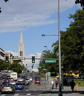
This article deals with the streets and highways of Arlington County, Virginia, a suburb of Washington, D.C. in the United States.

<span class="mw-page-title-main">Virginia State Route 237</span> State highway in northern Virginia, US

State Route 237 is a primary state highway in the U.S. state of Virginia. The state highway runs 13.07 miles (21.03 km) from SR 236 in Fairfax east to U.S. Route 50 in Arlington. SR 237 connects Fairfax and Arlington with Falls Church. Between Fairfax and Falls Church, the state highway mostly runs concurrently with US 29. East of Falls Church, SR 237 parallels Interstate 66 (I-66) and connects several of Arlington's urban villages.

Transport in Edmonton is fairly typical for a Canadian city of its size, involving air, rail, road and public transit. With very few natural barriers to growth and largely flat to gently rolling terrain bisected by a deep river valley, the city of Edmonton has expanded to cover an area of nearly 768 km2 (297 sq mi), of which only two-thirds is built-up, while the metropolitan area covers around 9,430 km2 (3,640 sq mi).

<span class="mw-page-title-main">Arlington Boulevard</span>

Arlington Boulevard is a major arterial road in Arlington County, Fairfax County, and the independent City of Fairfax in Northern Virginia in metropolitan Washington, DC, United States. It is designated U.S. Route 50 (US 50) for its entire length and is part of the National Highway System.

<span class="mw-page-title-main">Roads and freeways in metropolitan Detroit</span> List of roads in part of Michigan

The Detroit metropolitan area in southeast Michigan is served by a comprehensive network of roads and highways. Three primary Interstate Highways pass through the region, along with three auxiliary Interstates, and multiple state and U.S. Highways. These are supplemented by the Mile Road System, a series of local roads spaced one mile apart on a perpendicular grid.

<span class="mw-page-title-main">Numbered street</span> Street whose name is an ordinal number

A numbered street is a street whose name is an ordinal number, as in Second Street or Tenth Avenue. Such forms are among the most common street names in North America, but also exist in other parts of the world, especially in Colombia, which takes the system to an extreme, and the Middle East. Numbered streets were first used in Philadelphia and now exist in many major cities and small towns. Grid-based naming systems usually start at 1, and then proceed in numerical order. In the United States, seven out of the top ten most common street names are numbers, with the top three names being "2nd," "3rd," and "1st" respectively. Streets named "0th" are quite uncommon, however, but do exist, and negative numbered streets are extraordinarily rare. Fractional numbered streets exist in some places, such as 10+12 Street in Springfield, Illinois.

The Los Angeles Avenues refer to a series of 50 numbered streets in Los Angeles, California in the Northeast and Eastside regions. They are all designated with the word "Avenue" followed by a number such as "Avenue 64." The Avenues are located in the Los Angeles neighborhoods of Lincoln Heights, Cypress Park, Montecito Heights, Glassell Park, Highland Park, Mt. Washington and Eagle Rock. They are not related to 2nd through 13th Avenues west of Arlington Avenue in Jefferson Park and other neighborhoods in South Los Angeles.

Many arterial roads in the Phoenix metropolitan area have the same name in multiple cities or towns. Some roads change names or route numbers across town borders, resulting in occasional confusion. For example, the road known as Apache Boulevard in Tempe continues east as Main Street in neighboring Mesa and then as Apache Trail in Apache Junction. Although Broadway Road maintains the same name through Goodyear, Avondale, Phoenix, Tempe, Mesa, and Apache Junction, each town uses a different reference point for address numbers.

159th Street is a major east-west street in the southern suburbs of Chicago. It runs east from Thornton Street in Lockport, crossing Interstate 355 in Lockport, Interstate 57 in Markham, Interstate 294 in Harvey and Interstate 94 in South Holland, on its way to its east end at U.S. Route 6 and Illinois Route 83 in Calumet City. The road carries no routes from Hopkins Road to Broadway, Independence Boulevard, Illinois Route 7 from Thornton Street to Wolf Road, and carries U.S. Route 6 from Wolf Road to Torrence Avenue, and no routes again from Torrence Avenue to Cline Avenue. The Street intersects 4 Interstate Highways. Interstate 355, Interstate 57, Interstate 294, and Interstate 94.

Douglas Road, also West 37th Avenue on the greater Miami grid plan and Northwest 88th Avenue in Miramar, is a 20.4-mile (32.8 km) north–south thoroughfare running west of downtown Miami in Miami-Dade County and Broward County, Florida. It changes names and becomes Pine Island Road, at the intersection with Sheridan Street.

References

  1. The sole numbered avenue is 21st Avenue North.