
Herringfleet is a place and former civil parish, now in the parish of Somerleyton, Ashby and Herringfleet, in the East Suffolk district, in the north of the English county of Suffolk. It is located 5.5 miles (8.9 km) north-west of Lowestoft. The parish was combined with Somerleyton and Ashby to create the parish of "Somerleyton, Ashby and Herringfleet" on 1 April 1987.

Abberley is a village and civil parish in north west Worcestershire, England.

Aldringham cum Thorpe is a civil parish in the East Suffolk district of Suffolk, England. Located south of the town of Leiston, the parish includes the villages of Aldringham and Thorpeness, which is on the coast, between Sizewell (north) and Aldeburgh (south). In 2007 it had an estimated population of 700, rising to 759 at the 2011 Census.
Ashley is a village and civil parish in the East Cambridgeshire district of Cambridgeshire, England, about 4 miles (6.4 km) east of Newmarket. The modern village consists of the two ancient parishes of Ashley and Silverley. Ashley covers 2,250 acres (910 ha) and in the 2011 census had a population of 749. Ashley is in the electoral area of Cheveley ward.

Beaumont-cum-Moze is a civil parish in the Tendring district of Essex, England. According to the 2001 census it had a population of 352, reducing to 339 at the 2011 Census. The parish includes the hamlets of Beaumont and Moze Cross.

Blundeston is a village and civil parish in the north of the English county of Suffolk. It is 3.5 miles (5.6 km) north-west of Lowestoft, 6 miles (9.7 km) south of Great Yarmouth and around 1.75 miles (2.82 km) inland from the North Sea coast. It is part of the area known as Lothingland in the East Suffolk district. Blundeston Prison was located on the southern edge of the village but closed in early 2014.

Marton-cum-Moxby is a civil parish in North Yorkshire, England. The population of the parish was less than 100 at the time of the 2011 Census, therefore its details were included with Farlington. It lies to the east of the villages of Stillington and Farlington, near Easingwold. The settlements are the hamlets of Marton-in-the-Forest and Moxby, both agricultural in character.

Fritton is a village and former civil parish in county of Norfolk, England. The village is located 6 miles (9.7 km) south-west of Great Yarmouth and 16 miles (26 km) south-east of Norwich, along the A143 between Gorleston-on-Sea and Haverhill. In 1961 the parish had a population of 192.

Flempton is a village and civil parish in the West Suffolk district of Suffolk, England. It is on the A1101 road 5 miles NW from Bury St Edmunds.
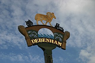
Debenham is a village and civil parish located 11 miles (18 km) north of Ipswich in the Mid Suffolk district of Suffolk, England. The River Deben rises in the parish, and flows along a prolonged ford through the village.

Onehouse is a small village in the English county of Suffolk, about 3 miles west from the centre of Stowmarket near to the Golf Club. The population of the parish at the 2011 Census was 810.

Monk Soham is a village in Suffolk, eastern England, four miles (6.4 km) northeast of Debenham and six miles (10 km) northwest of Framlingham. The neighbouring villages are Bedfield, Ashfield cum Thorpe, Kenton and Bedingfield. The nearest primary school is in Bedfield. There are secondary schools in Framlingham, Debenham and Woodbridge.

Thorpe Morieux is a small village and civil parish in Suffolk, England. It is 10 miles south-east of Bury St Edmunds and 10 miles north east of Sudbury.

Pettaugh is a village and civil parish located within the district council area of Mid Suffolk, England.

Ixworth is a village and civil parish in the West Suffolk district of Suffolk, England, 6 miles (9.7 km) north-east of Bury St Edmunds on the A143 road to Diss and 9 miles (14 km) south-east of Thetford. The parish had a population of 2,365 at the 2011 Census.

Clopton is a village and civil parish in Suffolk. It is located between Ipswich and Debenham two kilometres north of Grundisburgh on the River Lark. The village is no larger than a series of houses either side of the B1078, surrounded by farm land. The village itself has no clear centre; houses and other buildings are concentrated around the four manors of Kingshall, Brendhall, Rousehall and Wascolies, all of which are mentioned in the Domesday Book of 1086.

Hinderclay is a village and civil parish in the Mid Suffolk district of Suffolk in eastern England. The village is located around 14 miles (23 km) - from Bury St Edmunds in an area of rolling arable land to the south of the Little Ouse river valley. Neighbouring villages include Thelnetham and Rickinghall. In 2005 its population was 340. The parish also contains the hamlet of Thorpe Street.
Ashby is a former civil parish, now in the parish of Somerleyton, Ashby and Herringfleet, in the East Suffolk district, in the north of the English county of Suffolk. It is 5+1⁄2 miles (8.9 km) north-west of Lowestoft.

Ringsfield is a village and civil parish in the English county of Suffolk. It is 2 miles (3.2 km) south-west of Beccles in the East Suffolk district.

North Cove is a village and civil parish in the north of the English county of Suffolk. It is part of the East Suffolk district, located around 3 miles (4.8 km) east of Beccles and 5 miles (8.0 km) west of Lowestoft. It merges with the village of Barnby and the villages share some resources, although the two parishes retain separate parish councils.


