
The Canadian Shield, also called the Laurentian Plateau, is a geologic shield, a large area of exposed Precambrian igneous and high-grade metamorphic rocks. It forms the North American Craton, the ancient geologic core of the North American continent. Glaciation has left the area with only a thin layer of soil, through which exposures of igneous bedrock resulting from its long volcanic history are frequently visible. As a deep, common, joined bedrock region in eastern and central Canada, the Shield stretches north from the Great Lakes to the Arctic Ocean, covering over half of Canada and most of Greenland; it also extends south into the northern reaches of the United States.

Alberta is one of the thirteen provinces and territories of Canada. Located in Western Canada, the province has an area of 661,190 km2 (255,290 sq mi) and is bounded to the south by the United States state of Montana along 49° north for 298 km (185 mi); to the east at 110° west by the province of Saskatchewan for 1,223 km (760 mi); and at 60° north the Northwest Territories for 644 km (400 mi). The southern half of the province borders British Columbia along the Continental Divide of the Americas on the peaks of the Rocky Mountains, while the northern half borders British Columbia along the 120th meridian west. Along with Saskatchewan it is one of only two landlocked provinces or territories.

Lake Athabasca is located in the north-west corner of Saskatchewan and the north-east corner of Alberta between 58° and 60° N in Canada. The lake is 26% in Alberta and 74% in Saskatchewan.

Carswell is an impact crater within the Athabasca Basin of the Canadian Shield in northern Saskatchewan, Canada. It is 39 kilometres (24 mi) in diameter and the age is estimated to be 115 ± 10 million years. The crater is exposed at the surface.
The McArthur River Uranium Mine, in northern Saskatchewan, Canada, is the world's largest high-grade uranium deposit.
The Key Lake mine is a former uranium mine in Saskatchewan, Canada. It is 570 kilometres (350 mi) north of Saskatoon by air on the southern rim of the uranium-rich Athabasca Basin. Key Lake was initially developed to open-pit mine two nearby uranium ore deposits: the Gaertner deposit and the Deilmann deposit. Mining of this ore ceased in the late 1990s; the Key Lake mill now processes uranium ore from the McArthur River mine and from existing stockpiles on site. High-grade ore from McArthur river is blended with lower grade local rock before being passed through the mill. The mill has a permitted annual production capacity of 25 million pounds of U3O8. In addition, ammonium sulfate fertilizer is produced as a byproduct from used reagents. The pits of the mined out local deposits are being used as mill tailings management facilities.
Rabbit Lake is the second largest uranium milling facility in the western world, and is the longest operating uranium production facility in Saskatchewan. The facility is located approximately 800 km north of Saskatoon, Saskatchewan, on the northeast edge of the uranium rich Athabasca Basin. The closest community is Wollaston Lake, about 40 kilometers by lake or air. Rabbit Lake was the first Canadian mine to offer a seven-days-in/seven-days-out commuter system of staffing. Access is provided by Highway 905. Production at Rabbit Lake was suspended in April 2016.
The McClean Lake mine is a uranium mine and milling operation located west of Wollaston Lake, about 700 kilometres north of Saskatoon, in the Athabasca Basin region of Saskatchewan, Canada. The McClean ore body was discovered in 1979, followed by the discovery of the JEB ore body in 1982. From 1985 to 1990, a cluster of deposits named Sue A, Sue B and Sue C were discovered.
Cluff Lake mine is decommissioned former uranium mine located in northern Saskatchewan, located 30 km east of the provincial border with Alberta and approximately 75 kilometres south of Lake Athabasca.

Beaver River is a large river in east-central Alberta and central Saskatchewan, Canada. It flows east through Alberta and Saskatchewan and then turns sharply north to flow into Lac Île-à-la-Crosse on the Churchill River which flows into Hudson Bay.

Wollaston Lake is a lake in north-eastern Saskatchewan, Canada. It is 550 kilometres (340 mi) northeast of Prince Albert. With a surface area of 2,286 square kilometres (883 sq mi), it is the largest bifurcation lake in the world – that is, a lake that drains naturally in two directions.
Highway 962 is an isolated provincial highway in the far north part of the Canadian province of Saskatchewan. For part of the year the highway is not connected to any other highway in the province, but during the winter months a winter (ice) road forms across Lake Athabasca, connecting to Highway 962 and allowing access to Fond-du-Lac and other communities to the east. Highway 962 is about 40 km (25 mi) long.

Highway 955 is a provincial highway in the Canadian province of Saskatchewan. It runs from Highway 155 near La Loche to Cluff Lake Mine. The mine has been closed since the early 2000s and its adjacent airstrip is also closed now, meaning there are no formal services at the northern turn-around point. Drivers using the route need to carry extra fuel and other supplies, including spare tires owing to the sharp gravel used on the road.

The Cigar Lake Mine is a large high-grade underground uranium mine, located in the uranium-rich Athabasca Basin of northern Saskatchewan, Canada, at the south-west corner of Waterbury Lake. The deposit, discovered in 1981, is second in size of high-grade deposits only to the nearby McArthur River mine. Other deposits, such as Olympic Dam in Australia, contain more uranium but at lower grades.
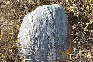
The geology of Saskatchewan can be divided into two main geological regions, the Precambrian Canadian Shield and the Phanerozoic Western Canadian Sedimentary Basin. Within the Precambrian shield exists the Athabasca sedimentary basin. Meteorite impacts have altered the natural geological formation processes. The prairies were most recently affected by glacial events in the Quaternary period.

Nuclear industry in Canada is an active business and research sector, producing about 15% of its electricity in nuclear power plants of domestic design. Canada is the world's largest exporter of uranium, and has the world's second largest proven reserves. Canada also exports nuclear technology within the terms of the Nuclear Non-proliferation Treaty, to which it is a signatory, and is the world's largest producer of radioactive medical isotopes.
The Joli Fou Formation is a stratigraphical unit of middle Albian age in the Western Canadian Sedimentary Basin. It takes the name from the Joli Fou Rapids on the Athabasca River, and was first described in an outcrop along the river, 8 kilometers (5.0 mi) downstream from Joli Fou Rapids, by RTD Wickenden in 1949.
Orano Canada is a uranium mining, milling, and exploration company headquartered in Saskatoon, Saskatchewan, Canada. Orano is a subsidiary of the Orano Group, an international nuclear energy company headquartered in Paris, France with 16,000 employees worldwide.

Hathor Exploration Limited is a uranium exploration company based in Vancouver, British Columbia, Canada. Its exploration office is located in Saskatoon, Saskatchewan, Canada. Hathor's exploration projects concentrate on properties within the Athabasca Basin of Northern Saskatchewan, Canada.

The Geikie River is a river in northern Canadian province of Saskatchewan. Its source is Costigan Lake located near the uranium producing areas around the Key Lake mine in the Athabasca Basin and flows in a north-easterly direction to drain into Wollaston Lake.


