
The Kerguelen Islands, also known as the Desolation Islands, are a group of islands in the sub-Antarctic constituting one of the two exposed parts of the Kerguelen Plateau, a large igneous province mostly submerged in the southern Indian Ocean. They are among the most isolated places on Earth, located more than 3,300 km (2,100 mi) from Madagascar. The islands, along with Adélie Land, the Crozet Islands, Amsterdam and Saint Paul islands, and France's Scattered Islands in the Indian Ocean, are part of the French Southern and Antarctic Lands and are administered as a separate district.
Baie-Comeau is a city located approximately 420 kilometres (260 mi) north-east of Quebec City in the Côte-Nord region of the province of Quebec, Canada. It is located on the shores of the Saint Lawrence River near the mouth of the Manicouagan River, and is the seat of Manicouagan Regional County Municipality.
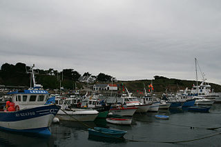
Houat is a French island off the south coast of Brittany in the department of Morbihan. It is located, along with two other major islands, in the entrance to the Baie de Quiberon. Its "twin sister" island is Hoëdic.

Îles de Los are an island group lying off Conakry in Guinea, on the west coast of Africa. Their name is derived from the Portuguese: Ilhas dos Ídolos, "Islands of the Idols". They are located about two kilometres off the headland limiting the southern side of Sangareya Bay.
Vaudreuil was a federal electoral district in the province of Quebec, Canada, represented in the House of Commons of Canada from 1867 to 1914, and from 1968 to 1997.

Nosy Boraha[ˈnuʃ buˈrahə̥], previously known as Sainte-Marie, main town Ambodifotatra, is an island off the east coast of Madagascar. The island forms an administrative district within Analanjirofo Region, and covers an area of 222 km2. It has a population estimated at 30,000.

The Municipality of Baie-James was a municipality in northern Quebec, Canada, which existed from 1971 to 2012. Located to the east of James Bay, Baie-James covered 297,332.84 km2 (114,800.85 sq mi) of land, making it the largest incorporated municipality in Canada — only eight unorganized territories were larger. Its territory almost entirely covered the administrative region of Jamésie, although it contained less than five percent of the population. Essentially, it was the remainder of the Jamésie Territory's land after all of the major population centres were removed.

The Municipality of Gros-Mécatina is on the Lower North Shore of the Gulf of Saint Lawrence, near the border with Labrador in Quebec, Canada. Located near crab, lobster, and scallop fishing grounds, it is dependent on the fishing business, including a fish processing factory that contributes to regional economic activity.

Yof Bay is a bay on the north side of the Cap-Vert peninsula, directly north of the city centre of Dakar, Senegal. It stretches southwest from the town Kayar to Yoff, a suburb of Dakar. The bay opens towards the north and lies in the area of the westernmost point of Africa. Small Île de Yoff lies in the NW corner of the bay.

Baie-Sainte-Catherine, Quebec is a town in Quebec, Canada. The municipal's territory extends along the Saguenay and Saint Lawrence Rivers, whereas the town itself is on the small St. Catherine Bay, which is located at the confluence of these two rivers. Its elevation is 260 feet.

The roadstead of Brest is a roadstead or bay located in the Finistère department in Brittany in northwestern France. The surface area is about 180 km². The port of Brest and one of the two French naval bases, Brest Arsenal, are located on its northern edge. It is linked to the Atlantic Ocean by the Goulet de Brest, a strait about 1.8 km wide. Three main rivers drain into the roadstead: the Penfeld, the Élorn and the Aulne.

Shippegan is a civil parish in Gloucester County, New Brunswick, Canada. Located in the northeastern corner of the province at the end of the Acadian Peninsula, the parish consists of the three main islands of Taylor, Lamèque, and Miscou, along with several smaller islands and tidal wetlands; Taylor Island is now joined to the mainland by an isthmus, which is crossed by a causeway.
The Marais breton is a zone géographique humide along France's Atlantic coast. It marks the border between two traditional French provinces, Brittany and Poitou, and extends between two French departments, Loire-Atlantique and Vendée, both of which included in the administrative region of Pays de la Loire.

The Taurus Reservoir is a 95-square-kilometre (37 sq mi) reservoir in Matawinie, in the administrative region of Lanaudière, Québec, Canada. It is in the Saint Lawrence River drainage basin and is on the Matawin River.

The Zec de la Rivière-Nouvelle is a "zone d'exploitation contrôlée" (zec) in the unorganized territory of Rivière-Nouvelle, in Avignon Regional County Municipality, in the administrative region Gaspésie-Îles-de-la-Madeleine, in Quebec, in Canada. The main purpose of the ZEC is the management of salmon fishing.

Acul Bay, also known as North Acul Bay, is a bay on the northern coast of Haiti north of the city of Acul-du-Nord and west of the city of Cap-Haïtien.

Grosse Caye is an island of Haiti which is located in Sud, east of Île-à-Vache which is located a bit further west, in the Baie des Cayes and north of the Canal du Sud.

The Sept Îles Archipelago Regional Park is a proposed protected area in the Côte-Nord region of Quebec, Canada. The islands are important to migratory sea birds, and are also of interest to tourists. The management plan was prepared in 2008.
Baie de l'Oiseau is a natural harbour in the Loranchet Peninsula, in the North-Western part of the island Grande Terre, part of the Kerguelen Islands. It was the landing site of the expedition under Yves de Kerguelen in 1772, and later of the expedition under James Cook in 1776. The site of Port-Christmas is part of the bay.

The Bay of Bourgneuf is a bay situated on the French Atlantic coast, at the border of the Loire-Atlantique and Vendée departments. In the Middle Ages the bay was known as the baie de Bretagne or baye de Bretagne.
