Barren vegetation

Last updated
Barren vegetation in Luzerne County, Pennsylvania, U.S. April 2008. Luzerne (Pennsylvania)2.jpg
Barren vegetation in Luzerne County, Pennsylvania, U.S. April 2008.

Barren vegetation describes an area of land where plant growth may be sparse, stunted, and/or contain limited biodiversity. Environmental conditions such as toxic or infertile soil, high winds, coastal salt-spray, and climatic conditions are often key factors in poor plant growth and development. Barren vegetation can be categorized depending on the climate, geology, and geographic location of a specific area. [1]

Contents

Pine barrens, coastal barrens, and serpentine barrens are some of the more distinct ecoregions for barren vegetation and are the most commonly researched by scientists. Often referred to as "heathlands", barrens can be excellent environments for unique biological diversity and taxonomic compositions. [1]

Serpentine Barrens

Biological diversity

Serpentine barren habitats include grasslands, chaparral, and woodlands as well as some areas that are very sparsely vegetated. Areas of sparse vegetation are often characterized by annual and perennial herbaceous plant species. [2] The flora of the serpentines is recognized globally for its high level of biological diversity which includes over 1600 taxa of plants occurring in serpentine areas of the eastern U.S., with as many as 2000 taxa considered to be endemic to serpentine rich soils. [3]

Geology

Serpentine barrens are distinct due to the serpentine-rich soil produced by the hydration weathering and metamorphic transformation of ultramafic igneous bedrock. [4] Serpentine barrens are often characterized as high-stress environments with low water and nutrient availability. These areas are often depleted in basic nutrients such as nitrogen and phosphorus. The soil is often shallow and can be toxic due to high heavy metal concentrations such as nickel, cobalt and chromium. [4] As a result of the harsh conditions and unique edaphic properties presented by serpentine barrens these environments support stress-tolerant plant communities characterized by distinct and locally defined plant species. [4]

Pine barrens

The Pine Barrens comprise 550,000 hectares of a heavily forested area of coastal plain and are home to at least 850 species of plant life, including many which are endangered or threatened. [5]

The Pine Barrens are primarily formed on unconsolidated, acidic, medium-to-coarse grained sands and gravel. The mature soils are considered to be true podzols and are siliceous and highly permeable. [5] The low moisture holding capacity and nutrient status of the soil create low vegetation growth rates throughout much of the Pine Barrens. [6]

Coastal barrens

A heathland in Botany Bay National Park, Sydney, Australia Botany Bay National Park - panoramio (29).jpg
A heathland in Botany Bay National Park, Sydney, Australia

Coastal Barrens are characterized by short vegetation, sparse tree cover, exposed bedrock, and bog pockets. Often, coastal barrens exhibit stressful climatic conditions and are subject to consistently windy conditions and salt-spray. [1]

Coastal Barrens typically host low growing shrub communities with sparse tree cover and are often dominated by ericaceous species such as the black huckleberry ( Gaylussacia baccata ) and low bush blueberry ( Vaccinium angustifolium ). [7] The coastal barrens of Atlantic Canada host a variety of taxonomic species such as macro lichens, mosses, and vascular plants. [1] Studies have recorded 173 different species in various coastal barren regions of the province of Nova Scotia. [1] This number included 105 vascular plants, 41 macro lichens, and 27 moss species with six provincially rare vascular species that were found predominantly in nearshore areas that contained high levels of substrate salt and nutrients, variable substrate depth, and short vegetation. [1]

In Sydney, Australia, the coastal area is mostly dominated by mallee or stunted forms of eucalyptus trees, and scrubby vegetation such as Allocasuarina distyla , Angophora hispida , Banksia ericifolia and Grevillea oleoides , among other species, typically in an exposed coastal sandstone plateau with infertile, shallow, fairly damp soils. Unique to New South Wales, such vegetation is found from Gosford to Royal National Park, with southern outliers at Barren Grounds and Jervis Bay. [8]

Climate zones

Although barren lands are generally located in areas associated with arid, semi-arid, polar and tundra climates, they can also be extensively found in milder, temperate, and/or humid climates as well, such as:

Avalon Peninsula, Newfoundland, Canada, August 2012 Avalon Peninsula Newfoundland Canada August 2012.jpg
Avalon Peninsula, Newfoundland, Canada, August 2012

Anthropogenic relationships

Anthropogenic interactions have been used over the years to help change and drive vegetation in the eastern US. Meaning that the actions of human-beings will play a role in what type of vegetation will grow in some locations. This is including things like fires and fire suppression, grazing, logging, and agriculture clearing. Research has been done and anecdotal evidence has been shown to suggest vegetation structures and composition in the eastern serpentine barrens may have also been influenced by local disturbance regimes associated with these events as well as mining [10]

Savannahs and barrens are ecosystems that are rare in North America. This is due in part to human impacts, such as agriculture, urbanization, and altering the natural fire regimes. [15] Over the past 50 years, the area of savannah-like openings and pine woodland has been continuously reduced over the years, a tendency opposite to that of hardwood forests. These changes in vegetation structures along with the composition are caused by, in part to anthropogenic changes in the fire regime. [10] Following the burning of vegetation there is a release of inorganic nutrients into the ecosystem caused by the combustion of the plants biomass and therefore, releasing the nutrients. This release of nutrients, after the occurrence, is thought to be a reason for an increase in plant productivity. [16]

Global distribution and geography

Regions on the Earth’s surface where soils are dominating the ecosystems with little to no plant cover are often referred to as “Barren”. These places are areas like deserts, Polar Regions, areas of high elevation, and zones of glacier retreat. For barren zones that are situated in mountain ranges, they are often called the "Subnival Zone", and are found at elevations between the upper limit of the vegetation zone and the lower limit of the ice-covered zone. Subnival zones in places like the Rockies, Andes, and Himalayas have increased greatly in the past few years due to the retreat of high elevation glaciers and the ice caps. [17]

One area for study is The Nottingham Serpentine Barrens, which covers 200 ha in southern Chester Country, Pennsylvania on the Pennsylvania-Maryland border. [10] The typical serpentine barren is either a prairie or savannah grassland. The soils here in this location are a section of the Neshaminy-Chrome-Conowingo association. These soils are deep and are derived from the serpentine bedrock. This series of soils are well-drained and also moderately sloping. With this, these specific locations have been under heavy erosion forces and have a depth to its parent bedrock within a distance of 15–75 cm. Here, there is also low permeability which makes it difficult for plants to have availability to water and therefore hard to collect moisture.

Mean elevation and elevation range limits both vegetation zones and individual species should be defined with increasing latitude. For example, in the southern Appalachians, high-elevation outcrops, composition gradients are a function of elevation, potential solar radiation, a geographic gradient that corresponds to broad geological differences (mafic rocks to the northwest vs. felsic rocks in the southwest direction), and surficial geomorphology (bedrock surfaces that are less fractured in the southeast). [11]

See also

Related Research Articles

<span class="mw-page-title-main">Wetland</span> Land area that is permanently, or seasonally saturated with water

A wetland is a distinct ecosystem that is flooded or saturated by water, either permanently for years or decades or seasonally for a shorter periods. Flooding results in oxygen-poor (anoxic) processes taking place, especially in the soils. Wetlands are different from other land forms or water bodies due to their aquatic plants adapted to oxygen-poor waterlogged soils. Wetlands are considered among the most biologically diverse of all ecosystems, serving as home to a wide range of plant and animal species. Methods exist for assessing wetland functions and wetland ecological health. These methods have contributed to wetland conservation by raising public awareness of the functions that wetlands can provide. Constructed wetlands are a type of wetland that can treat wastewater and stormwater runoff. They may also play a role in water-sensitive urban design. Environmental degradation threatens wetlands more than any other ecosystem on Earth, according to the Millennium Ecosystem Assessment from 2005.

<span class="mw-page-title-main">Sclerophyll</span> Type of plant

Sclerophyll is a type of vegetation that is adapted to long periods of dryness and heat. The plants feature hard leaves, short internodes and leaf orientation which is parallel or oblique to direct sunlight. The word comes from the Greek sklēros (hard) and phyllon (leaf). The term was coined by A.F.W. Schimper in 1898, originally as a synonym of xeromorph, but the two words were later differentiated.

<span class="mw-page-title-main">Great Basin Desert</span> Desert in the western United States

The Great Basin Desert is part of the Great Basin between the Sierra Nevada and the Wasatch Range. The desert is a geographical region that largely overlaps the Great Basin shrub steppe defined by the World Wildlife Fund, and the Central Basin and Range ecoregion defined by the U.S. Environmental Protection Agency and United States Geological Survey. It is a temperate desert with hot, dry summers and snowy winters. The desert spans large portions of Nevada and Utah, and extends into eastern California. The desert is one of the four biologically defined deserts in North America, in addition to the Mojave, Sonoran, and Chihuahuan Deserts.

<span class="mw-page-title-main">Ecology of the Sierra Nevada</span> Ecological features of the Sierra Nevadas

The ecology of the Sierra Nevada, located in the U.S. states of California and Nevada, is diverse and complex. The combination of climate, topography, moisture, and soils influences the distribution of ecological communities across an elevation gradient from 500 to 14,500 feet. Biotic zones range from scrub and chaparral communities at lower elevations, to subalpine forests and alpine meadows at the higher elevations. Particular ecoregions that follow elevation contours are often described as a series of belts that follow the length of the Sierra Nevada. There are many hiking trails, paved and unpaved roads, and vast public lands in the Sierra Nevada for exploring the many different biomes and ecosystems.

<span class="mw-page-title-main">Primary succession</span> Gradual growth and change of an ecosystem on new substrate

Primary succession is the beginning step of ecological succession after an extreme disturbance, which usually occurs in an environment devoid of vegetation and other organisms. These environments are typically lacking in soil, as disturbances like lava flow or retreating glaciers scour the environment clear of nutrients.

<span class="mw-page-title-main">Atlantic coastal pine barrens</span> Temperate coniferous forest ecoregion of Northeast United States

The Atlantic coastal pine barrens is a now rare temperate coniferous forest ecoregion of the Northeast United States distinguished by unique species and topographical features, generally nutrient-poor, often acidic soils and a pine tree distribution once controlled by frequent fires.

<span class="mw-page-title-main">Serpentine soil</span> Soil type

Serpentine soil is an uncommon soil type produced by weathered ultramafic rock such as peridotite and its metamorphic derivatives such as serpentinite. More precisely, serpentine soil contains minerals of the serpentine subgroup, especially antigorite, lizardite, and chrysotile or white asbestos, all of which are commonly found in ultramafic rocks. The term "serpentine" is commonly used to refer to both the soil type and the mineral group which forms its parent materials.

<span class="mw-page-title-main">Páramo</span> High-altitude wet tundra in South America

Páramo may refer to a variety of alpine tundra ecosystems located in the Andes Mountain Range, South America. Some ecologists describe the páramo broadly as "all high, tropical, montane vegetation above the continuous timberline". A narrower term classifies the páramo according to its regional placement in the northern Andes of South America and adjacent southern Central America. The páramo is the ecosystem of the regions above the continuous forest line, yet below the permanent snowline. It is a "Neotropical high mountain biome with a vegetation composed mainly of giant rosette plants, shrubs and grasses". According to scientists, páramos may be "evolutionary hot spots", that meaning that it's among the fastest evolving regions on Earth.

<span class="mw-page-title-main">Pine barrens</span> Type of ecoregion or plant community

Pine barrens, pine plains, sand plains, or pineland areas occur throughout the U.S. from Florida to Maine as well as the Midwest, West, and Canada and parts of Eurasia. Perhaps the most well known pine-barrens area to North Americans is the New Jersey Pine Barrens. Pine barrens are generally pine forests in otherwise "barren" and agriculturally challenging areas. Such pine forests often occur on dry, acidic, infertile soils, and also include grasses, forbs, and low shrubs. The most extensive pine barrens occur in large areas of sandy glacial deposits, lakebeds, and outwash terraces along rivers.

<span class="mw-page-title-main">Dwarf forest</span> Type of forest ecosystem

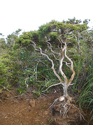
Dwarf forest, elfin forest, or pygmy forest is an uncommon ecosystem featuring miniature trees, inhabited by small species of fauna such as rodents and lizards. They are usually located at high elevations, under conditions of sufficient air humidity but poor soil. There are two main dwarf forest ecosystem types, involving different species and environmental characteristics: coastal temperate and montane tropical regions. Temperate coastal dwarf forest is common for parts of Southern California. Montane tropical forests are found across tropical highlands of Central America, northern South America and Southeast Asia. There are also other isolated examples of dwarf forests scattered across the world, while the largest dwarf forest is found in the Philippines.

<span class="mw-page-title-main">Forests of the Iberian Peninsula</span> Overview of forests of the Iberian Peninsula

The woodlands of the Iberian Peninsula are distinct ecosystems on the Iberian Peninsula. Although the various regions are each characterized by distinct vegetation, the borders between these regions are not clearly defined, and there are some similarities across the peninsula.

<span class="mw-page-title-main">Sierra Nevada subalpine zone</span> Biotic zone in California, United States

The Sierra Nevada subalpine zone refers to a biotic zone below treeline in the Sierra Nevada mountain range of California, United States. This subalpine zone is positioned between the upper montane zone at its lower limit, and tree line at its upper limit.

Altitudinal zonation in mountainous regions describes the natural layering of ecosystems that occurs at distinct elevations due to varying environmental conditions. Temperature, humidity, soil composition, and solar radiation are important factors in determining altitudinal zones, which consequently support different vegetation and animal species. Altitudinal zonation was first hypothesized by geographer Alexander von Humboldt who noticed that temperature drops with increasing elevation. Zonation also occurs in intertidal and marine environments, as well as on shorelines and in wetlands. Scientist C. Hart Merriam observed that changes in vegetation and animals in altitudinal zones map onto changes expected with increased latitude in his concept of life zones. Today, altitudinal zonation represents a core concept in mountain research.

<span class="mw-page-title-main">Klamath Mountains (ecoregion)</span> Temperate coniferous forests ecoregion in northern California and southwestern Oregon

The Klamath Mountains ecoregion of Oregon and California lies inland and north of the Coast Range ecoregion, extending from the Umpqua River in the north to the Sacramento Valley in the south. It encompasses the highly dissected ridges, foothills, and valleys of the Klamath and Siskiyou Mountains. It corresponds to the Level III ecoregion designated by the Environmental Protection Agency and to the Klamath-Siskiyou forests ecoregion designated by the World Wide Fund for Nature.

<span class="mw-page-title-main">Pinyon–juniper woodland</span> Biome of Western United States higher elevation deserts

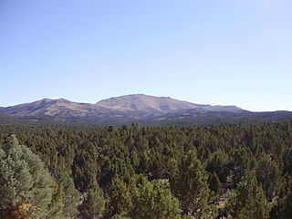
Pinyon–juniper woodland, also spelled piñon–juniper woodland, is a biome found mid-elevations in arid regions of the Western United States, characterized by being an open forest dominated by low, bushy, evergreen junipers, pinyon pines, and their associates. At lower elevations, junipers often predominate and trees are spaced widely, bordering on and mingling with grassland or shrubland, but as elevation increases, pinyon pines become common and trees grow closer, forming denser canopies. Historically, pinyon-juniper woodland has provided a vital source of fuel and food for peoples of the American Southwest.

<span class="mw-page-title-main">Montane ecosystems</span> Ecosystems found in mountains

Montane ecosystems are found on the slopes of mountains. The alpine climate in these regions strongly affects the ecosystem because temperatures fall as elevation increases, causing the ecosystem to stratify. This stratification is a crucial factor in shaping plant community, biodiversity, metabolic processes and ecosystem dynamics for montane ecosystems. Dense montane forests are common at moderate elevations, due to moderate temperatures and high rainfall. At higher elevations, the climate is harsher, with lower temperatures and higher winds, preventing the growth of trees and causing the plant community to transition to montane grasslands and shrublands or alpine tundra. Due to the unique climate conditions of montane ecosystems, they contain increased numbers of endemic species. Montane ecosystems also exhibit variation in ecosystem services, which include carbon storage and water supply.

<span class="mw-page-title-main">Ponderosa pine forest</span> Plant community where Pinus ponderosa is common

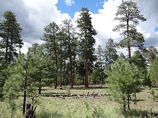
Ponderosa pine forest is a plant association and plant community dominated by ponderosa pine and found in western North America. It is found from the British Columbia to Durango, Mexico. In the south and east, ponderosa pine forest is the climax forest, while in the more northern part of its range, it can transition to Douglas-fir or grand fir, or white fir forests. Understory species depends on location. Fire suppression has led to insect outbreaks in ponderosa pine forests.

<span class="mw-page-title-main">Ecological regions of Quebec</span>

The Ecological regions of Quebec are regions with specific types of vegetation and climates as defined by the Quebec Ministry of Forests, Wildlife and Parks. Given the size of this huge province, there is wide variation from the temperate deciduous forests of the southwest to the arctic tundra of the extreme north.

<span class="mw-page-title-main">Northeastern Highlands (ecoregion)</span>

The Northeastern Highlands Ecoregion is a Level III ecoregion designated by the United States Environmental Protection Agency (EPA) in the U.S. states of Vermont, New Hampshire, Massachusetts, Maine, Connecticut, New York, New Jersey, and Pennsylvania. The ecoregion extends from the northern tip of Maine and runs south along the Appalachian Mountain Range into eastern Pennsylvania. Discontiguous sections are located among New York's Adirondack Mountains, Catskill Range, and Tug Hill. The largest portion of the Northeastern Highlands ecoregion includes several sub mountain ranges, including the Berkshires, Green Mountains, Taconic, and White Mountains.

The Eastern Temperate Forests is a Level I ecoregion of North America designated by the Commission for Environmental Cooperation (CEC) in its North American Environmental Atlas. The region covers much of the Eastern and Midwestern United States, the U.S. Interior Highlands, and parts of Ontario, Quebec, and the Maritimes.

References

  1. 1 2 3 4 5 6 Oberndorfer, E. C.; Lundholm, J. T. (2008). "Species richness, abundance, rarity and environmental gradients in coastal barren vegetation". Biodiversity and Conservation. 18 (6): 1523–1553. doi:10.1007/s10531-008-9539-5. S2CID   44217329.
  2. Baker, A., Proctor, J. and Reeves, R. (1992). Vegetation of ultramafic (serpentine) soils: proceedings of the first international conference on serpentine ecology. Intercept Limited, U.K, pp. 509.
  3. Kruckeberg, A. (1984). California serpentines: flora, vegetation, geology, soils, and management problems. University of California Press, Berkeley, pp. 180.
  4. 1 2 3 Schedlbauer, J. L.; Pistoia, V. L. (October 2013). "Water relations of an encroaching vine and two dominant C4 grasses in the serpentine barrens of southeastern Pennsylvania". The Journal of the Torrey Botanical Society. 140 (4): 493–505. doi:10.3159/TORREY-D-13-00010.1. S2CID   84078549.
  5. 1 2 Forman, T.T. Richard, 1979. Pine Barrens: ecosystem and landscape, New York Academic Press, ISBN   0122634500.
  6. Tedrow, J. C. F. (1952). "Soil conditions in the Pine Barrens of New Jersey". Bartonia. 26 (26): 28–35. JSTOR   41610337.
  7. 1 2 Burley, S. T.; Harper, K. A.; Lundholm, J. T. (2010). "Vegetation composition, structure and soil properties across coastal forest–barren ecotones". Plant Ecology. 211 (2): 279–296. doi:10.1007/s11258-010-9789-7. S2CID   25502599.
  8. Sydney Coastal Heaths by NSW Office of Environment and Heritage
  9. Mansberg, L.; Wentworth, T. R. (1984). "Vegetation and Soils of a Serpentine Barren in Western North Carolina". Bulletin of the Torrey Botanical Club. 111 (3): 273–286. doi:10.2307/2995909. JSTOR   2995909.
  10. 1 2 3 4 Arabas, K. B. (2000). "Spatial and Temporal Relationships among Fire Frequency, Vegetation, and Soil Depth in an Eastern North American Serpentine Barren". Journal of the Torrey Botanical Society. 127 (1): 51–65. doi:10.2307/3088747. JSTOR   3088747.
  11. 1 2 Wiser, S.K., (1999), High-elevation outcrops and barrens of the Southern Appalachian Mountains, in Savannas, barrens, and rock outcrop plant communities of North America, p. 119
  12. Statistical, Historical, and Political Description of NSW by William Charles Wentworth, 1819
  13. Understanding pre-European Adelaide plains and foothills vegetation associations – managing remnants and recreating grasslands. Adrian Shackley B. Rur. Sc. UNE, LLB Adelaide, B. Ec. Adelaide.
  14. "Glades". www.apsu.edu. November 22, 2017. Archived from the original on 2017-11-22.
  15. Petersen, S. M.; Drewa, P. B. (2014). "Effects of Biennial Fire and Clipping on Woody and Herbaceous Ground Layer Vegetation: Implications for Restoration and Management of Oak Barren Ecosystems". Restoration Ecology. 22 (4): 525–533. doi:10.1111/rec.12102. S2CID   82523907.
  16. Anderson, R. C.; Menges, E. S. (1997). "Effects of fire on sandhill herbs: nutrients, mycorrhizae, and biomass allocation". American Journal of Botany. 84 (7): 938–948. doi:10.2307/2446284. JSTOR   2446284. PMID   21708648.
  17. Freeman, K. R.; Pescador, M. Y.; Reed, S. C.; Costello, E. K.; Robeson, M. S.; Schmidt, S. K. (2009). "Soil CO2 flux and photoautotrophic community composition in high-elevation, 'barren' soil". Environmental Microbiology. 11 (3): 674–686. doi: 10.1111/j.1462-2920.2008.01844.x . PMID   19187281.