
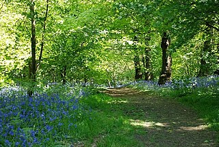
The Mendip Hills is a range of limestone hills to the south of Bristol and Bath in Somerset, England. Running from Weston-super-Mare and the Bristol Channel in the west to the Frome valley in the east, the hills overlook the Somerset Levels to the south and the Chew Valley and other tributaries of the Avon to the north. The highest point, at 325 metres above sea level, is Beacon Batch which is the summit area atop Black Down. The hills gave their name to the former local government district of Mendip, which administered most of the local area until April 2023. The higher, western part of the hills, covering 198 km2 (76 sq mi) has been designated an Area of Outstanding Natural Beauty (AONB), which gives it a level of protection comparable to a national park.

The Metropolitan Borough of Dudley is a metropolitan borough of West Midlands, England. It was created in 1974 following the Local Government Act 1972, through a merger of the existing Dudley County Borough with the municipal boroughs of Stourbridge and Halesowen.
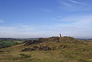
Charnwood Forest is a hilly tract in north-western Leicestershire, England, bounded by Leicester, Loughborough and Coalville. The area is undulating, rocky and picturesque, with barren areas. It also has some extensive tracts of woodland; its elevation is generally 600 feet (180 m) and upwards, the area exceeding this height being about 6,100 acres (25 km2). The highest point, Bardon Hill, is 912 feet (278 m). On its western flank lies an abandoned coalfield, with Coalville and other former mining villages, now being regenerated and replanted as part of the National Forest. The M1 motorway, between junctions 22 and 23, cuts through Charnwood Forest.

Pensnett is an area of the Metropolitan Borough of Dudley, West Midlands, England, 2.3 miles (3.7 km) south-west of central Dudley. Pensnett has been a part of Dudley since 1966, when the Brierley Hill Urban District, of which it was a part, was absorbed into the County Borough of Dudley, later the Metropolitan Borough of Dudley from 1974.

Titterstone Clee Hill, sometimes referred to as Titterstone Clee or Clee Hill, is a prominent hill in the rural English county of Shropshire, rising at the summit to 533 metres (1,749 ft) above sea level.
Corndon Hill is a hill in Powys, Mid Wales, whose summit rises to 513.6 metres (1,685 ft) above sea level. It has a topographic prominence of 203.1 metres (666 ft), so is listed as a Marilyn.

Pemulwuy is a suburb in Greater Western Sydney, in the state of New South Wales, Australia. Pemulwuy is located 30 kilometres west of the Sydney central business district in the local government area of the Cumberland Council. Pemulwuy is home to the highest point between the Blue Mountains and Sydney, the summit of Prospect Hill.

Corstorphine Hill is a low ridge-shaped hill rising above the western suburbs of Edinburgh, Scotland. Although there has been residential and commercial development on its lower slopes, especially in the south and west, most of the hill is occupied by a local nature reserve, consisting of extensive broadleaf woodland, accessible to the public.

Blackford Hill 164 metres (538 ft) is a hill in Edinburgh, the capital city of Scotland. It is in the area of Blackford, between Morningside, and the Braid Hills. Together with the Hermitage of Braid, it comprises the 60.3 hectares Hermitage of Braid and Blackford Hill Local Nature Reserve, within which lies Hermitage House.

Dudley Museum and Art Gallery was a public museum and art gallery located in the town centre of Dudley in the West Midlands, England. It was opened in 1883, situated within buildings on St James's Road, and remained at that site until its closure in 2016. Some of the museum collections have since been relocated to the Dudley Archives centre on Tipton Road.
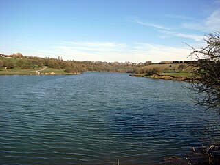
Fens Pools is a 37.6 hectares biological site of Special Scientific Interest in the West Midlands. The site was notified in 1989. under the Wildlife and Countryside Act 1981 and is currently managed by the Country Trust.
Pensnett Chase was a wooded area of land owned by the Lords of Dudley Castle in the parishes of Kingswinford and Dudley. As a chase, it was originally used by them to hunt game in although it was also used as common land by local people. At some periods it was regarded as extending into Gornal and including Baggeridge Wood at one end and perhaps Cradley Heath at the other. By the 17th century the ancient woodlands had largely been cleared.

Prospect Hill, or Marrong Reserve, is a heritage-listed hill in Pemulwuy and Prospect in the greater western region of Sydney, New South Wales, Australia. Situated about 30 kilometres west of central Sydney, the hill is Sydney's largest body of igneous rock and is higher than the ridges of the Cumberland Plain around it, with its present-day highest point being 117 metres high, although before its summit was quarried away it rose to a height of 131 metres above sea level.

Crickley Hill and Barrow Wake is a 56.8-hectare (140-acre) biological and geological Site of Special Scientific Interest in Gloucestershire, notified in 1974.
Saltwells Local Nature Reserve is situated in the Netherton area of Dudley Metropolitan Borough in West Midlands, England. The reserve, created in 1981, covers 247 acres and includes Saltwells Wood and part of Netherton Hill within its boundaries. The reserve encloses two Sites of Special Scientific Interest and one scheduled ancient monument.

Warren's Hall Country Park is a local nature reserve situated in Sandwell Metropolitan Borough in the West Midlands of England. It lies next to Bumble Hole Local Nature Reserve. It includes ponds, canals, grassland, small wooded areas and the entrance to Netherton Canal Tunnel.
Buckpool and Fens Pool Local Nature Reserve is situated in the Pensnett area of the West Midlands. The largest area of open water in Dudley Metropolitan Borough, it contains both large and small ponds, one end of the Stourbridge Canal, streams and grassy areas. It was created in 1993.

Grin Low is a hill overlooking Buxton in Derbyshire, in the Peak District. The summit is 434 metres (1,424 ft) above sea level.

The Black Country UNESCO Global Geopark is a geopark in the Black Country, a part of the West Midlands region of England. Having previously been an ‘aspiring Geopark’, it was awarded UNESCO Global Geopark status on 10 July 2020.
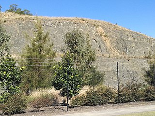
The Prospect dolerite intrusion, or Prospect intrusion, is a Jurassic picrite or dolerite laccolith that is situated in Sydney, New South Wales, Australia. Lying in the heart of Cumberland Plain, in the suburb of Pemulwuy, the intrusion is Sydney's largest body of igneous rock, rising to a height of 117 metres (384 ft) above sea level. The site is formed by an intrusion of dolerite rock into Ashfield Shale. At least seven different rock types occur in the intrusion.

