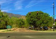
The City of Colorado Springs is the Home Rule Municipality that is the county seat and the most populous municipality of El Paso County, Colorado, United States. Colorado Springs is the second most populous city and the most extensive city in the State of Colorado. It is the principal city of the Colorado Springs, CO Metropolitan Statistical Area and is the second most prominent city of the Front Range Urban Corridor. It is located in east central Colorado, on Fountain Creek, 70 miles (113 km) south of Denver. At 6,035 feet (1,839 m) the city stands over 1 mile (1.6 km) above sea level, though some areas are significantly higher and lower. Colorado Springs is near the base of Pikes Peak, which rises 14,115 feet (4,302 m) above sea level on the eastern edge of the Southern Rocky Mountains.

El Paso County is one of the 64 counties of the U.S. state of Colorado. The 2010 Census recorded its population of 622,263 for El Paso County. The Census Bureau's 2018 estimate indicates it is the second-most populous county in Colorado, after the City and County of Denver. The county seat is Colorado Springs, the second most populous city in Colorado. El Paso County is included in the Colorado Springs, Colorado, Metropolitan Statistical Area.
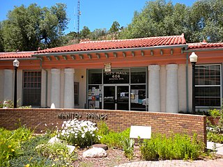
The City of Manitou Springs is a Home Rule Municipality located at the foot of Pikes Peak in western El Paso County, Colorado, United States. The town was founded for its natural mineral springs. The downtown area continues to be of interest to travelers, particularly in the summer, with many one-story small shops, restaurants, and pubs, as well as a creekside city park with a children's playground made from unusual materials. Among other services, shops sell clothing, candy, souvenirs, and outdoor recreation. The main road through the center of town was one of the direct paths to the base of Pikes Peak. Barr Trail, which winds its way up Pikes Peak, is accessible from town. The subdivision Crystal Hills was added to the municipality in the 1960s.

Cascade is an unincorporated community and U.S. Post Office in El Paso County, Colorado, United States. The ZIP Code of the Cascade Post Office is 80809.

Before it was founded, the site of modern-day Colorado Springs, Colorado, was part of the American frontier. Old Colorado City, built in 1858 during the Pike's Peak Gold Rush was the Colorado Territory capital. The town of Colorado Springs, was founded by General William Jackson Palmer as a resort town. Old Colorado City was annexed into Colorado Springs. Railroads brought tourists and visitors to the area from other parts of the United States and abroad. The city was noted for junctions for seven railways: Denver and Rio Grande (1870), Denver and New Orleans Manitou Branch (1882), Colorado Midland (1886-1918), Colorado Springs and Interurban, Atchison, Topeka, and Santa Fe (1889), Rock Island (1889), and Colorado Springs and Cripple Creek Railways. It was also known for mining exchanges and brokers for the Cripple Creek Gold Rush.

Fountain Creek is a stream that originates in Woodland Park in Teller County and flows through El Paso County to its confluence with the Arkansas River near Pueblo in Pueblo County, Colorado. The 74.5-mile-long (119.9 km) creek, once known as the Fontaine qui Bouille, is a tributary of the Arkansas River.

Cheyenne Mountain State Park is a Colorado state park that was acquired in June 2000 through a partnership between the City of Colorado Springs, Colorado State Parks, Great Outdoors Colorado (GOCO), Colorado Lottery, El Paso County, and other local private organizations.
Colorado Springs geography describes geographical topics regarding the city of Colorado Springs, Colorado in El Paso County, Colorado. With 194.87 sq mi (504.7 km2) of land, it is the state's largest-sized city. Denver is the most populated city.

Palmer Park is a regional park in Colorado Springs, Colorado. Located at 3650 Maizeland Road, the park is several miles northeast of the downtown area. Elevation Outdoors Magazine named it Best Urban Park in its Best of Rockies 2017 list. One of Best of the Springs Expert Picks - Sports & Recreation by The Gazette, Seth Boster states that it may have the city's best views of Pikes Peak and a place "where an escape into deep nature is easy. It is strange and marvelous to look out at urban sprawl while perched on some high rock ledge, surrounded by rugged wilderness."

The Hayward Area Recreation and Park District (H.A.R.D.) is the park management agency for most of the parks in the city of Hayward, California. It was created in 1944 and is an independent special district under California law. H.A.R.D. is the largest recreation district in California. It also manages parks in the bordering unincorporated communities of Castro Valley, San Lorenzo, Fairview, Ashland and Cherryland. It manages the park grounds for numerous schools in the region. Events and classes are scheduled and listed in a quarterly brochure. The parks 2010-2011 budget was $24,383,637.

Monument Valley Park is a historic, recreational park in Colorado Springs, Colorado through which Monument Creek flows. It is a National Register of Historic Places listing and is on the Colorado State Register of Historic Properties.
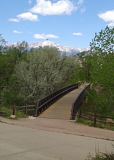
Pikes Peak Greenway is a 16 mile trail in Colorado Springs, Colorado that parallels Monument and Fountain Creeks and winds through and alongside parks, like Monument Valley Park, and sports complexes. It connects with other trails, such as the Midland Trail, Bear Creek Trail and Templeton Gap Trail.

Memorial Park or Memorial Community Park is a community park in Colorado Springs, Colorado. It has a wide range of sports facilities, including an indoor and outdoor pool, a recreation center, trails and Prospect Lake.

Bear Creek Cañon Park is a high-country park located in Colorado Springs, Colorado with steep trails for hiking, mountain biking and horseback riding.

North Cheyenne Cañon Park or North Cheyenne Canyon Park is a regional park located in Colorado Springs, Colorado. It is a National Register of Historic Places listing.

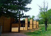
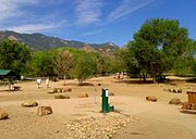
There are a wide range of recreational areas and facilities in Colorado Springs, Colorado.

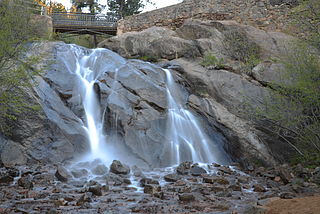
South Cheyenne Cañon, or South Cheyenne Canyon, is a canyon in Colorado Springs, El Paso County, Colorado. The South Cheyenne Cañon road to Seven Falls is called "The Grandest Mile of Scenery" in Colorado. Seven Falls has been a tourist attraction since it was opened in the early 1880s. Trails from the top of the falls lead to Midnight Falls, near the headwaters of South Cheyenne Creek, and Inspiration Point. The area has been a center for parks, such as the Stratton Park and Colorado College Park. Now, part of South Cheyenne Cañon, including the Starsmore Discovery Center, is in the North Cheyenne Cañon Park. The area sustained a significant flood in September 2013, which closed Seven Falls until Spring 2015. Presently the falls are open again.

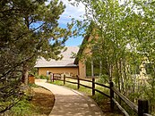
Fountain Creek Regional Park and Nature Center is a park and nature center in Fountain, El Paso County, Colorado near Colorado Springs.
The Manitou Park Recreation Area is a recreation area in the Pike National Forest, located 5.2 miles (8.4 km) north of Woodland Park along Colorado State Highway 67 in Teller County, Colorado. The recreation area includes several campgrounds and a picnic area, the Manitou Lake Picnic Area.
Cheyenne Creek is a stream in Colorado Springs, El Paso County, Colorado at 5,920 feet (1,800 m) in elevation. The stream is fed by the North Cheyenne Creek and South Cheyenne Creek and flows into Fountain Creek near Nevada Avenue, between Interstate 25 and the Pikes Peak Greenway trail. North Cheyenne Creek and South Cheyenne Creek flow through Teller and El Paso Counties. The source of South Cheyenne Creek is Mount Big Chief, near St. Peter's Dome, and it flows to Seven Falls.