
Willapa Bay is a bay located on the southwest Pacific coast of Washington state in the United States. The Long Beach Peninsula separates Willapa Bay from the greater expanse of the Pacific Ocean. With over 120 square miles (310 km2) of surface area Willapa Bay is the second-largest riverine estuary on the Pacific coast of the continental United States. Early settlers called the bay Shoalwater Bay and this name is found on old maps and charts of the region.

The St. Joseph River is an 86.1-mile-long (138.6 km) tributary of the Maumee River in northwestern Ohio and northeastern Indiana in the United States, with headwater tributaries rising in southern Michigan. It drains a primarily rural farming region in the watershed of Lake Erie.

The Willapa River is a river on the Pacific coast of southwestern Washington in the United States, approximately 20 miles (32 km) long. It drains an area of low hills and a coastal plain into Willapa Bay, a large estuary north of the mouth of the Columbia River.

Bear River is a small clear slow-moving river in the U.S. state of Michigan. 14.7 miles (23.7 km) long, it is the largest tributary of Little Traverse Bay in the northwest of the lower peninsula. Traverse Bay is on Lake Michigan. The river is formed as the outflow of Walloon Lake on the boundary between Charlevoix County and Emmet County, draining from the southeast end of the lake at 45°15′40″N84°56′01″W near the community of Walloon Lake in Melrose Township. M-75 has its northern terminus in a junction with US 131 nearby.

The Sunrise River is a 39.1-mile-long (62.9 km) tributary of the St. Croix River in east–central Minnesota in the United States. It originates within the boundaries of the Comfort Lake - Forest Lake Watershed District near the city of Forest Lake in Washington County. It's headwaters are considered several small tributaries that flow into and contribute to Forest Lake, the longest of which is the Washington Judicial Ditch 6. From the outflow from Forest Lake, the river flows north, accepting the South Branch from the west near the city of Wyoming, and continues north into Mud Lake, where the West Branch, which rises in southeast Isanti County and briefly enters Anoka County, joins it near the city of Stacy. From Stacy it flows generally north-northwest through Chisago County to meet the St. Croix River within Wild River State Park near the communities of Sunrise and Almelund. Not far upstream from its mouth, the Sunrise collects its North Branch, which rises in Isanti County and flows through the city of North Branch.
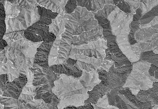
The Willapa Hills is a geologic, physiographic, and geographic region in southwest Washington. When described as a physiographical province, the Willapa Hills are bounded by the Pacific Ocean to the west, the Columbia River to the south, the Olympic Mountains to the north, and the Cascade Range to the east. Some definitions place the Puget Lowland physiographic province east of the Willapa Hills. Included within the province are the Black Hills, the Doty Hills, and a number of broad river valleys, some of which open up into broad estuaries on the Pacific such as Grays Harbor and Willapa Bay. Other definitions do not include the Black Hills. The USGS GNIS defines the Willapa Hills as bounded by the Columbia River to the south and the Chehalis River to the north, without giving specific east and west bounds. The Willapa Hills are one of the Pacific Coast Ranges, which continue north as the Olympic Mountains and south, across the Columbia River, as the Oregon Coast Range.
Black River is a 4.2-mile-long (6.8 km) river in the southwest part of the U.S. state of Michigan that empties into Lake Michigan in South Haven at 42°24′08″N86°17′04″W, where it discharges past the South Pier Lighthouse. The river takes its name from the dark brown color of its water, which is caused by suspended sediments and organic materials picked up along its course. The river supports a variety of wildlife including trout, snapping turtles, leeches, and many other varieties of flora and fauna. The Black River watershed encompasses 287 square miles (740 km2) across two counties and 13 townships.
Beards Brook or Beard Brook is a 12.5-mile-long (20.1 km) stream located in southern New Hampshire in the United States. It is a tributary of the North Branch of the Contoocook River, part of the Merrimack River watershed.
The North River is a river, approximately 30 miles (48 km) long, in western Washington, in the United States. It empties into Willapa Bay, the first large estuary on the Washington coast north of the Columbia River.
Doty, Washington is an unincorporated community located 1.3-miles directly west of Dryad and 5 miles east of Pe Ell on Washington State Route 6. As of 2023, approximately 250 people reside in or around Doty, which boasts a general store, post office, fire department, and two churches. Logging and farming are the industries that most of the residents rely on for income.
Menlo is a small unincorporated community in the Willapa Valley of Pacific County, Washington, United States. The community is home to a general store and post office, the Pacific County Fairgrounds and a secondary/high school — Willapa Valley High School.

The Dartmouth Range is a mountain range in the White Mountains of New Hampshire in the United States. The range lies in the township of Low and Burbank's Grant and the town of Carroll in Coos County.

The Naselle River is a river in the U.S. state of Washington.
The Bone River is a short river in the U.S. state of Washington. It is about 6 miles (9.7 km) long.
The Palix River is a stream in the U.S. state of Washington. Its tributaries include three forks, North, Middle, and South Fork Palix River, as well as the Canon River. The river's length, including the Canon River, its longest tributary, is approximately 14 miles (23 km).
The South Branch Sunday River is a 2.5-mile-long (4.0 km) mountain stream in western Maine. It is a tributary of the Sunday River, which flows to the Androscoggin River and ultimately to the Kennebec River and the Atlantic Ocean.
Ceres is an unincorporated community in Lewis County, in the U.S. state of Washington. It is located off Washington State Route 6 in a bend of the Chehalis River. The Willapa Hills Trail bisects the area.

The Doty Hills are hills in Lewis County and Grays Harbor County in southwest Washington. The hills lie north of Doty, Washington and west of Chehalis, between the Black Hills to their north and the Willapa Hills to their south. They are considered part of the Willapa Hills physiographic province.
Johns River is a short tidal river flowing into the south end of Grays Harbor in the U.S. state of Washington.
The Cedar River is a short stream flowing into the north end of Willapa Bay in the U.S. state of Washington.
