
Columbia, formerly Wright's Ferry, is a borough (town) in Lancaster County, Pennsylvania, United States. As of the 2020 census, it had a population of 10,222. It is 28 miles (45 km) southeast of Harrisburg, on the east (left) bank of the Susquehanna River, across from Wrightsville and York County and just south of U.S. Route 30.

Republic is a city in Ferry County, Washington, United States. The population was 1,073 at the 2010 census, a 12.5% increase over the 2000 census. It is the county seat of Ferry County. It was the largest mining camp in the Republic Mining District, and home to the "Hot Air Line" railway.

Northport is a town in Stevens County, Washington, United States. The population was 295 at the 2010 census.

Goble is an unincorporated community in Columbia County, Oregon, United States. It is located on U.S. Route 30 and the Columbia River.

Curlew is an unincorporated community and census-designated place (CDP) located in northwestern Ferry County, Washington, United States, between Malo and Danville on State Route 21. The BNSF Railway ran through the town. The historic Ansorge Hotel is located in Curlew. As of the 2010 census, the population of the community was 118. The settlement is named for the curlew birds once prevalent in the area.

State Route 20 (SR 20), also known as the North Cascades Highway, is a state highway that traverses the U.S. state of Washington. It is the state's longest highway, traveling 436 miles (702 km) across the northern areas of Washington, from U.S. Route 101 (US 101) at Discovery Bay on the Olympic Peninsula to US 2 near the Idaho state border in Newport. The highway travels across Whidbey Island, North Cascades National Park, the Okanagan Highland, the Kettle River Range, and the Selkirk Mountains. SR 20 connects several major north–south state highways, including Interstate 5 (I-5) in Burlington, US 97 through the Okanogan–Omak area, SR 21 in Republic, and US 395 from Kettle Falls to Colville.
Wild Cat Bluff is a ghost town in northwestern Anderson County, Texas, United States, and is a part of the Palestine, Texas micropolitan area.

Wrights, California is a ghost town in unincorporated west Santa Clara County, California. It is located near Summit Road in the Santa Cruz Mountains, on the north bank of Los Gatos Creek, east of State Route 17.

The Kettle River Range, often called the Kettle Range, is the southernmost range of the Monashee Mountains, located in far southeastern British Columbia, Canada and Ferry County, Washington, in the United States. Most of the northern half of the range is protected by the Colville National Forest and the southern half of the range is located on the Colville Indian Reservation. The highest peak is Copper Butte, which reaches 2,177 metres (7,142 ft). The range is crossed by Washington State Route 20 at Sherman Pass.
Jodie, also known as Imboden, is an unincorporated community in Fayette County, West Virginia, United States. It is located along the Gauley River at the mouth of Rich Creek, 4 miles (6.4 km) northeast of Gauley Bridge. Due to its proximity to the county line, Jodie is part of the Nicholas County ZIP code of 26690; it had its own post office until its closure on July 23, 2005.
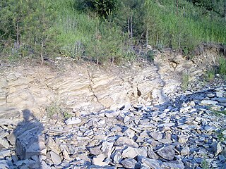
The Klondike Mountain Formation is an Early Eocene (Ypresian) geological formation located in the northeast central area of Washington state. The formation is comprised of volcanic rocks in the upper unit and volcanic plus lacustrine (lakebed) sedimentation in the lower unit. the formation is named for the type location designated in 1962, Klondike Mountain northeast of Republic, Washington. The formation is a lagerstätte with exceptionally well-preserved plant and insect fossils has been found, along with fossil epithermal hot springs.
Ferry is a ghost town in Ferry County, Washington, United States. Ferry was founded during the late 1890s. The town was located to the west of Vulcan Mountain. Ferry was a ramshackle collection of crude log homes and false front buildings to support the mining boom in the area. By 1910, insurance fires took their toll and before long Ferry had passed into oblivion. Today little remains of the town.
Boundary is a ghost town located in Stevens County, Washington, United States. The town was located near the Canada–US border and near the Columbia River. Boundary's peak years were during the 1890s. The population was around 900. The town started off as a railroad camp. When the railroad finally spanned the wild Pend Oreille with a bridge, the railroad workers quickly moved on leaving the town of Boundary deserted. The town contained the Boundary Hotel, post office, and general store. A town called "New Boundary" came into being south of the original townsite and the old town eventually vanished.
Pemberton Ferry, later renamed Croom, is a ghost town in Central Florida near Brooksville, Florida and Ridge Manor, Florida. A rail line came to Pemberton Ferry in 1884. It was a rail stop by the Withlacoochee River just north of where the I-75 bridge over Croom-Rital Road and Withlacoochee State Trail is today.

Sugarloaf Mountain is a 900-foot (270 m) peak located in the town of Fishkill near the Hudson River and Breakneck Ridge. One of several similarly named mountains in the U.S. state of New York, it is part of the Hudson Highlands, located entirely within Hudson Highlands State Park.
Corfu is a ghost town in Grant County, in the U.S. state of Washington. The community was named after the island of Corfu, in Greece.


