Belo Horizonte is the sixth-largest city in Brazil, with a population around 2.7 million and the third largest metropolitan area with a population of 6 million. It is the 13th-largest city in South America and the 18th-largest in the Americas. The metropolis is anchor to the Belo Horizonte metropolitan area, ranked as the third-most populous metropolitan area in Brazil and the 17th-most populous in the Americas. Belo Horizonte is the capital of the state of Minas Gerais, Brazil's second-most populous state. It is the first planned modern city in Brazil.

Minas Gerais is a state in Southeastern Brazil. It ranks as the second most populous, the third by gross domestic product (GDP), and the fourth largest by area in the country. The state's capital and largest city, Belo Horizonte, is a major urban and finance center in Latin America, and the sixth largest municipality in Brazil and its metropolitan area is the third largest in Brazil with just over 5.8 million inhabitants, after those of São Paulo and Rio de Janeiro. Nine Brazilian presidents were born in Minas Gerais, the most of any state. The state has 10.1% of the Brazilian population and is responsible for 8.7% of the Brazilian GDP.
Contagem is a city in the center of the state of Minas Gerais, in Brazil. It is only 21 kilometres from the capital, Belo Horizonte, and forms part of a metropolitan area with a population of 4.8 million.

Três Corações is a municipality in the south of Minas Gerais state in Brazil. As of 2020, the city population was estimated at 80,032, making it one of the largest cities in the south of Minas Gerais. The city is geographically located close to the circumcenter of the three largest metropolitan areas in Brazil, thus making it a strategic hub for commerce. Três Corações is internationally famous for being the birthplace of football legend Pelé.

Juiz de Fora, also known as J.F., is a city in the southeastern Brazilian state of Minas Gerais, approximately 40 kilometres (25 mi) from the state border with Rio de Janeiro. According to 2020 estimates the current population is about 573,285 inhabitants. The geographical area of the municipality is 1,437 km2 (555 sq mi).
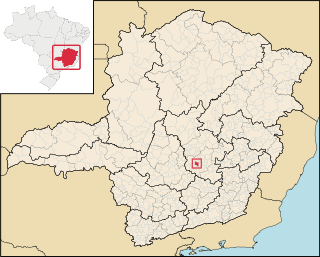
Patrocínio is a municipality in the state of Minas Gerais in Brazil. The population is 91,449 in an area of 2874 km2. The elevation is 965 m.

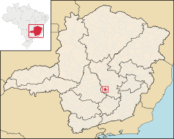
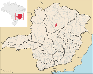
Luz is a Brazilian municipality located in the West part of the state of Minas Gerais. Luz is located between the city of Araxá and the capital city of the state of Minas Gerais, Belo Horizonte. The population is 18,257 in an area of 1172 km². The city belongs to the Central Mineira region and to the micro-region of Bom Despacho. It became a municipality in 1923.

Campeonato Mineiro is the state football league of the state of Minas Gerais and is controlled by the Minas Gerais Football Federation FMF.

Barbacena is a municipality in the state of Minas Gerais, Brazil. As of 2020, the municipality had 138,204 inhabitants. The total area of the municipality is 788 km2 (304 sq mi).

Ipatinga is a municipality in eastern Minas Gerais state, Brazil. The city was founded on 29 April 1964 and covers a total area of 164.8 km2 (63.6 sq mi). Its population is 267,333 as of 2021. It is part of the Vale do Aço metropolitan area.

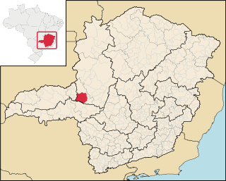
Araxá is a municipality in Western Minas Gerais state, Brazil. Its estimated population by IBGE in 2020 is 107,337 inhabitants and the area of the municipality is 1,283 square kilometres (495 sq mi), with 3.45 square kilometres (1.33 sq mi) making up the urban perimeter.
Caratinga is a municipality in eastern Minas Gerais state, Brazil. The population in 2020 was 92,603 inhabitants and the total area of the municipality was 1,251 km2. The elevation is 578 meters above sea level, with maximum elevation of 1,516 m in the Serra do Rio Preto and 330 m at the mouth of the Córrego Boachá.
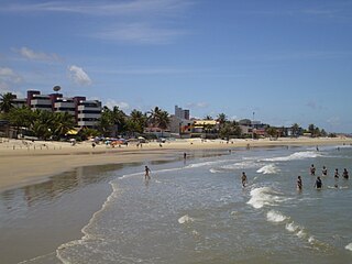
Parnamirim is a city in the state of Rio Grande do Norte, Brazil, next to the state capital city of Natal and part of its metropolitan area.
Ribeirão das Neves is a Brazilian municipality located in the state of Minas Gerais. The city belongs to the mesoregion Metropolitana de Belo Horizonte and to the microregion of Belo Horizonte. Most residents commute to Belo Horizonte. The population in 2020 was 338,197.

Ibirité is a Brazilian municipality located in the state of Minas Gerais. The city belongs to the mesoregion Metropolitana de Belo Horizonte and to the microregion of Belo Horizonte. Its population in 2020 was 182,153.

Arantina is a Brazilian municipality located in the state of Minas Gerais. Its population as of 2020 is estimated to be 2,787 people living in a total area of 89.382 km². The city belongs to the mesoregion of Sul and Sudoeste de Minas and to the microregion of Andrelândia.

Guarda-Mor is a municipality in the north of the Brazilian state of Minas Gerais. Its population in 2020 was 6,569 inhabitants in a total area of 2,066 km2. It is a large producer of cattle and grains, especially soybeans.
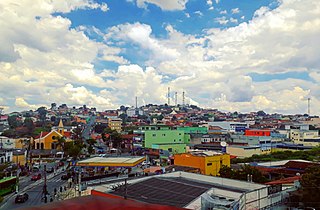
Claro dos Poções is a Brazilian municipality located in the north of the state of Minas Gerais. In 2020 the population was 7,514 in a total area of 706 km². It became a municipality in 1962.

Marmelópolis is a municipality in the state of Minas Gerais in the Southeast region of Brazil.
Belo Horizonte, Brazil's sixth largest city, and the capital of Minas Gerais state, has a vibrant, diversified economy. It receives a large number of visitors and exerts a pivotal influence in the country's economy. Both multinational and Brazilian companies, such as Google, Deloitte, Thoughtworks, Localiza, Oi, and Fiat maintain offices or headquarters in the city. The service sector plays a very important role in the economy of Belo Horizonte, being responsible for 85% of the city's gross domestic product (GDP), with industry making up for most of the remaining 15%. Belo Horizonte has a developed industrial sector, being traditionally a hub of the Brazilian siderurgical and metallurgical industries, as the state of Minas Gerais has traditionally been rich in minerals.