Biesenthal

Last updated
Biesenthal
Ev-kirche-biesenthal-rr.jpg
Parish church
Wappen Biesenthal.png
Location of Biesenthal within Barnim district
Biesenthal in BAR.pngBritzJoachimsthalMarienwerderSchorfheideZiethen
Germany adm location map.svg
Red pog.svg
Biesenthal
Brandenburg location map.svg
Red pog.svg
Biesenthal
Coordinates: 52°46′N13°38′E / 52.767°N 13.633°E / 52.767; 13.633
Country Germany
State Brandenburg
District Barnim
Municipal assoc. Biesenthal-Barnim
Subdivisions2 Ortsteile
Government
   Mayor (201924) Carsten Bruch [1] (CDU)
Area
  Total60.48 km2 (23.35 sq mi)
Elevation
50 m (160 ft)
Population
 (2021-12-31) [2]
  Total6,101
  Density100/km2 (260/sq mi)
Time zone UTC+01:00 (CET)
  Summer (DST) UTC+02:00 (CEST)
Postal codes
16359
Dialling codes 03337
Vehicle registration BAR
Website www.biesenthal.de

Biesenthal is a town in the district of Barnim in Brandenburg, Germany. It is the administrative seat of the Amt ("collective municipality") Amt Biesenthal-Barnim.

Contents

Geography

Finow river 2009-05-01-fahrradtour-rr-30.jpg
Finow river

The town is located on the Finow river, about 31 km (19 mi) northeast of Berlin (centre). The surrounding Biesenthal Basin is part of the Barnim Plateau and the Barnim Nature Park, characterised by numerous kames and glacial lakes stemming from the Weichselian glaciation.

History

In the early Middle Ages, the region was settled by Polabian Slavs. Conquered by the Ascanian margraves of Brandenburg, Bizdal was first mentioned in a 1258 deed. A local parish was already documented in 1265; the present-day fieldstone church was probably erected at this time. The settlement on the Via Imperii trade route to Berlin was vested with market rights by Margrave John V in 1315.

A castle was mentioned in 1337, it was purchased by the Hohenzollern elector John George of Brandenburg in 1577. Its ruins were cleared away after the Thirty Years' War, only ground walls remained. In 1907, a view tower (Kaiser-Friedrich-Turm) was erected on the castle hill.

During the 18th century, the townscape was devastated by several blazes. From 1815 to 1947, Biesenthal was part of the Prussian Province of Brandenburg. The economic development was decisively promoted by the opening of the Berlin–Stettin railway line in 1843. In World War II, a subcamp of the Sachsenhausen concentration camp was located here. The town was occupied by Red Army forces in 1945 and became part of the Soviet occupation zone. From 1947 to 1952, Biesenthal was part of the State of Brandenburg, from 1952 to 1990 of the Bezirk Frankfurt of East Germany and since 1990 again of Brandenburg.

Demography

Development of population since 1875 within the current boundaries (Blue line: Population; Dotted line: Comparison to population development of Brandenburg state; Grey background: Time of Nazi rule; Red background: Time of communist rule) Bevolkerungsentwicklung Stadt Biesenthal.pdf
Development of population since 1875 within the current boundaries (Blue line: Population; Dotted line: Comparison to population development of Brandenburg state; Grey background: Time of Nazi rule; Red background: Time of communist rule)
Biesenthal: Population development
within the current boundaries (2017) [3]
YearPop.±% p.a.
1875 2,632    
1890 2,732+0.25%
1910 3,370+1.05%
1925 3,556+0.36%
1933 3,879+1.09%
1939 4,529+2.62%
1946 4,598+0.22%
1950 5,120+2.72%
1964 4,910−0.30%
1971 4,801−0.32%
1981 4,730−0.15%
1985 4,892+0.85%
1989 4,815−0.40%
1990 4,668−3.05%
1991 4,624−0.94%
YearPop.±% p.a.
1992 4,695+1.54%
1993 4,846+3.22%
1994 4,911+1.34%
1995 4,869−0.86%
1996 4,923+1.11%
1997 5,058+2.74%
1998 5,183+2.47%
1999 5,220+0.71%
2000 5,272+1.00%
2001 5,340+1.29%
2002 5,394+1.01%
2003 5,454+1.11%
2004 5,509+1.01%
2005 5,625+2.11%
2006 5,621−0.07%
YearPop.±% p.a.
2007 5,637+0.28%
2008 5,507−2.31%
2009 5,563+1.02%
2010 5,543−0.36%
2011 5,498−0.81%
2012 5,525+0.49%
2013 5,564+0.71%
2014 5,632+1.22%
2015 5,679+0.83%
2016 5,671−0.14%
2017 5,734+1.11%
2018 5,791+0.99%
2019 5,869+1.35%
2020 6,029+2.73%

Politics

Town hall Biesenthal Rathaus.jpg
Town hall

Seats in the town's assembly (Stadtverordnetenversammlung) as of 2014 local elections:

Notable people

Related Research Articles

<span class="mw-page-title-main">Eberswalde</span> Town in Brandenburg, Germany

Eberswalde is a major town and the administrative seat of the district Barnim in the German State of Brandenburg, about 50 km northeast of Berlin. Population 42,144, geographical location 52°50′N13°50′E. The town is often called Waldstadt, because of the large forests around it, including the Schorfheide-Chorin Biosphere Reserve. Despite this fact, Eberswalde was an important industrial center until the German Reunification.

<span class="mw-page-title-main">Prenzlau</span> Town in Brandenburg, Germany

Prenzlau is a town in Brandenburg, Germany, the administrative seat of Uckermark District. It is also the centre of the historic Uckermark region.

<span class="mw-page-title-main">Schwedt</span> Town in Brandenburg, Germany

Schwedt is a town in Brandenburg, in northeastern Germany. With the official status of a Große kreisangehörige Stadt, it is the largest town of the Uckermark district, located near the river Oder, which forms the border with Poland.

<span class="mw-page-title-main">Gartz</span> Town in Brandenburg, Germany

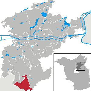
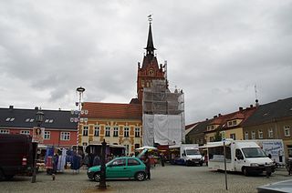
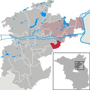
Gartz is a town in the Uckermark district in Brandenburg, Germany. It is located on the West bank of the Oder River, on the border with Poland, about 20 km south of Szczecin, Poland. It is located within the historic region of Western Pomerania.

<span class="mw-page-title-main">Briesen (Mark)</span> Municipality in Brandenburg, Germany

Briesen (Mark) is a village and a municipality in the Oder-Spree district, Brandenburg, Germany. It is situated east of the capital Berlin, between the towns Fürstenwalde and Frankfurt an der Oder. Briesen was first mentioned in 1403.

<span class="mw-page-title-main">Werneuchen</span> Town in Brandenburg, Germany

Werneuchen is a town in Brandenburg, Germany, in the district of Barnim northeast of Berlin within the metropolitan area. Most of the population of Werneuchen commutes to Berlin.

<span class="mw-page-title-main">Fürstenwalde</span> Town in Brandenburg, Germany

Fürstenwalde/Spree is the most populous town in the Oder-Spree District of Brandenburg, Germany.

<span class="mw-page-title-main">Oderberg</span> Town in Brandenburg, Germany

Oderberg is a town in the district of Barnim, in Brandenburg in northeastern Germany. It is situated 16 km east of Eberswalde, and 27 km southwest of Schwedt, close to the border with Poland, and in close vicinity of Berlin.

<span class="mw-page-title-main">Bad Freienwalde</span> Town in Brandenburg, Germany

Bad Freienwalde is a spa town in the Märkisch-Oderland district in Brandenburg, Germany.

<span class="mw-page-title-main">Wandlitz</span> Municipality in Brandenburg, Germany

Wandlitz is a municipality in the district of Barnim, in Brandenburg, Germany. It is situated 25 km north of Berlin, and 15 km east of Oranienburg. The municipality was established in 2004 by merger of the nine villages Basdorf, Klosterfelde, Lanke, Prenden, Schönerlinde, Schönwalde, Stolzenhagen, Wandlitz and Zerpenschleuse.

<span class="mw-page-title-main">Ahrensfelde</span> Municipality in Brandenburg, Germany

Ahrensfelde is a municipality in the district of Barnim, in Brandenburg, Germany. It is situated on the Barnim Plateau at the city limits of Berlin, about 13 km (8.1 mi) northeast of the city centre. The municipal area comprises the villages of Ahrensfelde, Blumberg, Eiche, Lindenberg, and Mehrow.

<span class="mw-page-title-main">Buckow</span> Town in Brandenburg, Germany

Buckow is a town in the Märkisch-Oderland district, in Brandenburg, Germany. The water cure resort is the administrative seat of the Amt Märkische Schweiz and located in the centre of the eponymous hill range, since 1990 part of the Märkische Schweiz Nature Park protected area.

<span class="mw-page-title-main">Golßen</span> Town in Brandenburg, Germany

Golßen or Golssen is a town in the district of Dahme-Spreewald, in Brandenburg, Germany. It is the administrative seat of the Amt Unterspreewald.

<span class="mw-page-title-main">Storkow, Brandenburg</span> Town in Brandenburg, Germany

Storkow (Mark) is a town in Oder-Spree district, in Brandenburg, Germany.

<span class="mw-page-title-main">Joachimsthal, Brandenburg</span> Town in Brandenburg, Germany

Joachimsthal  is a small town in the district of Barnim, in Brandenburg, Germany. It is situated within the Schorfheide-Chorin Biosphere Reserve on the isthmus between the lakes Grimnitzsee in the north and Werbellinsee in the south, about 17 km (11 mi) northwest of the district's capital Eberswalde and 55 km (34 mi) northeast of the Berlin city centre. The municipality is the administrative seat of the Amt Amt Joachimsthal.

<span class="mw-page-title-main">Teupitz</span> Town in Brandenburg, Germany

Teupitz is a small town in the Dahme-Spreewald district, in Brandenburg, Germany. It is the administrative seat of the Schenkenländchen municipal association (Amt).

<span class="mw-page-title-main">Schorfheide, Brandenburg</span> Municipality in Brandenburg, Germany

Schorfheide is a municipality in the Barnim district of Brandenburg, Germany. It was established in 2003 by the merger of Finowfurt and Groß Schönebeck.

<span class="mw-page-title-main">Britz, Brandenburg</span> Municipality in Brandenburg, Germany

Britz is a municipality in the district of Barnim in Brandenburg in Germany.

<span class="mw-page-title-main">Hohenfinow</span> Municipality in Brandenburg, Germany

Hohenfinow is a municipality in the Barnim district in Brandenburg, Germany. It is part of the Amt Amt Britz-Chorin-Oderberg.

<span class="mw-page-title-main">Niederfinow</span> Municipality in Brandenburg, Germany

Niederfinow is a municipality in the district of Barnim in Brandenburg in Germany.

References

  1. Landkreis Barnim Wahl der Bürgermeisterin / des Bürgermeisters, accessed 30 June 2021.
  2. "Bevölkerungsentwicklung und Flächen der kreisfreien Städte, Landkreise und Gemeinden im Land Brandenburg 2021" (PDF). Amt für Statistik Berlin-Brandenburg (in German). June 2022.
  3. Detailed data sources are to be found in the Wikimedia Commons.Population Projection Brandenburg at Wikimedia Commons