Big Lagoon (California)

Last updated
Big Lagoon
BigLagoonKayaks.png
Kayaks at the south end of Big Lagoon
Relief map of California.png
Red pog.svg
Big Lagoon
Usa edcp relief location map.png
Red pog.svg
Big Lagoon
Location Humboldt County, California
Coordinates 41°11′00″N124°07′00″W / 41.18333°N 124.11667°W / 41.18333; -124.11667
Type Lagoon
Primary inflows Maple Creek
Primary outflows Pacific Ocean
Basin  countriesUnited States
Max. length3.8 mi (6 km) [1]
Max. width1.4 mi (2 km) [1]
Surface area1,470 acres (5.9 km2) [2]
Max. depth22 feet (6.7 m) [2]
Shore length19 miles (14 km) [2]
Surface elevation20 feet (6.1 m) [2]
FrozenNo
1 Shore length is not a well-defined measure.

Big Lagoon is the southernmost and largest of three similar lagoons within Humboldt Lagoons State Park, along the coast of Humboldt County, California.

Contents

It is located between Trinidad to the south and Orick at the mouth of Redwood Creek to the north.

The lagoons are shallow bays between rocky headlands where coastal wave action has formed a sandy bar separating each lagoon from the Pacific Ocean. The lagoons are resting areas for migratory waterfowl using the Pacific Flyway between Lake Earl on the Smith River estuarine wetlands 40 miles (64 km) to the north and Humboldt Bay on the Mad River estuarine wetlands 30 miles (48 km) to the south.

BigLagoonMap.png

Geology

Big Lagoon is similar to other coastal features of northern California including Humboldt Bay to the south and Lake Earl to the north; an alluvial plain is surrounded by steep uplands. Hills adjacent to Big Lagoon have been identified as the Franciscan Assemblage along the eastern shore and Pleistocene dune sandstone to the south. [1] Studies around Humboldt Bay indicate tectonic activity along the Cascadia subduction zone has caused local sea level changes at intervals of several centuries. [3] The plain may support fresh water wetlands or Sitka Spruce forests following uplift events and salt marsh or inundated shellfish beds following subsidence events. At the present lagoon level, the sand bar normally separates the lagoon from the ocean during summer months. Winter precipitation may raise the water level in the lagoon a few meters above sea level. Hydrostatic pressure and storm surf may then breach the sand bar allowing the lagoon to drain into the sea and then receive tidal inflow until wave action reforms the bar. [4]

History

Roosevelt elk graze the wetlands south of the lagoon and may sometimes be seen where U.S. Route 101 crosses the lagoon. Hammond Lumber Company Plant Three included 20th century company housing and a sawmill log pond built where Maple Creek enters the south end of Big Lagoon. [5] The coastal portion of Big Lagoon was used as an aerial rocket range by the United States Navy during World War II. [6] Canoe access to Big Lagoon is available from a park on the south shore near the community of Big Lagoon and Big Lagoon Rancheria.

The B.E.P.O. Beast Sightings

The "B.E.P.O. Beast" sightings refer to a series of 1980s word-of-mouth reports of a primate-like creature roaming the outskirts of Big Lagoon. The name "B.E.P.O" is an acronym standing for "Big Elusive Primate Organism," given to the creature by locals of Humboldt Bay and by those that allegedly spotted the creature. According to those that saw the B.E.P.O. Beast, it largely resembled a sasquatch, a creature with a plethora of reports in Humboldt County and its surrounding heavily wooded areas. Reportedly covered in green-brown fur, in all reports, the creature only walked around the perimeter of Big Lagoon, namely in the wooded peninsula surrounding the coast of the lagoon. Additionally, the creature was reported to have a foul smell emitting from its fur, similar to that of rotting fish and animal feces. The smell and the hairy appearance of the B.E.P.O. Beast had led some to believe that the creature is a California species of the Skunk ape. The height of the creature, however, was allegedly significantly larger than the Floridian species, with witnesses reporting the B.E.P.O Beast to stand anywhere between eight and twelve feet tall. This wide range in heights has led some to believe that there was more than one "B.E.P.O." in Big Lagoon. Because the evidence of the B.E.P.O. Beast is anecdotal, the existence of the creature is unsubstantiated and unsupported.

Notable alleged sightings

One report from a local of Trinidad claims that the creature rushed towards him when spotted hiding in the trees of the wooded campground area. The creature ran towards the man, alternating between a bipedal and quadrupedal run. The man retreated in a boat off of the boat ramp, and the creature stopped upon reaching the water, splashing the shore aggressively before walking back into the trees. Despite reporting the incident to an official from the county park and later following up with the California Department of Fish and Game, no footprints, DNA, or evidence of the sighting was recovered.

Possible explanations

The most plausible and accepted explanation of the B.E.P.O. Beast is that it was a California black bear suffering from extreme mange. Known to stand both bipedally and on all fours, the aggressive behavior and movement is reminiscent of a black bear. [7] The coloration of the B.E.P.O Beast has been attributed to dried moss and algae from the lagoon stuck in the fur of the bear. In 1984, a vacationing zoologist by the name of Jaden Shepard was asked about the creature and proposed that in addition to mange, there may be the presence of a genetic mutation that affected the gastrointestinal regulation of the creature, which may have accelerated the mange and contributed to the creature's odor. Additionally, he proposed that if this mutation was transmissible through familial lineage, the difference in heights of the reports could be explained by a family of bears suffering from the same mutation. Because Big Lagoon is home to a large population of Roosevelt elk, it is hypothesized that these animals could be sustained by elk, local waterfowl such as pintail, wigeons, shovelers, scaup, ruddy ducks, grebes, herons, snipe, or osprey, and fish such as steelhead and coastal cutthroat. [8]

See also

Related Research Articles

<span class="mw-page-title-main">Estuary</span> Partially enclosed coastal body of brackish water

An estuary is a partially enclosed coastal body of brackish water with one or more rivers or streams flowing into it, and with a free connection to the open sea. Estuaries form a transition zone between river environments and maritime environments and are an example of an ecotone. Estuaries are subject both to marine influences such as tides, waves, and the influx of saline water, and to fluvial influences such as flows of freshwater and sediment. The mixing of seawater and freshwater provides high levels of nutrients both in the water column and in sediment, making estuaries among the most productive natural habitats in the world.

<span class="mw-page-title-main">Humboldt County, California</span> County in California, United States

Humboldt County is a county located in the U.S. state of California. As of the 2020 census, the population was 136,463. The county seat is Eureka.

<span class="mw-page-title-main">Barrier island</span> Coastal dune landform that forms by wave and tidal action parallel to the mainland coast

Barrier islands are a coastal landform, a type of dune system and sand island, where an area of sand has been formed by wave and tidal action parallel to the mainland coast. They usually occur in chains, consisting of anything from a few islands to more than a dozen. They are subject to change during storms and other action, but absorb energy and protect the coastlines and create areas of protected waters where wetlands may flourish. A barrier chain may extend for hundreds of kilometers, with islands periodically separated by tidal inlets. The largest barrier island in the world is Padre Island of Texas, United States, at 113 miles (182 km) long. Sometimes an important inlet may close permanently, transforming an island into a peninsula, thus creating a barrier peninsula, often including a beach, barrier beach. Though many are long and narrow, the length and width of barriers and overall morphology of barrier coasts are related to parameters including tidal range, wave energy, sediment supply, sea-level trends, and basement controls. The amount of vegetation on the barrier has a large impact on the height and evolution of the island.

<span class="mw-page-title-main">Point Reyes National Seashore</span> Park preserve in California, United States

Point Reyes National Seashore is a 71,028-acre (287.44 km2) park preserve located on the Point Reyes Peninsula in Marin County, California. As a national seashore, it is maintained by the US National Park Service as an important nature preserve. Some existing agricultural uses are allowed to continue within the park. Clem Miller, a US Congressman from Marin County, wrote and introduced the bill for the establishment of Point Reyes National Seashore in 1962 to protect the peninsula from development which was proposed at the time for the slopes above Drake's Bay.

<span class="mw-page-title-main">Ramsar site</span> Wetland site as designated by the Ramsar Convention

A Ramsar site is a wetland site designated to be of international importance under the Ramsar Convention, also known as "The Convention on Wetlands", an international environmental treaty signed on 2 February 1971 in Ramsar, Iran, under the auspices of UNESCO. It came into force on 21 December 1975, when it was ratified by a sufficient number of nations. It provides for national action and international cooperation regarding the conservation of wetlands, and wise sustainable use of their resources. Ramsar identifies wetlands of international importance, especially those providing waterfowl habitat.

<span class="mw-page-title-main">Humboldt Bay</span> Bay on the North Coast of California

Humboldt Bay is a natural bay and a multi-basin, bar-built coastal lagoon located on the rugged North Coast of California, entirely within Humboldt County, United States. It is the largest protected body of water on the West Coast between San Francisco Bay and Puget Sound, the second-largest enclosed bay in California, and the largest port between San Francisco and Coos Bay, Oregon. The largest city adjoining the bay is Eureka, the regional center and county seat of Humboldt County, followed by the city of Arcata. These primary cities, together with adjoining unincorporated communities and several small towns, comprise a Humboldt Bay Area with a total population of nearly 80,000 people. This comprises nearly 60% of the population of Humboldt County. The bay is home to more than 100 plant species, 300 invertebrate species, 100 fish species, and 200 bird species. In addition, the bay and its complex system of marshes and grasses support hundreds of thousands of migrating and local shore birds. Commercially, this second-largest estuary in California is the site of the largest oyster production operations on the West Coast, producing more than half of all oysters farmed in California.

<span class="mw-page-title-main">Humboldt Lagoons State Park</span> California state park

Humboldt Lagoons State Park is a California State Park on the Redwood Coast, in Humboldt County, California. It is located along U.S. Route 101 between Trinidad and Orick. The park protects three lagoons with estuaries and wetlands.

<span class="mw-page-title-main">Mendocino Range</span> Coastal mountain range of California, USA

The Mendocino Range is one of several coastal mountain ranges which compose the Pacific Coast Range. This massive range of coastal mountains was formed during a period of coastal orogeny, millions of years ago. The Mendocino Range is a component of the California Coast Ranges of California. The Klamath Range is north of this region, and the Cascade Range runs to the northeast.

<span class="mw-page-title-main">Mad River (California)</span> River in California, United States

The Mad River is a river in upper Northern California. It flows for 113 miles (182 km) in a roughly northwest direction through Trinity County and then Humboldt County, draining a 497-square-mile (1,290 km2) watershed into the Pacific Ocean north of the town of Arcata near [California Redwood Coast-Humboldt County Airport] in McKinleyville. The river's headwaters are in the Coast Range near South Kelsey Ridge.

<span class="mw-page-title-main">Redwood Creek (Marin County)</span> River in California, United States

Redwood Creek is a mostly perennial stream in Marin County, California. 4.7 miles (7.6 km) long, it drains a 7-square-mile (18 km2) watershed which includes the Muir Woods National Monument, and reaches the Pacific Ocean north of the Golden Gate at Muir Beach.

<span class="mw-page-title-main">Great Bay (New Jersey)</span> Bay in New Jersey, U.S.

Great Bay is located in southern New Jersey's Atlantic Coastal Plain in Ocean and Atlantic Counties, about ten miles (16 km) north of Atlantic City and is about 5.5 miles northwest of Brigantine, and 5.5 miles southwest of Beach Haven. The Mullica River flows into the bay, and together they form the Mullica River - Great Bay estuary habitat. The bay is connected to the Atlantic Ocean via the Little Egg Inlet. Great Bay is considered one of the least-disturbed marine wetlands habitats in the northeastern United States.

<span class="mw-page-title-main">Elkhorn Slough</span> Body of water in Monterey County, California

Elkhorn Slough is a 7-mile-long (11 km) tidal slough and estuary on Monterey Bay in Monterey County, California. It is California's second largest estuary and the United States' first estuarine sanctuary. The community of Moss Landing and the Moss Landing Power Plant are located at the mouth of the slough on the bay.

<span class="mw-page-title-main">Coast Range (EPA ecoregion)</span> Coastal ecoregion in the Western United States

The Coast Range ecoregion is a Level III ecoregion designated by the Environmental Protection Agency (EPA) in the U.S. states of Washington, Oregon, and California. It stretches along the Pacific Coast from the tip of the Olympic Peninsula in the north to the San Francisco Bay in the south, including Grays Harbor, Willapa Bay, and the Long Beach Peninsula in Washington, the entire length of the Oregon Coast, and the Northern California Coast. Named for the Coast Range mountains, it encompasses the lower elevations of the Olympic Mountains, the Oregon Coast Range, the Californian North Coast Ranges, and surrounding lowlands.

<span class="mw-page-title-main">Freshwater Lagoon</span> Lagoon in Humboldt County, California

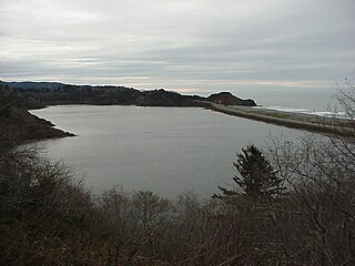
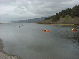
Freshwater Lagoon is the northernmost and smallest of three similar lagoons within Humboldt Lagoons State Park, along the coast of Humboldt County, California, United States.

<span class="mw-page-title-main">Stone Lagoon</span> Lagoon in Humboldt County, California

Stone Lagoon is the second of three similar lagoons within Humboldt Lagoons State Park, along the coast of Humboldt County, California.

<span class="mw-page-title-main">Moulting Lagoon Important Bird Area</span> Lake in Tasmania, Australia

Moulting Lagoon Important Bird Area is a composite wetland site in eastern Tasmania, Australia. It comprises two adjacent and hydrologically continuous wetlands – Moulting Lagoon and the Apsley Marshes – at the head of Great Oyster Bay, near the base of the Freycinet Peninsula, between the towns of Swansea and Bicheno. Both components of the site are listed separately under the Ramsar Convention as wetlands of international significance. Moulting Lagoon is so named because it is a traditional moulting place for black swans. It is an important site for waterbirds.

<span class="mw-page-title-main">Logan Lagoon</span>

Logan Lagoon is a 2172 ha wetland Conservation Area on Flinders Island, the largest of the Furneaux Group at the eastern end of Bass Strait, which is part of the Australian state of Tasmania.

<span class="mw-page-title-main">Belmont Slough</span> River in California, United States

Belmont Slough is a slough on the western shore of San Francisco Bay separating Redwood Shores and Foster City. It provides estuarine and marine deepwater habitats in its subtidal waters, which are characterized as brackish and saltwater.

<span class="mw-page-title-main">Bot River Lagoon</span> Section of the Bot-Kleinmond Estuarine System

The Bot River Estuary, also known as the Bot River Lagoon, is part of the Bot-Kleinmond Estuarine System in the Overberg region on the Western Cape of South Africa. It became a Ramsar site wetland in 2017. It is within the Kogelberg Biosphere Reserve.

Freshwater Creek is a 23 kilometres (14 mi) long creek in Humboldt County, California that is a tributary of the Eureka Slough that in turn feeds Humboldt Bay. It flows into the south-east corner of the Arcata Bay sub-bay of Humboldt Bay. Its downstream reach is also known as Freshwater Slough and its upstream reach as Freshwater Gulch.

References

  1. 1 2 3 Strand, Rudolph G. Geologic Map of California:Weed Sheet (1973) State of California Resources Agency
  2. 1 2 3 4 "Kayaking, fishing, camping, canoe at Big Lagoon in Northern California".
  3. "Evidence for Great Earthquakes at Southern Humboldt Bay, California in the Past 3000 years" (PDF). Oregon State University. Archived from the original (PDF) on 2010-06-25. Retrieved 2009-11-10.
  4. Barrier Breaching Processes and Barrier Spit Breach, Stone Lagoon, California
  5. Carranco, Lynwood Redwood Lumber Industry Golden West Books (1982) ISBN   0-87095-084-3 pp.45, 138 & 163
  6. "Big Lagoon Bombing Target Number 12". California State Military Museum. Retrieved 2009-11-10.
  7. "Bears Fact Sheet". www.tamaracfriends.org. Retrieved 2023-10-23.
  8. "Big Lagoon Wildlife Area". wildlife.ca.gov. Retrieved 2023-10-23.