Related Research Articles

The River Great Ouse is a river in England, the longest of several British rivers called "Ouse". From Syresham in Northamptonshire, the Great Ouse flows through Buckinghamshire, Bedfordshire, Cambridgeshire and Norfolk to drain into the Wash and the North Sea near Kings Lynn. Authorities disagree both on the river's source and its length with one quoting 160 mi (260 km) and another 143 mi (230 km). Mostly flowing north and east, it is the fifth longest river in the United Kingdom. The Great Ouse has been historically important for commercial navigation, and for draining the low-lying region through which it flows; its best-known tributary is the Cam, which runs through Cambridge. Its lower course passes through drained wetlands and fens and has been extensively modified, or channelised, to relieve flooding and provide a better route for barge traffic. The unmodified river would have changed course regularly after floods.
The River Little Ouse is a river in the east of England, a tributary of the River Great Ouse. For much of its length it defines the boundary between Norfolk and Suffolk.

St Neots is a town in the Huntingdonshire District in Cambridgeshire, England. It lies about 50 miles (80 km) north of London and about 18 miles (29 km) west of Cambridge. The districts of Eynesbury, Eaton Ford and Eaton Socon were formerly independent but nowadays are considered merged into St Neots.

Thetford is a market town and civil parish in the Breckland District of Norfolk, England. It is on the A11 road between Norwich and London, just east of Thetford Forest. The civil parish, covering an area of 29.55 km2 (11.41 sq mi), in 2015 had a population of 24,340.
The River Nar is a river in England, a tributary of the River Great Ouse. It rises at Mileham near Litcham in Norfolk and flows 15 miles west through Castle Acre and Narborough, joining the Ouse at King's Lynn. It has had a variety of alternative names, such as the Setch, the Sandringham, and Lynn Flu, though these are rarely, if ever, used today. In 2011 the Nar was recognised by the Environment Agency as one of the top ten most improved rivers in England and Wales.

Blo' Norton is a village and civil parish in the Breckland district of Norfolk, England, on the River Little Ouse, about 6+1⁄2 miles (10 km) west of Diss. The 2001 Census recorded the parish population as 270 people, living in about 100 households.

Thetford Priory is a Cluniac monastic house in Thetford, Norfolk, England. It should not be confused with the Dominican Friary of Blackfriars, Thetford that later became part of Thetford Grammar School.

Brandon is a town and civil parish in the English county of Suffolk. Brandon is located in the Breckland area of Suffolk, close to the adjoining county of Norfolk. It lies between the towns of Bury St Edmunds, Thetford, Mildenhall, Downham Market and the city of Ely. It lies next to Thetford Forest Park.

The Angles Way is a long-distance footpath in England, close to the River Waveney and River Little Ouse and thus close to the Norfolk/Suffolk border between Great Yarmouth and Thetford.

The A1065 is a main road in the English region of East Anglia. It provides the principal road connection to parts of the west and north of the county of Norfolk from Newmarket and points south of there, including London. It runs from a junction near Mildenhall, to a junction on the western outskirt of Fakenham.

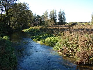
The River Thet is a river in Norfolk, England and is a tributary of the River Little Ouse.It rises in Breckland with sources in Deopham Green and Rockland All Saints and joins the Little Ouse in Thetford after flowing approximately southwest.
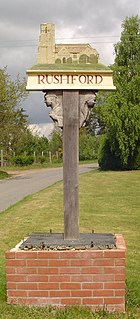
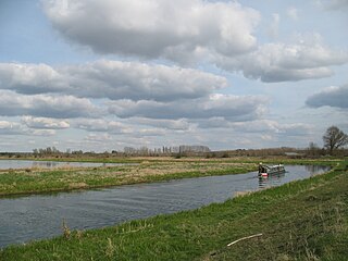
Rushford is a small village in the English county of Norfolk. It is situated on the north bank of the River Little Ouse, 3+1⁄2 miles (5.6 km) east of the town of Thetford and south of the main A1066 road. The river forms the boundary between Norfolk and Suffolk and, until 1894, Rushford was in both counties. Rushford Hall is south of the river and thus in Suffolk.

Little Thetford is a small village in the civil parish of Thetford, 3 miles (5 km) south of Ely in Cambridgeshire, England, about 76 miles (122 km) by road from London. The village is built on a boulder clay island surrounded by flat fenland countryside, typical of settlements in this part of the East of England. During the Mesolithic era, the fenland basin was mostly dry and forested, although subject to salt and fresh water incursions. The marshes and meres of this fenland may therefore have been difficult to occupy, other than seasonally, but there is evidence of human settlement on the island since the late Neolithic Age; a Bronze Age causeway linked the village with the nearby Barway, to the south-east. An investigation, prior to a 1995 development in the village, discovered a farm and large tile-kiln of Romano-British origin; further investigations uncovered an earlier settlement of the Pre-Roman Iron Age. The Roman road Akeman Street passed through the north-west corner of the parish, and the lost 7th century Anglo-Saxon village of Cratendune may be nearby.

Santon Downham is a village and civil parish in the West Suffolk district of Suffolk in eastern England. In 2005 it had a population of 240. The village is located within Thetford Forest on a meander of the River Little Ouse on the Norfolk-Suffolk border. Thetford is 4 miles (6 km) southeast and the nearest railway station is in Brandon 2 miles (3 km) west.
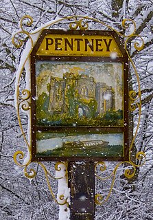
Pentney is a village and civil parish in the English county of Norfolk, located about 8 miles (13 km) south east of King's Lynn placing it about halfway between King's Lynn and Swaffham on the A47 road. It covers an area of 10.39 km2 (4.01 sq mi) and had a population of 387 in 184 households at the 2001 census, increasing to 544 at the 2011 Census. For the purposes of local government, it falls within the district of King's Lynn and West Norfolk. It is in the valley of the River Nar, a tributary of the River Great Ouse.

Wiggenhall St Mary Magdalen is a civil parish and village in the English county of Norfolk. It is 6 miles (9.7 km) south of the town of King's Lynn on the west bank of the River Great Ouse. It covers an area of 17.76 km2 (6.86 sq mi) and had a population of 729 in 304 households in the 2011 census. For the purposes of local government, it falls within the district of King's Lynn and West Norfolk.

Holy Sepulchre Church was a medieval monastic house in Thetford, Norfolk. The ruined nave of this 14th-century church are the only surviving remains in England of a priory of Canons of the Holy Sepulchre, who followed the Rule of Saint Augustine and aided pilgrims to Christ's tomb. It was later used as a barn, and is a Grade I listed building.
St. George's Priory, Thetford was a Benedictine priory on the Suffolk side of Thetford, England. It was located at the current site of the British Trust for Ornithology, South of Nuns Bridges Road.

Blo' Norton and Thelnetham Fens are a 21.3 hectare biological Site of Special Scientific Interest (SSSI) on the Norfolk/Suffolk border. Blo' Norton Fen is in the parish of Blo' Norton in Norfolk and Thelnetham Fen is in Thelnetham parish in Suffolk. It is a Nature Conservation Review site, Grade 2, and part of the Waveney and Little Ouse Valley Fens Special Area of Conservation, Thelnetham Fen is managed by the Suffolk Wildlife Trust and Blo' Norton Fen by the Little Ouse Headwaters Project (LOHP).
References
- ↑ Time Team (1994–2014) Thetford, Norfolk www.imdb.com, accessed 1 February 2021
- ↑ Blackfriars- Scheduled Monument- List Entry Number: 1004006 historicengland.org.uk, accessed 1 February 2021
| | This article about a Norfolk building or structure is a stub. You can help Wikipedia by expanding it. |
| | This article about a British Christian monastery, abbey, priory or other religious house is a stub. You can help Wikipedia by expanding it. |