
Bristol city centre is the commercial, cultural and business centre of Bristol, England. It is the area north of the New Cut of the River Avon, bounded by Clifton Wood and Clifton to the north-west, Kingsdown and Cotham to the north, and St Pauls, Lawrence Hill and St Phillip's Marsh to the east. The Bristol Royal Infirmary, Bristol Royal Hospital for Children, the BBC, the main campus of the University of Bristol, the Crown and Magistrate's Courts, Temple Meads railway station, Bristol bus station, the Park Street, Broadmead and Cabot Circus shopping areas together with numerous music venues, theatres and restaurants are located in this area. The area consists of the council wards of Central, Hotwells & Harbourside, and part of Lawrence Hill.
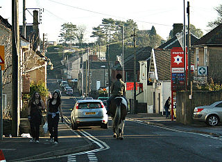
Peasedown St John is a village and civil parish in Somerset, England, standing on a hilltop roughly 5 miles (8 km) south-southwest of the city of Bath, and 2 miles (3 km) north-east of the town of Radstock at the foot of the Mendip Hills. Peasedown used to be a coal mining village, and after the last of the mines shut in the 1970s it became a dormitory village for Bath, Trowbridge and to a lesser extent Bristol. Its size was increased by substantial housing developments in the 1960s, 1970s and late 1990s, making it one of the largest villages in Somerset.
Bristol, the largest city in South West England, has an eclectic combination of architectural styles, ranging from the medieval to 20th century brutalism and beyond. During the mid-19th century, Bristol Byzantine, an architectural style unique to the city, was developed, and several examples have survived.

The Exchange is a Grade I listed building built in 1741–43 by John Wood the Elder, on Corn Street, near the junction with Broad Street in Bristol, England. It was previously used as a corn and general trade exchange but is now used as offices and St Nicholas Market.

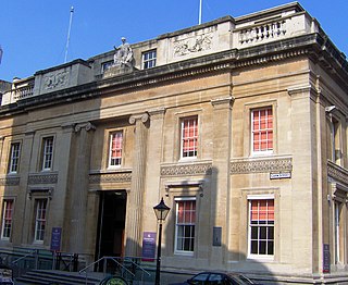
City Hall has been the seat of local government in Bristol, United Kingdom, since 1956. It is situated on College Green, opposite the Cathedral and at the foot of Park Street in Bristol city centre. Throughout its history it has been home to Bristol City Council. Designed in the 1930s but built after the Second World War, it is a grade II* listed building.

Samuel Sloan was a Philadelphia-based architect and best-selling author of architecture books in the mid-19th century. He specialized in Italianate villas and country houses, churches, and institutional buildings. His most famous building—the octagonal mansion "Longwood" in Natchez, Mississippi—is unfinished; construction was abandoned during the American Civil War.
Richard Shackleton Pope was a British architect working mainly in Bristol. His father was a clerk of works for Sir Robert Smirke, and Pope succeeded him, also working for C.R. Cockerell. He moved to Bristol to work on one of Cockerell's projects and decided to settle in the city, where he became District Surveyor from 1831 to 1874, with considerable influence over building works.

St John on the Wall in Bristol is a historic church in the care of heritage charity The Churches Conservation Trust. The upper church and its medieval vaulted crypt is located at the lower end of Broad Street and is built into the old city's medieval walls.

The Former Everard's Printing Works is at 37-38 Broad Street in Bristol, England. It has been designated as a Grade II* listed building.
The Old Council House is a building on Corn Street, Bristol, England. It has been designated by English Heritage as a grade II* listed building.
St Werburgh's Church, Bristol, is a former church, now a climbing centre in the St Werburghs area of central north-east Bristol, England. It has been designated on the National Heritage List for England as a Grade II* listed building.

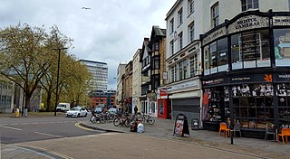
Corn Street, together with Broad Street, Wine Street and High Street, is one of the four cross streets which met at the Bristol High Cross, the heart of Bristol, England when it was a walled mediaeval town. From this crossroads Corn Street and its later extension Clare Street runs downhill approximately 325m south-westwards to The Centre.

The Church of St. John Baptist, Cirencester is a parish church in the Church of England in Cirencester, Gloucestershire, England. It is a Grade I listed building.

St John the Baptist's Church is an Anglican church in Crawley, West Sussex, England. It is the parish church of Crawley, and is the oldest building in the town centre, dating from the 1250—although many alterations have been made since, and only one wall remains of the ancient building. In September 2017, a team from St Peter’s Brighton began a new phase in the life of St John’s Crawley. St John's offer a variety of services, traditional and informal, contemporary services.

Slebech was a community in Pembrokeshire, Wales, which is now part of the combined community of Uzmaston and Boulston and Slebech, a sparsely populated community on the northern shore of the Eastern River Cleddau. The community shares boundaries with the communities of Wiston and Llawhaden and mainly consists of farmland and woodland. Much of the community is within the Pembrokeshire Coast National Park and Picton Castle's stable block loft is an important breeding roost for the rare Greater Horseshoe Bat.

Elisha Smith Robinson (1817–1885) was an English businessman and politician.

Margaret Isobel Chilton (1875–1963), born at Clifton, Bristol, was a British stained glass artist and instructor.

Mary le Port Street was an important thoroughfare from an early stage in the development of the settlement of Bristol, England, linking the area around St Peters Church and, later, Bristol Castle with the Saxon core of the town to the west at High Street, Wine Street, Corn Street and Broad Street. It was heavily damaged by aerial bombing in 1940, and was relegated to an unnamed service road and footway in post-war reconstruction of the area.
High Street, together with Wine Street, Broad Street and Corn Street, is one of the four cross streets which met at the carfax, later the site of the Bristol High Cross, the heart of Bristol, England when it was a walled medieval town. From this crossroads High Street runs downhill south-east to Bristol Bridge, a distance of approximately 155m.

Bristol Guildhall is a municipal building in Broad Street, Bristol, England. It is a Grade II* listed building.


