Brunswick is a city in Chariton County, Missouri, United States. Its population was 801 at the 2020 census.[4] Brunswick, by official state proclamation, is the Pecan Capital of Missouri.[5] The Missouri Farmers Association (MFA Incorporated) was founded in Brunswick in 1914.
Brunswick school constructed in 1871. It served until the early 1930s
For thousands of years varying cultures of indigenous peoples settled by the Missouri River. At the time of European contact, historical tribes in the area included the Missouri, Osage, Kaw, Otoe and others. In 1723 Etienne de Veniard, Sieur de Bourgmont built Fort Orleans near here, established on the Missouri River near the mouth of the Grand River. It was occupied 1723-1726 as the first multi-year European fort and settlement in present-day Missouri. It was to be a trading centerpiece of La Louisiane, the new territory claimed by the French.
Following the Louisiana Purchase and the end of the French colonial period the area saw a large influx of immigrants from the U.S., especially Kentucky and Tennessee. They brought African-Americanslaves and slaveholding traditions with them. The new land owners planted and cultivate crops similar to those in the Upper South: hemp and tobacco. Chariton was one of several counties along the Missouri River to become known as Little Dixie.[6]
The original town of Brunswick was laid out in 1836 by James Keyte. Keyte, an English immigrant and Methodist minister, was also the founder of Keytesville, Missouri, the county seat of Chariton County.[7] It was named after Brunswick, in England.[8] The original town plat was about 500 yards (457 meters) south of its current location, but due to changes in the Missouri and Grand rivers, the location is now underwater. A Mr. Keyte established the first store in the town, and its first industry, a sawmill. Early growth was slow for the community, with the population estimated at around 125 citizens by 1840. However, in the early 1840s a large influx of new residents increased the size of the town and scope of business offerings. They included a hotel, a wagon maker, brick factory, and a pork packing facility. Doctor Edwin Price, brother of famed Confederate general Sterling Price, was an early settler.[7] In the decades leading up to the American Civil War surrounding counties had no railroad over which to ship or receive goods and crops, thus Brunswick with its steamboat access, became a regional trading center. In 1849 Brunswick recorded 534 arrivals and departures by steamboats. The first school was established at Brunswick in June 1840 with approximately thirty-five students and a one-room log schoolhouse. It was also in 1840 that the first wave of German immigrants arrived in the Brunswick area. Another influx of Germans took place in 1842. The Brunswicker, the town's first newspaper, began publication in October 1847 and continues today, making it one of the state's oldest.[9] Brunswick's first bank, a branch of the Merchants Bank of St. Louis, opened.[5]
After the Civil War and the loss of their slaves, farmers shifted to other less labor-intensive, crops. However, in 1880 Chariton County still led the state of Missouri in tobacco production, with 14 million pounds harvested. After nearly ten years of delay due to the war, the railroad finally reached Brunswick in 1867, reducing the reliance on steamboats to transport goods and people.[9]
Dr. W.W. Bowen established the Brunswick Institute of Pharmacy in 1910. The school would train more than 5,000 pharmacists and druggists before closing in 1937.[9] In 1914, farmers organized the Missouri Farmers Association (MFA), a cooperative, based in Brunswick. It has since moved to Columbia, Missouri. Brunswick saw a growth of industry through the mid-20th century, with the construction of an alfalfa-drying plant constructed in 1939, the Chariton Electric Company in 1958, in 1965 the opening of the Tuloma Fertilizer blending plant, and in 1970 a glove factory. Also in 1965 the U.S. Coast Guard built a small base near Brunswick to service increased river traffic; however, the facility was relatively short-lived, closing in March 1973.[5]
Following World War II, Brunswick became the center of an area of pecan groves. In 1972 State Representative Creason secured a state resolution naming Brunswick the Pecan Capital of Missouri.[5] The Brunswick Pecan Festival was first held in 1980, celebrating the large number of pecans being harvested in the area. It would become an annual tradition that is held each October. The world's largest 20th-century pecan—a concrete replica—is located along Highway 24 in downtown Brunswick. It measures seven by twelve feet and weighs twelve thousand pounds. It was constructed in 1982 by George James in honor of the Starking Hardy Giant pecan, which he discovered on his property in 1947.[10]
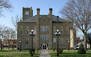
Schools in the Brunswick area date back to 1840, when a small one-room log "subscription" or private school was constructed. Following the Civil War, attention turned more toward public education, with the first public school opening in the town circa 1868.[12] A large three-story brick school was constructed in 1871 and served the community well into the early 20th century, being replaced by a new school in 1930–31. The present junior high / high school building used by Brunswick R-II school district was constructed in 1956–57. The most recent addition to the facilities is a new grade school constructed in 1991–1992.[5] In 1949 Missouri reorganized public education, with the state board of education consolidating or reorganizing many small rural schools into larger districts, this gave birth to the aforementioned Brunswick R-II district. The district, in student count, is the second largest in Chariton County, trailing Salisbury schools. Enrollment in all grades from 2006 to 2010 averaged 250 students.[13] The school colors are red and black. Their mascot is the Wildcat. Brunswick R-II participates in sports and other activities as a Class 1A school under guidelines from the Missouri State High School Activities Association.
The town has a lending library, the Brunswick Area Public Library.[14]
Notable people
Darold Knowles—Former MLB relief pitcher. First pitcher to ever appear in all seven games of a World Series. The baseball field at Brunswick R-II school is named in his honor.
Wayne E. Meyer—U.S. Navy admiral, "Father of the Aegis weapons system".
According to the United States Census Bureau, the city has a total area of 1.25 square miles (3.24km2), of which 1.20 square miles (3.11km2) is land and 0.05 square miles (0.13km2) is water.[16]
Climate
Climate data for Brunswick, Missouri (1991–2020 normals, extremes 1890–2017)
As of the census[20] of 2010, there were 858 people, 379 households, and 223 families residing in the city. The population density was 715.0 inhabitants per square mile (276.1/km2). There were 491 housing units at an average density of 409.2 per square mile (158.0/km2). The racial makeup of the city was 88.8% White, 9.1% African American, 0.1% Native American, 0.1% from other races, and 1.9% from two or more races. Hispanic or Latino of any race were 0.2% of the population.
There were 379 households, of which 25.3% had children under the age of 18 living with them, 40.1% were married couples living together, 14.5% had a female householder with no husband present, 4.2% had a male householder with no wife present, and 41.2% were non-families. 37.2% of all households were made up of individuals, and 20% had someone living alone who was 65 years of age or older. The average household size was 2.16 and the average family size was 2.77.
The median age in the city was 47.7 years. 22.5% of residents were under the age of 18; 6.9% were between the ages of 18 and 24; 17.9% were from 25 to 44; 25.2% were from 45 to 64; and 27.4% were 65 years of age or older. The gender makeup of the city was 48.0% male and 52.0% female.
2000 census
As of the census[3] of 2000, there were 925 people, 426 households, and 242 families residing in the city. The population density was 776.8 inhabitants per square mile (299.9/km2). There were 536 housing units at an average density of 450.1 per square mile (173.8/km2). The racial makeup of the city was 86.16% White, 13.30% African American, 0.32% from other races, and 0.22% from two or more races. Hispanic or Latino of any race were 0.86% of the population.
There were 426 households, out of which 20.9% had children under the age of 18 living with them, 44.6% were married couples living together, 9.4% had a female householder with no husband present, and 43.0% were non-families. 39.0% of all households were made up of individuals, and 26.3% had someone living alone who was 65 years of age or older. The average household size was 2.09 and the average family size was 2.74.
In the city the population was spread out, with 21.2% under the age of 18, 6.2% from 18 to 24, 22.5% from 25 to 44, 22.3% from 45 to 64, and 27.9% who were 65 years of age or older. The median age was 45 years. For every 100 females, there were 82.8 males. For every 100 females age 18 and over, there were 80.4 males.
The median income for a household in the city was $27,969, and the median income for a family was $34,107. Males had a median income of $27,639 versus $18,182 for females. The per capita income for the city was $18,516. About 11.3% of families and 17.7% of the population were below the poverty line, including 15.9% of those under age 18 and 19.8% of those age 65 or over.
Related Research Articles
Macon County is a county located in the northern portion of the U.S. state of Missouri. As of the 2020 census, the population was 15,209. Its county seat is Macon. The county was organized January 6, 1837, and named for Nathaniel Macon, a Revolutionary War hero and North Carolina politician.
Chariton County is a county located in the north-central portion of the U.S. state of Missouri. As of the 2020 census, the population was 7,408. Its county seat is Keytesville. The county was organized November 16, 1820, from part of Howard County and is named for the Chariton River.
Appanoose County is a county in the U.S. state of Iowa. As of the 2020 census, the population was 12,317. Its county seat is Centerville.
Chariton is a city in, and the county seat of, Lucas County, Iowa, United States. The population was 4,193 at the 2020 census. Lucas is the primary distribution center for and the former corporate headquarters of the Hy-Vee supermarket chain.
Russell is a city in Lucas County, Iowa, United States. The population was 472 in the 2020 census, a decline from the 559 population in 2000.
Williamson is a city in Lucas County, Iowa, United States. The population was 120 at the time of the 2020 census.
Gibbs is a village in Wilson Township, Adair County, Missouri, United States. The population was 107 at the 2010 census.
Novinger is a town in Nineveh Township, Adair County, Missouri, United States. The population was 456 at the 2010 census.
Keytesville is a city in and the county seat of Chariton County, Missouri, United States. The population was 440 as of the 2020 census. Keytesville is the hometown of U.S. Army General Maxwell D. Taylor, who commanded the "Screaming Eagles" 101st Airborne division during the Normandy invasion of World War II. Confederate General Sterling Price, who attacked Keytesville during an unsuccessful cavalry raid across his home state, had previously operated a hotel there.
Mendon is a city in western Chariton County, Missouri, United States. The population was 163 at the 2020 census.
Rothville is a village in northern Chariton County, Missouri, United States. The population was 63 at the 2020 census.
Salisbury is a city in Chariton County, Missouri, United States. The population was 1,563 at the 2020 census.
Sumner is a city in Chariton County, Missouri, United States. The population was 78 at the 2020 census. It was named in honor of U.S. Senator Charles Sumner.
Triplett is a city in Chariton County, Missouri, United States. The population was 33 at the 2020 census.
Worthington is a village in southeast Putnam County, Missouri, United States. The population was 47 at the 2020 census.
For the place nicknamed "the Queen City of the Ozarks", see Springfield, Missouri.
Green City is a city in northeast Sullivan County, Missouri, United States. The population was 657 at the 2010 census.
Moberly is a city in Randolph County, Missouri, United States. The population was 13,974 at the 2010 census. It is part of the Columbia, Missouri metropolitan area.
Glasgow is a city on the Missouri River mostly in northwest Howard County and extending into the southeast corner of Chariton County in the U.S. state of Missouri. The population was 1,087 at the 2020 census.
Marceline is a city in Chariton and Linn counties in the U.S. state of Missouri. The population was 2,123 at the 2020 census.
1 2 3 4 5 "Brunswick Timeline"(PDF). Brunswick Area Chamber of Commerce. 2012. Archived(PDF) from the original on March 3, 2016. Retrieved August 11, 2012.
This page is based on this Wikipedia article Text is available under the CC BY-SA 4.0 license; additional terms may apply. Images, videos and audio are available under their respective licenses.