Budbrooke

Last updated

Budbrooke
Warwickshire UK location map.svg
Red pog.svg
Budbrooke
Location within Warwickshire
Population1,863 (2011)
OS grid reference SP2665
District
Shire county
Region
Country England
Sovereign state United Kingdom
Post town Warwick
Postcode district CV35
Dialling code +44(0)1926
Police Warwickshire
Fire Warwickshire
Ambulance West Midlands
UK Parliament
List of places
UK
England
Warwickshire
52°17′02″N1°37′16″W / 52.284°N 1.621°W / 52.284; -1.621 Coordinates: 52°17′02″N1°37′16″W / 52.284°N 1.621°W / 52.284; -1.621

Budbrooke is a village and civil parish in the Warwick district of Warwickshire, England. It is 3 miles west of Warwick and according to the 2001 census the parish had a population of 2,319, reducing to 1,863 at the 2011 Census. [1] Most of the population of Budbrooke live in Hampton Magna, a housing estate built in the late 1960s, with other smaller settlements in Budbrooke Village and Hampton on the Hill. [2]

Contents

History

Middle Ages

The original parish dates from 1086 (Domesday Book) when Ralph de Limesi held Budebroc for William the Conqueror. It consisted of five hides of land, a mill, farms and woods. It was one mile long and three furlongs wide. The parish church of St. Michael dates from the twelfth century. [3] In 1350, the village suffered from the Black Death and became a ghost town. Most of the village, including the vicarage and the Manor house, crumbled. The track which now passes under the railway arch known as Kyte's Bridge was the most likely route for the corpses being taken from the village to Dead Field on Hatton Hill. Of the original village, only the church remains, and even that became a ruin in the mid-17th century, not to be restored until the Victorian era.

Early Modern period

When the old village declined, the centre of the parish moved to Grove Park, the home of the Dormer family who were granted the manor in 1608. During the English Civil War, a force of five thousand Royalist horse and foot soldiers paused at Grove Park to rest. The Parliamentarian supporter, Lord Brook in Warwick, was aware of their arrival and, with seven thousand men, met the Royalists. After some "negotiations" the Royalist forces marched away, joining Charles I and his army at Coventry.

The village of Hampton-on-the-Hill, on the edge of Grove Park, became the main development area of the parish. A significant community developed there, with a shop that later became a police house, a forge, a post office, a club room and a public house. The Roman Catholic church of St Charles Borromeo was built by Lord Dormer and given to the parish in 1819. In the 1790s, the Birmingham and Warwick Canal was constructed, which is now part of the Birmingham "main line" of the Grand Union Canal. This passes through Budbrooke parish, and the Hatton flight of 21 canal locks that lift the canal up out of the Avon valley are just outside the village.

Budbrooke barracks

Budbrooke Barracks was established on a site about half a mile to the east of Budbrooke church. A restored St. Michael's church became the battalion church. The military connections of the area are retained in some of the road names in the village of Hampton Magna, created in the late 1960s, with the Royal Warwickshire Regiment itself being commemorated in a road called simply, "The Warwicks". Caen Close and Normandy Close recall the part played by the regiment in the liberation of France during the Second World War. Arras Boulevard commemorates the Battle of Arras during the First World War. Montgomery Avenue is named after Bernard Montgomery. The barracks site was remembered in the celebrations of the 60th anniversary of VE and VJ Day, which were held in the parish on 10 September 2005. The Royal Warwickshire Regiment was the senior Regiment in what was, in the 1950s, the "Midland Brigade: viz with the Leicestershire Regiment, the Sherwood Foresters,(the Nottinghamshire and Derbyshire regiment, the Lincolnshire Regiment. It had a huge Drill Square and was the unit where Brigade OR1's, (National Servicemen of potential officer status), were trained before taking the exams of the Unit Selection Board prior to the War Office Selection Board.

Creation of Hampton Magna

In the late 1960s and early 1970s the barracks site was re-developed into the "20th Century Village" of Hampton Magna. As a result of the community spirit in the new village, a Community Centre was built in Field Barn Road on land leased to the Parish Council by the local District Council. Budbrooke Primary School was built in 1968, replacing the old school in Hampton-on-the Hill. In 2019, Warwick District Council released land adjacent to Hampton Magna from the green belt to allow extra housing to be built onto the existing village.

Budbrooke today

The parish is dominated by the Hampton Magna housing estate, with Hampton-on-the-Hill being the second largest settlement. The village of Budbrooke is extremely small and consists of only a few buildings. In addition, there are a small handful of farms within the parish. In Hampton-on-the-Hill, most of the former public buildings have been converted to private dwellings. However, there is a modern village hall (on the site of a previous hall provided by the Dormer family) and is regularly used. The parish has one school (Budbrooke Primary School), which is located in the centre of Hampton Magna. There are two churches in the parish; these are St. Michael's, a 12th Century Anglican parish church located in Budbrooke village and St. Charles Borromeo Catholic Church in Hampton-on-the-Hill. The Budbrooke Community Centre which was extended in 1985 hosts a number of local community activities including 1st Hampton Magna Scouts Group. Other facilities in Hampton Magna include a surgery, the Cawston House suite of retirement properties, and two parks (on Styles Close and Montgomery Avenue) and a farm shop located in Groves park on the border of Hampton-on-the-Hill and Hampton Magna housing estate Groves Park called the Veg Box.

The original six shops in Hampton Magna included a newsagent, a hardware store, a VG shop, a greengrocer, a hairdresser and a butcher's shop. Today, three units remain: a combined Post Office, newsagent and Costcutter's mini mart; a beauty salon; and The Open Door, a Christian cafe, meeting centre and fair trade products shop sponsored by St. Michael's Church. Housing has been built on the site of the other three units. The former local pub (originally called The 'Bout Time, because of the time it took the brewer to decide to build it) was named after Montgomery of Alamein, and was known to locals affectionately as "The Monty". It contains a collection of photographs and other memorabilia of the Royal Warwickshire Regiment including many photographs of Montgomery, and relics of the North African Campaign. In early 2013, the Montgomery of Alamein closed its door for the last time and then underwent an redevelopment by an Asian businessman who also owns the local Costcutter's mini mart. It is now an Indian bar/restaurant/takeaway that after several name changes was re-branded The Barracks Bar Indian Restaurant.

Hampton Magna Athletic F.C was established in the 1969/70 season, they are now known as just Hampton Magna F.C. Their current home ground is Aylesford School. Their club crest is the same as Budbrooke Primary School's, the famous Antelope which is the Royal Warwickshire Regiment insignia. They are still going and in the 2019/20 season they celebrated their 50th anniversary. Their kit colours are black and gold (home) and red (away). They currently play in Tracey Thomas Leamington Spa and District Sunday Football League 2. In 2019 they won The Division 2 Cup at Racing Club Warwick. In 2017 they won Division 3 winning in the last game of the season to gain promotion. Central Ajax F.C. of the Midland Football League play within the parish boundaries.

Earthquake

At 5.30am on 23 September 2000 Budbrooke was the epicentre of one of the largest earthquakes ever recorded in the 21st century in the United Kingdom. The earthquake measured 4.2 on the Richter Scale [4] and caused little damage. [5]

Transport

Budbrooke is close to the A46 which runs to the east of the parish. This leads to Coventry in the northbound direction, and to junction 15 of the M40 in the southbound direction. Access to nearby Warwick is provided by both the A425 and A4189. Warwick Parkway railway station is located within Budbrooke parish, which is operated by Chiltern Railways. Located about half a mile north-east of Hampton Magna, it provides direct rail services to both London Marylebone and Birmingham Moor Street, via the Chiltern Main Line. The station primarily serves as a park and ride facility for the wider area, but is also used by local residents. The nearest passenger airport is Birmingham Airport which is 17 miles away. The smaller cargo only Coventry Airport is also 10 miles away. The 68 bus route operated by Stagecoach serves the village. There are hourly journeys to Hatton, Parkway station, Warwick, Leamington Spa and Cubbington. [6]

Related Research Articles

<span class="mw-page-title-main">Leamington Spa</span> Spa town in Warwickshire, England

Royal Leamington Spa, commonly known as Leamington Spa or simply Leamington, is a spa town and civil parish in Warwickshire, England. Originally a small village called Leamington Priors, it grew into a spa town in the 18th century following the popularisation of its water which was reputed to have medicinal qualities. In the 19th century, the town experienced one of the most rapid expansions in England. It is named after the River Leam, which flows through the town.

<span class="mw-page-title-main">Nuneaton</span> Market town in Warwickshire, England

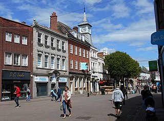
Nuneaton is a market town in the borough of Nuneaton and Bedworth in northern Warwickshire, England, located adjacent to the county border with Leicestershire to the north-east. Nuneaton's population at the 2021 census was 94,634, an increase from 86,552 at the 2011 census making it the largest town in Warwickshire.

<span class="mw-page-title-main">Southam</span> Human settlement in England

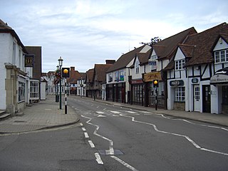
Southam is a market town and civil parish in the Stratford-on-Avon district of Warwickshire, England. Southam is situated on the River Stowe, which flows from Napton-on-the-Hill and joins Warwickshire's River Itchen at Stoneythorpe, just outside the town.

<span class="mw-page-title-main">Warwick</span> Town and the county town of Warwickshire, England

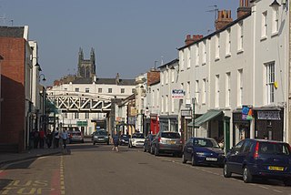
Warwick is a market town, civil parish and the county town of Warwickshire in the Warwick District in England, adjacent to the River Avon. It is 9 miles (14 km) south of Coventry, and 19 miles (31 km) south-east of Birmingham. It is adjoined with Leamington Spa and Whitnash.

<span class="mw-page-title-main">Warwickshire</span> County of England

Warwickshire is a county in the West Midlands region of England. The county town is Warwick, and the largest town is Nuneaton. The county is famous for being the birthplace of William Shakespeare at Stratford-upon-Avon and Victorian novelist George Eliot,, at Nuneaton. Other significant towns include Rugby, Leamington Spa, Bedworth, Kenilworth and Atherstone. The county offers a mix of historic towns and large rural areas. It is a popular destination for international and domestic tourists to explore both medieval and more recent history.

<span class="mw-page-title-main">Knowle, West Midlands</span> Human settlement in England

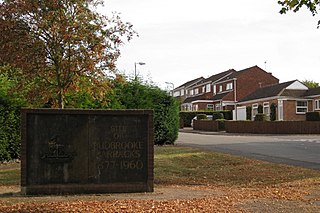
Knowle is a large village situated 3 miles (5 km) east-southeast of the town of Solihull, West Midlands, England. Knowle lies within the Arden area of the historic county boundaries of Warwickshire, and since 1974 it has been part of the Metropolitan Borough of Solihull within the West Midlands. It lies 2.5 miles from the Warwickshire border and had a recorded population of 10,678.

<span class="mw-page-title-main">Warwick District</span> Non-metropolitan district in England

Warwick is a local government district of central Warwickshire in England. It borders the Borough of Rugby and Stratford-on-Avon District in Warwickshire as well as the West Midlands County. The City of Coventry is to the north and northeast, the Stratford-on-Avon District to the southwest and south, the Borough of Rugby to the east, and the Borough of Solihull to the west and northwest.

<span class="mw-page-title-main">Kineton</span> Human settlement in England

Kineton is a village and civil parish on the River Dene in south-east Warwickshire, England. The village is part of Stratford-on-Avon district, and in the 2001 census it had a population of 2,278, increasing to 2,337 at the 2011 Census.

<span class="mw-page-title-main">Meriden, West Midlands</span> Human settlement in England

Meriden is a village and civil parish in the Metropolitan Borough of Solihull, West Midlands, England. Historically, it is part of Warwickshire and lies between the cities of Birmingham and Coventry. It is located close to the Warwickshire border within a green belt of the countryside known as the Meriden Gap and is in the ecclesiastical parish of the Diocese of Coventry. The village is 6.75 miles east-northeast of Solihull, 6.5 miles west-northwest of Coventry and 4.5 miles east-southeast of Birmingham Airport. Birmingham city centre is 12.5 miles east-northeast of the village. Known as "Alspath" in the Domesday Book, it was historically thought to be the geographical centre of England until the early 2000s, though after an analysis by the Ordnance Survey this was proved to be incorrect.

<span class="mw-page-title-main">Leek Wootton</span> Human settlement in England

Leek Wootton is a village and former civil parish, now in the parish of Leek Wootton and Guy's Cliffe, in the Warwick district, in the county of Warwickshire, England, approximately 2 miles south of Kenilworth and 2.5 miles north of Warwick. It lies in the triangle created by Kenilworth, Warwick and Leamington Spa. In 1961 the parish had a population of 671.

<span class="mw-page-title-main">Balsall Common</span> Human settlement in England

Balsall Common is a large village in the Metropolitan Borough of Solihull, West Midlands, England. It is situated 4.5 miles (7.5 km) northwest of Kenilworth, 7.5 miles (12.1 km) west of Coventry, 8 miles (13 km) east of Solihull and 15 miles (24 km) to the southeast of Birmingham. The name “Balsall” comes from the Anglo Saxon word “Baelle” meaning corner of land, and “Heale” meaning a sheltered place

<span class="mw-page-title-main">Wellesbourne</span> Human settlement in England

Wellesbourne is a large village in the civil parish of Wellesbourne and Walton, in the county of Warwickshire, in the West Midlands region of the UK. In the 2021 census the parish, which also includes the hamlet of Walton, had a population of 7,283, a significant increase from 5,849 In the 2011 census. The civil parish was renamed from Wellesbourne to Wellesbourne and Walton on 1 April 2014.

<span class="mw-page-title-main">Hatton, Warwickshire</span> Human settlement in England

Hatton is a village and civil parish about 4 miles (6 km) west-northwest of Warwick, in the Warwick District of Warwickshire in England. The parish had a population of 1,078 at the 2001 Census, increasing to 2,319 at the 2011 Census. Notable landmarks include Hatton Locks, a series of 21 locks on the Grand Union Canal. The flight spans less than 2 miles (3.2 km) of canal, and has a total rise of 45 metres (148 ft).

<span class="mw-page-title-main">Cubbington</span> Human settlement in England

Cubbington is a village and civil parish with a population of 3,929, adjoining the north-eastern outskirts of Leamington Spa, Warwickshire, England, approximately 3 miles from the town centre. Welsh Road, running through the village crossroads, was an old sheep drovers' route connecting London and Wales. Since the 1950s when the village expanded there have been two parts to the village: Cubbington proper which was the old village core, and New Cubbington which is to the west, although both are referred to as Cubbington. Topographically the highest point of the village sits about 100 metres (330 ft) above sea level while its lowest is about 60 metres (200 ft). For many years the electorate for Cubbington was represented in government by the MP for Warwick and Leamington but for the 2010 UK Elections it moved to the new Kenilworth & Southam constituency.

<span class="mw-page-title-main">Warwick Parkway railway station</span> Railway station in Warwickshire, England

Warwick Parkway is a railway station with Park and Ride facilities on the western outskirts of Warwick in Warwickshire, England. It also serves the village of Budbrooke. Unusualy the station is not owned by Network Rail but by Warwickshire County Council.

<span class="mw-page-title-main">Clifton-upon-Dunsmore</span> Human settlement in England

Clifton-upon-Dunsmore is a village and civil parish in the Rugby borough of Warwickshire in England on the north-eastern outskirts of Rugby, approximately 2 miles (3.2 km) from Rugby town centre. The population of the parish taken at the 2011 census was 1,304. Clifton is counted as being part of the Rugby built-up area, but is considered separate from the town.

<span class="mw-page-title-main">Sherbourne, Warwickshire</span> Human settlement in England

Sherbourne is a village and civil parish in the Warwick district of Warwickshire, England. The population of the civil parish at the 2011 Census was 174.

<span class="mw-page-title-main">Budbrooke Barracks</span>

Budbrooke Barracks was a military installation near Budbrooke in Warwickshire, England.

References

  1. "Area: Budbrooke (Parish) – Key Figures for 2011 Census: Key Statistics". Office for National Statistics. Retrieved 26 December 2015.
  2. "Parish History". Budbrooke Parish Council. Retrieved 13 February 2016.
  3. St Michael's Church records
  4. "Earthquake in Budbrooke". cwn. Coventry Internet Developments. Retrieved 21 June 2008.
  5. "Warwickshire Earthquakes". Archived from the original on 21 June 2008. Retrieved 21 June 2008.
  6. "Timetables". Stagecoach.

Commons-logo.svg Media related to Budbrooke at Wikimedia Commons