
Hargrave is a village and civil parish in the West Suffolk district of Suffolk in eastern England, located about 7 miles (10 km) away from south west of Bury St Edmunds. Lying at the crossroads from Ousden and Lady's Green (west) and Chevington (east). Barrow, Suffolk (north) and Wickhambrook.
Aldeby is a village and civil parish in the English county of Norfolk. It is bounded to the south by the River Waveney, on the other side of which is Suffolk. The village is about five miles (8 km) by road from Beccles.

Aldringham cum Thorpe is a civil parish in the East Suffolk district of Suffolk, England. Located south of the town of Leiston, the parish includes the villages of Aldringham and Thorpeness, which is on the coast, between Sizewell (north) and Aldeburgh (south). In 2007 it had an estimated population of 700, rising to 759 at the 2011 Census.

Badingham is a civil parish in the East Suffolk district of eastern England, in the county of Suffolk. It is situated 21.8 miles north east of Ipswich, 35 miles (56 km) away from Norwich and 13 miles (21 km) away from the coast. With the road "A1120" slicing through the middle of the parish. Badingham's name is Anglo-Saxon and means "the farmstead of Beada's people". Badingham contains a significant number of farms, sparse amount of housing, numerous B&Bs as well as St. John's Church.
Barnardiston is a village and parish in the West Suffolk district of Suffolk, England. The village is located about four miles north-east of Haverhill off the A143.

Knodishall, a village in Suffolk, England, lies 3.5 miles (6 km) south-east of Saxmundham, 1 mile (2 km) south-west of Leiston, and 3 miles from the coast, in the Blything Hundred. Most dwellings are now at Coldfair Green; just a few remain in the original village by the parish Church of St Lawrence, which falls gently on the north side of the Hundred River valley. It is now an outlier of Knodishall Common, a settlement a mile to the south-east. The estimated parish population was 790 in 2019.
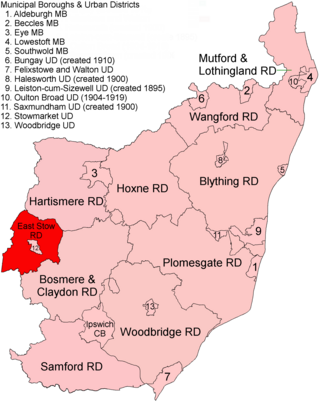
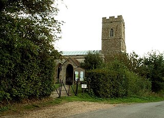
East Stow was a rural district in East Suffolk, England from 1894 to 1934.

Great Finborough is a village and civil parish in the Mid Suffolk district, in the county of Suffolk, England; about 3 miles (5 km) south west of Stowmarket and near one of the sources of the River Gipping. It has two schools, a pub and an active church. In 2001 the parish had a population of 755, increasing to 808 at the 2011 Census.
Frostenden is a village and civil parish in the East Suffolk district of the English county of Suffolk. It is around 8 miles (13 km) south-west of Lowestoft and 3.5 miles (5.6 km) north-west of Southwold and lies on the A12 road between Wrentham and Wangford. Neighbouring parishes include Wrentham, Sotterley, Uggeshall, Wangford with Henham, Reydon and South Cove.

Onehouse is a small village in the English county of Suffolk, about 3 miles west from the centre of Stowmarket near to the Golf Club. The population of the parish at the 2011 Census was 810.

Poslingford is a village and civil parish in the West Suffolk district of Suffolk in eastern England, near to a stream that feeds the into the Chilton stream and then the Suffolk Stour. The main part of the village follows the line of The Street, rising approximately 40 metres in height above sea level from south to north.
Bradfield Combust is a village and former manor and civil parish, now in the parish of Bradfield Combust with Stanningfield in Suffolk, England, located on the A134 between Windsor Green and Great Whelnetham. In 1961 the parish had a population of 108. In 1988 the parish was merged with Stanningfield to form "Bradfield Combust with Stanningfield".

Freckenham is a small rural village and civil parish in the West Suffolk district of Suffolk in East Anglia, in the country of England.
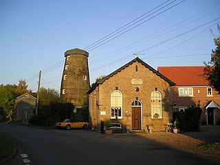
Buxhall Mill is a tower mill at Buxhall, Suffolk, England which has been converted to residential accommodation.
Sir John Spring, of Lavenham, Buxhall, Hitcham, and Cockfield, Suffolk, was an English merchant and politician.
Chediston is a village and a civil parish on the B1123 road, in the East Suffolk district, in the English county of Suffolk. It is located 2 miles west of Halesworth, its post town. The population of the civil parish as of the 2011 census was 195 and in 2018 it was estimated to be 234.
Stratford St Andrew is a small village and a civil parish just off the A12 road, in the East Suffolk district, in the English county of Suffolk. It is located 3 miles south west of Saxmundham, which is the nearest town to the village.

Mill Green is a hamlet near the village of Buxhall, in the English county of Suffolk.

Walter Arthur Copinger was an English professor of law, antiquary and bibliographer.
The Gospel Oak was a veteran tree in Polstead, Suffolk. The tree is associated with Saint Cedd, who reputedly planted it or preached beneath it. The oak tree is thought to have been named for its association with an annual church service, reputedly held beneath it for more than a millennium, and the tree is said to have been the oldest in the county when it collapsed in November 1953. A descendant grows nearby and has since been used as the site for the annual service.


