St. Bernard is a village in Hamilton County, Ohio, United States. It is an enclave and suburb of Cincinnati. The population was 4,070 at the 2020 census.

Clifton is a neighborhood in the north central part of Cincinnati, Ohio, United States. The population was 8,408 in the 2020 census.

California, Cincinnati is a neighborhood in the city of Cincinnati. Located at the confluence of the Little Miami River and Ohio River, it is the southeastern-most neighborhood in the city. California borders the Cincinnati neighborhoods of Mt. Washington and the East End, as well as Anderson Township. The population was 944 at the 2020 census.

Cincinnati Freedom, also known as Charlene Moo-ken, after Cincinnati Mayor Charlie Luken, was a 1,050-pound Charolais cow that gained fame when, on February 15, 2002, she leaped over a six-foot fence at Ken Meyers Meats, a Camp Washington (Cincinnati) slaughterhouse, and escaped. After eluding the traps and tranquilizer darts of SPCA officials and police officers for 11 days, she was finally captured just after midnight on February 26 in Clifton, Cincinnati, Ohio. She lived out the rest of her life at Farm Sanctuary's New York Shelter in Watkins Glen, New York, where she was particularly popular with animal rights activists and animal lovers.

Spring Grove Village is a neighborhood in Cincinnati, Ohio formerly known as Winton Place. It is located just off Interstate 75 in the Mill Creek Valley. The population was 1,916 at the 2020 census.

Columbia-Tusculum is the oldest neighborhood in Cincinnati, Ohio, and is located on the East Side of the city. The population was 1,523 at the 2020 census.

Avondale is a neighborhood in Cincinnati, Ohio. It is home to the Cincinnati Zoo and Botanical Garden. The population was 11,345 at the 2020 census.

Camp Washington Chili is a Cincinnati chili parlor founded in 1940 by Steve Andon and Fred Zannbus in the neighborhood of Camp Washington, near downtown Cincinnati, in southwestern Ohio. A well known Cincinnati landmark, the parlor is located at 3005 Colerain Avenue, and the current owner is the Greek-born John Johnson. The restaurant left its old location and moved to a site a few lots away in 2000, after being told to vacate by the city in order to widen Hopple Street. Their new location is modeled after a 1950s-style diner. The restaurant is open 24 hours a day every day but Sunday.

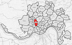
Carthage is a neighborhood located in the Mill Creek valley in Cincinnati, Ohio. Predominately residential, the neighborhood is a center of the city's Hispanic community. It shares a border with Elmwood Place, Ohio, which, with adjacent St. Bernard, Ohio, forms an enclave in the middle of Cincinnati. The population was 2,781 at the 2020 census.

CUF is a neighborhood in Cincinnati, Ohio. Its name is derived from the communities of Clifton Heights, University Heights, and Fairview. CUF is bordered by the neighborhoods of Clifton, the University of Cincinnati, Mount Auburn, Over-the-Rhine, and Camp Washington.

Corryville is a neighborhood in Cincinnati, Ohio, east of the University of Cincinnati, southeast of Clifton, south and west of Avondale, northwest of Walnut Hills, and north of Mount Auburn. The population was 4,373 at the 2020 census.

Queensgate is a neighborhood in Cincinnati, Ohio. It sits in the valley of Downtown Cincinnati and has been dominated by industrial and commercial warehouses for most of its history. Cincinnati's nickname of "Porkopolis" started here with hog slaughtering in the early 19th century.

Linwood is a neighborhood in Cincinnati, Ohio, United States. The population was 705 at the 2020 census.
Madisonville is a neighborhood in Cincinnati, Ohio. The population was 9,141 at the 2010 census.

Mount Airy is a neighborhood in Cincinnati, Ohio, United States. The population was 9,210 at the 2020 census. Interstate 74's Ohio-Iowa segment ends in Mount Airy, OH, while the westernmost North Carolina segment ends in Mount Airy, NC.

Riverside is a neighborhood in Cincinnati, Ohio. The West Side neighborhood is contained in a narrow strip of land along the Ohio River between Sayler Park and Sedamsville. It is a community that is more industrial than residential. It is home to St. Vincent De Paul Catholic Church. Riverside is also home to the Mount St. Joseph University ball fields.

Sayler Park is a neighborhood in Cincinnati, Ohio. The west side neighborhood on the Ohio River is approximately 1 mile (1.6 km) and 2 miles (3.2 km) wide. The population was 2,825 at the 2020 census.

Roselawn is a neighborhood in Cincinnati, Ohio, United States. The population was 7,039 at the 2020 census.

South Cumminsville is a neighborhood in Cincinnati, Ohio. It is bordered by Northside, Camp Washington, Millvale, and Fay Apartments. The population was 702 at the 2020 census.

Hartwell is the northernmost neighborhood in Cincinnati, Ohio, centered roughly on the intersections of I-75 and Ronald Reagan Cross County Highway. Its boundaries are a combination of Caldwell Park and Ronald Reagan Cross County Highway to the south, I-75 to the east, and a combination of Millsdale Street and Compton Road to the North. The population was 5,806 at the 2020 census.